A visual update from Neil and Leon’s project monitoring trip to Mt Pleasant Station in July 2023, where Landscape Rehydration interventions were designed and constructed by Mulloon Consulting between 2019-2020. The aim of the project was to utilise Mt Pleasant Station as a demonstration and community learning hub. It demonstrates erosion control measures which slow, spread and infiltrate surface flow. In so doing, the site will retain more moisture, as well as capture and cycle nutrients more efficiently. Coupled with the existing management strategy of time-controlled grazing, the interventions will ultimately rebuild landscape function and resilience.
The recent trip was to assess the structural, vegetative, and hydrological health of landscape rehydration measures, leading to the second of three monitoring commissions being completed. This article is a visual tour looking at the current conditions following a few wet seasons since the first phase of this project was completed.
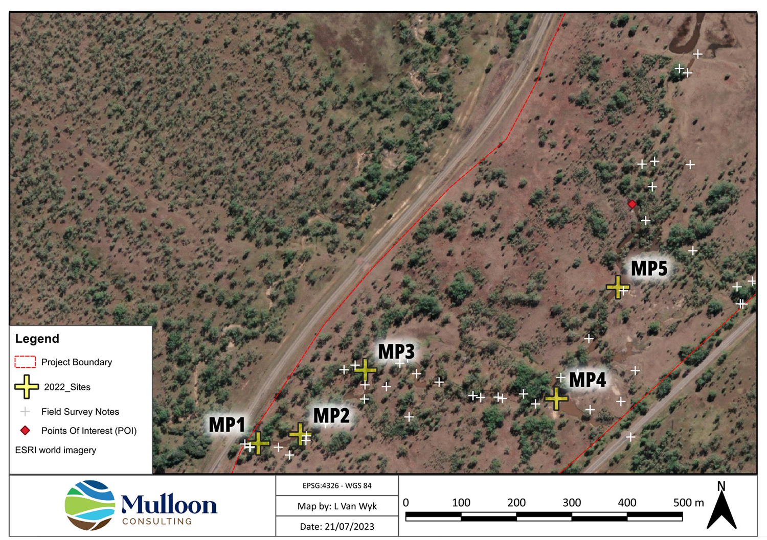
Mt Pleasant phase 1 project context map
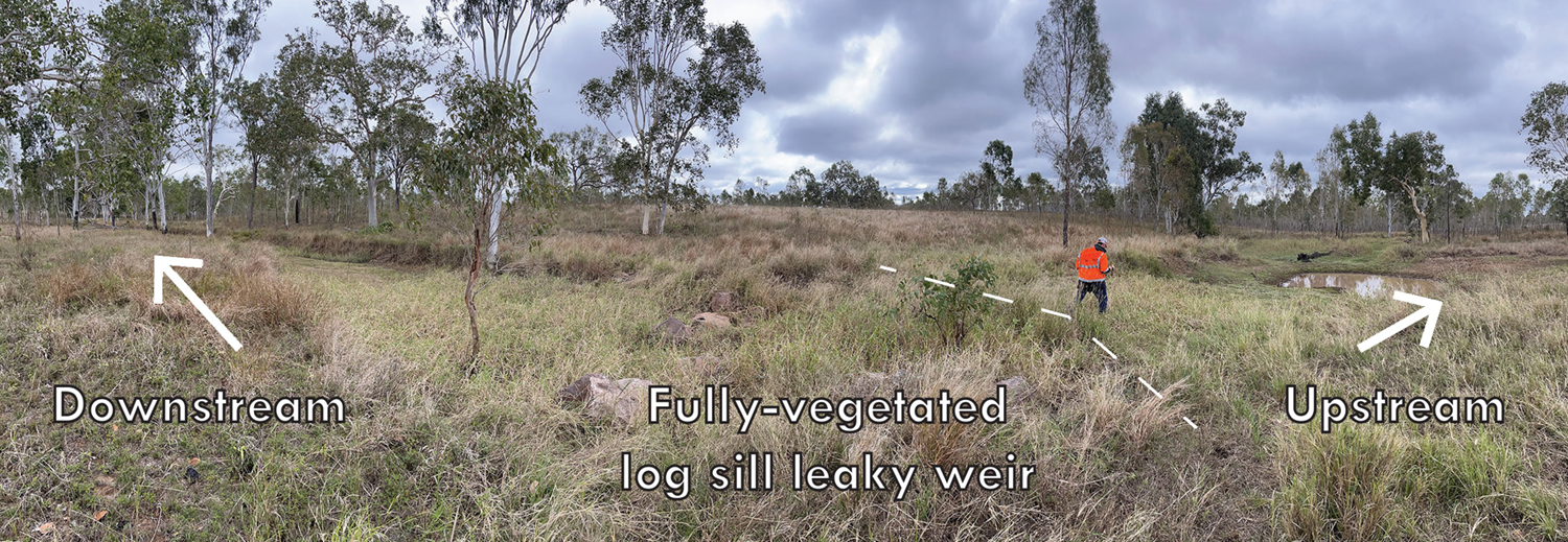
Panorama across the drainage line at the uppermost in-stream structure (MP5)

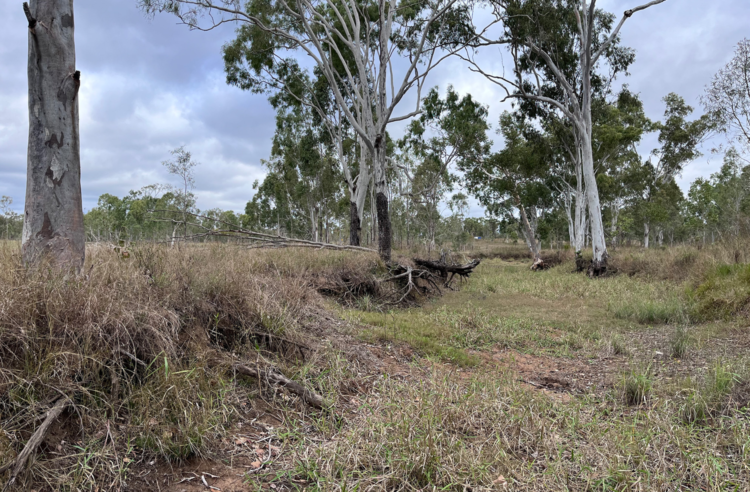
Direct downstream view from above the MP5 log sill leaky weir
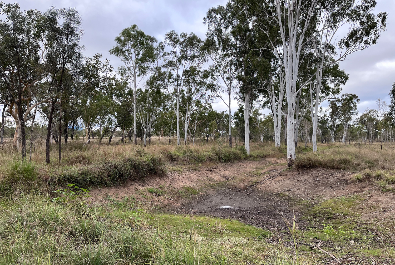
Downstream view from below the MP5 in-stream structure, showing a fully vegetated and stabilised gully floor
Upstream view from in-stream structure MP2 showing deposition of sediment, silt and organic matter in the ephemeral pond base
Alternative upstream view from above in-stream structure MP2, better revealing the landscape context
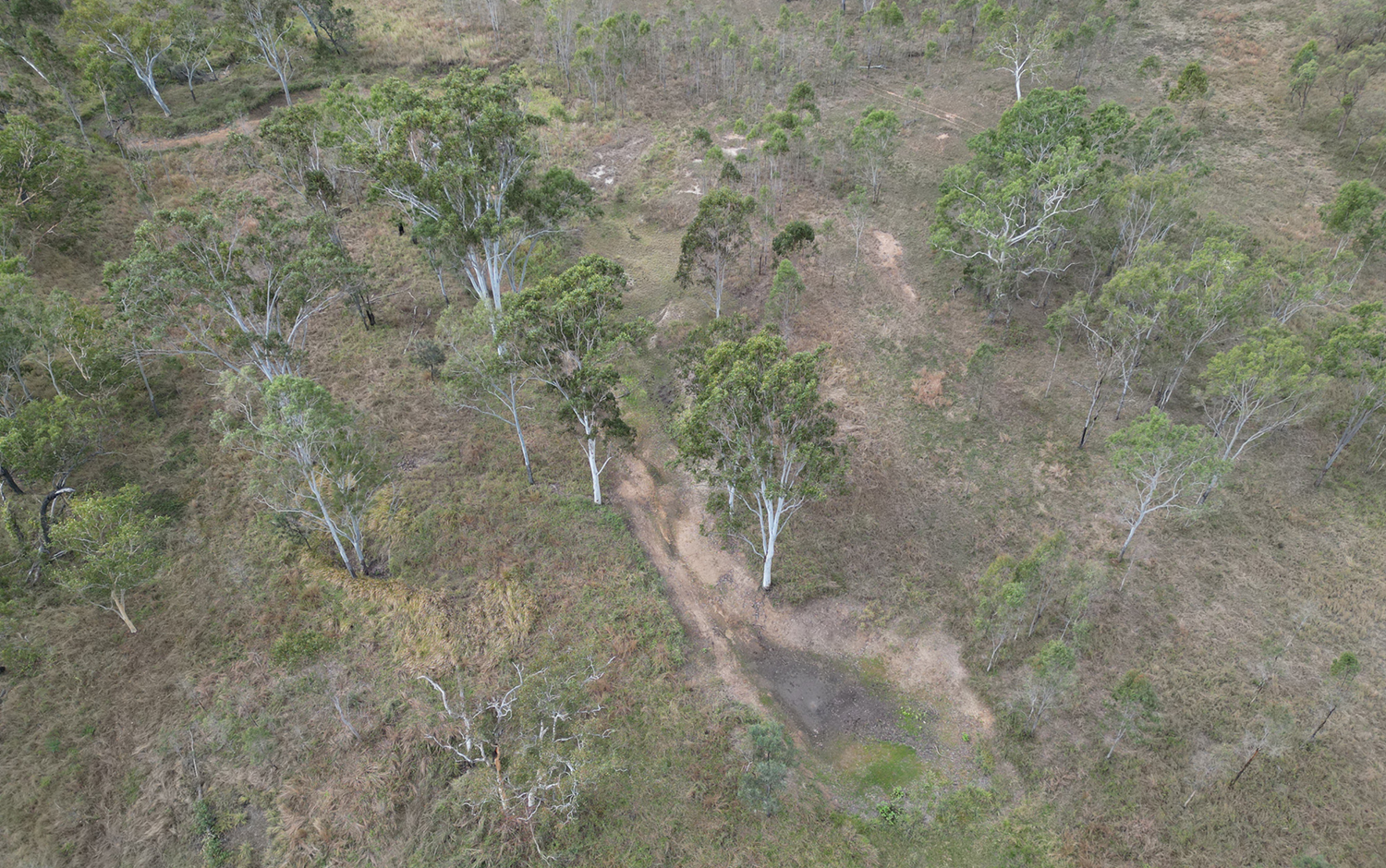
Lowest extent of project area where a set of railway culverts conveys runoff from the site
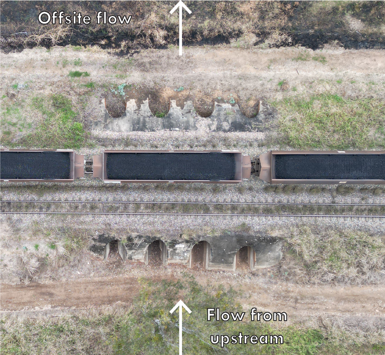
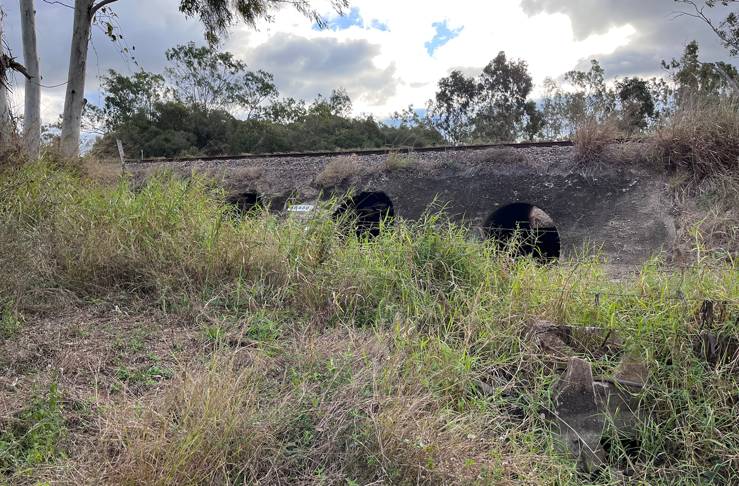
Aerial view of the railway culvert crossing where the project area terminates below MP1
This project has been delivered in partnership with NQ Dry Tropics, as part of the Landholders Driving Change (Burdekin Major Integrated Project), funded by the Queensland Government through the Queensland Reef Water Quality Program.