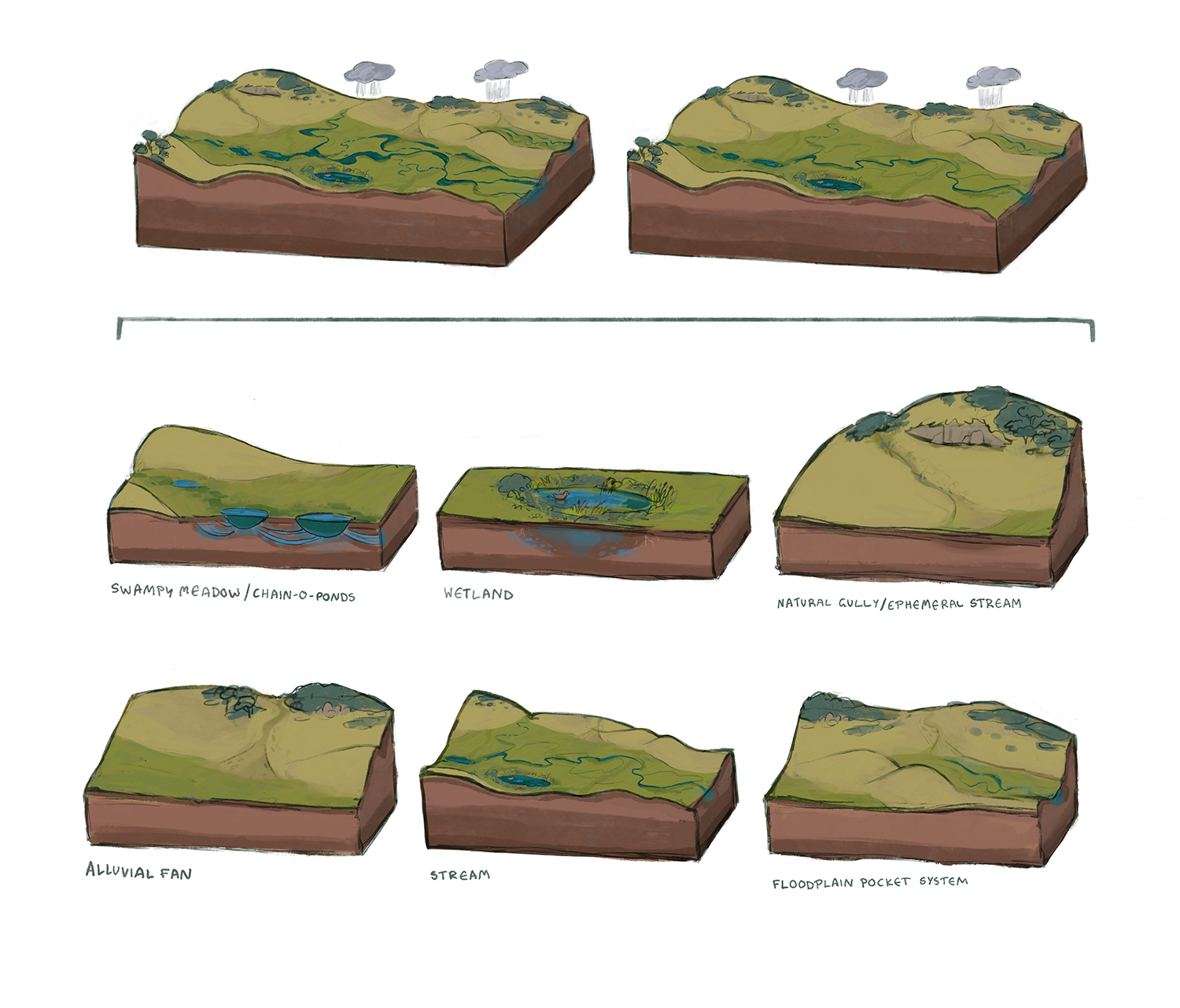
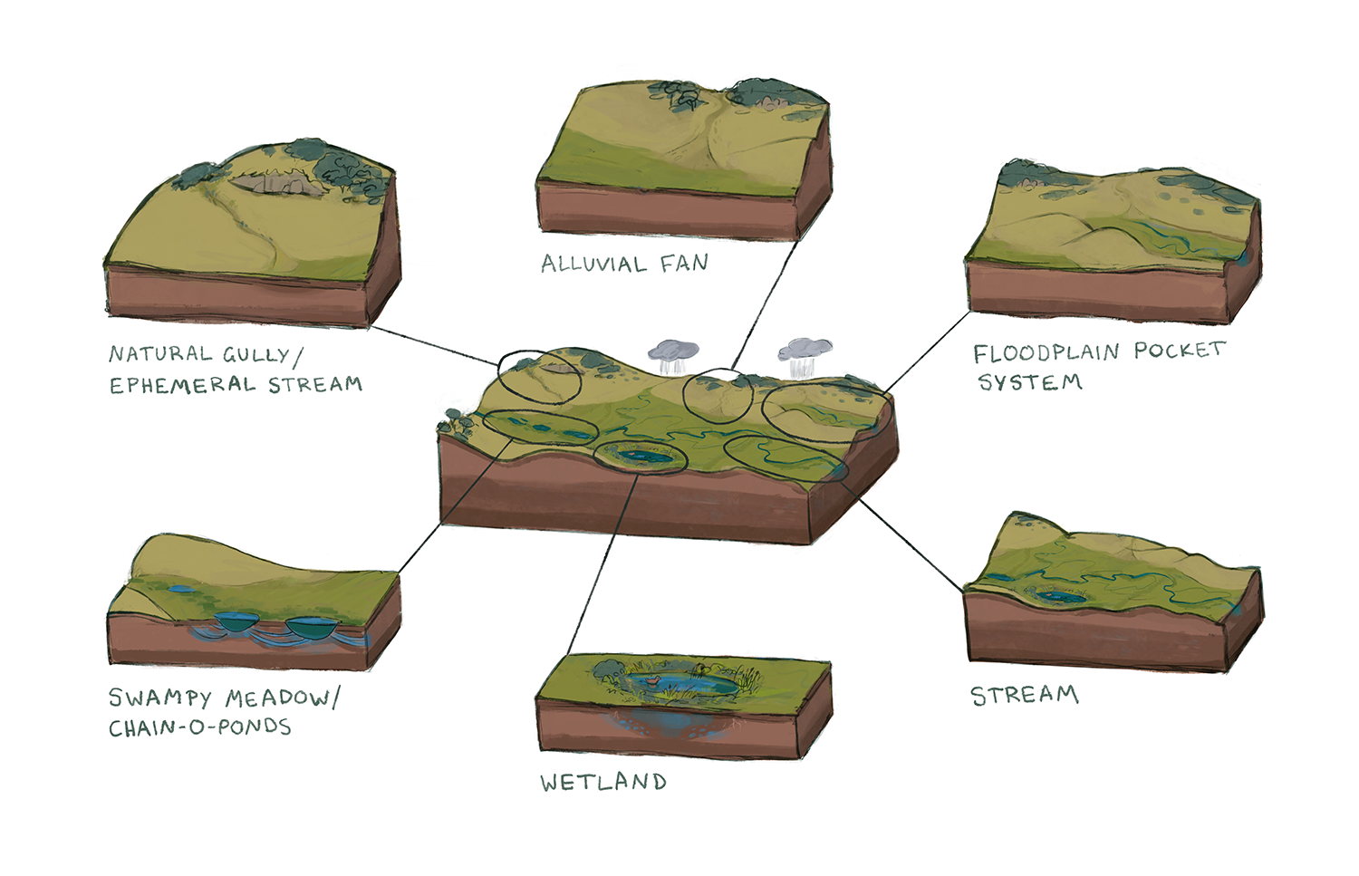
For National Science Week this year we are celebrating the Hydrological Landscape. And true to Mulloon form, there’s an artist involved! We commissioned illustrator Tilda Joy to help us foster wider understanding of how the hydrological features of South Eastern Australia function, how to tell if they are dysfunctional, and how we can heal them and reestablish water’s cycling, hydrating patterns across the landscape.
Tilda’s beautiful illustrations are part of a forthcoming publication we are very excited about: The Regenerative Power of Water: Nature Repair in the Sydney Catchment Area, which was commissioned by WaterNSW as part of our Water Stewardship Program. Keep an eye out on our news pages and socials for the announcement of its release so you can get a copy!
So… what hydrological feature are standing on right now ?
Defining ‘hydrological function’
Hydrological functions are the processes and interactions that govern the movement, distribution, and quality of water within the environment, including on the surface of the land, in the soil and underlying rocks, in the atmosphere, and in relation to living things.