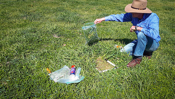
Sampling pasture biomass inside a quadrat
An important factor of our monitoring program in the Mulloon Rehydration Initiative (MRI) involves collecting field data to understand the effect of rehydration on landscape function. This on-ground data can also be used in conjunction with aerial (drone and planes) and satellite to provide spatial and temporal analysis. The Mulloon Institute has engaged Cibolabs to provide satellite analysis maps to landholders in the MRI, indicating pasture growth rates (30 days), greenness (NDVI), pasture biomass (TSDM) and food on offer (FOO).
Landscape Function Analysis (developed by David Tongway, CSIRO) involves taking measurements along a transect of approximately 50m that closely examines groundcover, plant types, organic litter, soil characteristics and how water moves through the landscape. These fixed transect sites give us detailed information about how the environment is changing as we return periodically to monitor the same site over time. Read more about Landscape Function Analysis.
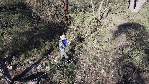
Measuring various landscape characteristics along a transect
A plate meter allows us to take quick and accurate pasture measurements such as pasture height, quantity and growth rate over time. The meter is walked through the paddock along the transect, ‘plonking’ the tool vertically on the ground at regular intervals. Once a reading is taken the height measurement is sent to the user’s mobile phone which records the GPS location and is then uploaded to a central data point once mobile reception is regained. The process is quite fast taking only 15 minutes to get 120 measurements! Read more about plate meters.
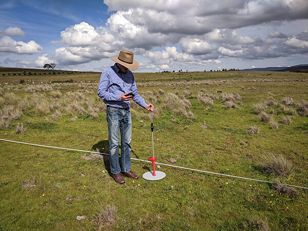
Using the plate meter to measure pasture height
Pasture biomass samples are collected from each paddock using electric grass shears to trim and collect all plant material to ground level within a square ‘quadrat’ frame. Samples are then weighed and dried and then re-weighed to give an accurate measurement of the dry weight of standing biomass (TSDM). The pasture samples are taken from three areas that reflect ‘low’, ‘medium’ and ‘high’ levels of biomass in the paddock, with plate meter measurements also taken at each location.
Initial weighing of pasture biomass samples
Drone imagery is also recorded to generate a high resolution mosaic image of the transects.
Collecting such detailed information assists with calibrating and validating the satellite data products, improving satellite accuracy and ability to assess the vegetation response in areas without LFA transects.* Such integrated monitoring is important to understanding the connection between plants, water, and soil that enable a productive and resilient landscape, which in turn helps inform farmers and land managers on how best to manage country with an integrated management approach.
* A potentially great project for a university student would be to assess the drone images against the LFA data and up-scale it to inform and calibrate the satellite data products.
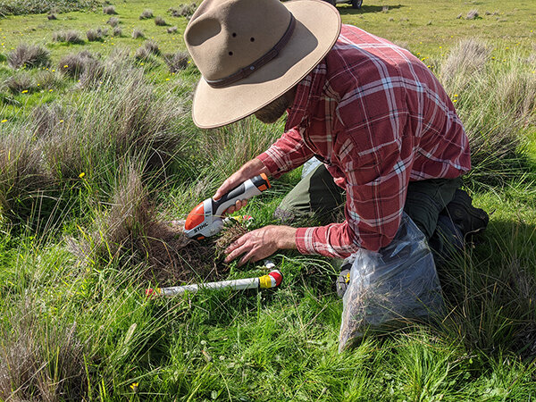
Using electric grass shears to sample pasture biomass within a quadrat