
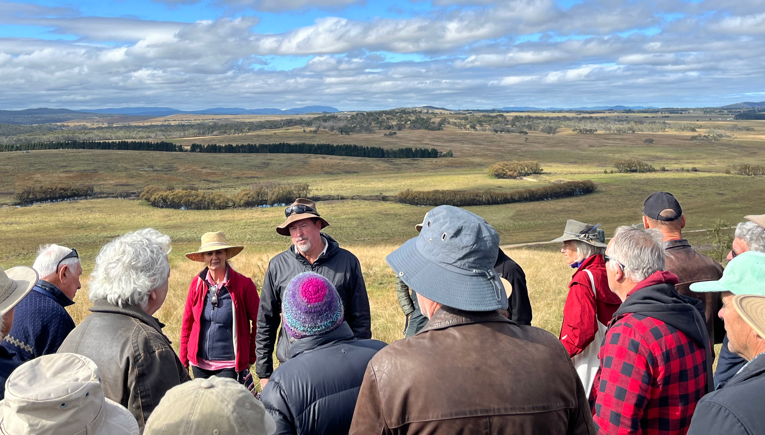
Peter Hazell and Carolyn Hall presenting to Conference attendees on Day 2, overlooking the Lower Mulloon floodplain.

Wow. What a conference. Thank you to everyone who attended.

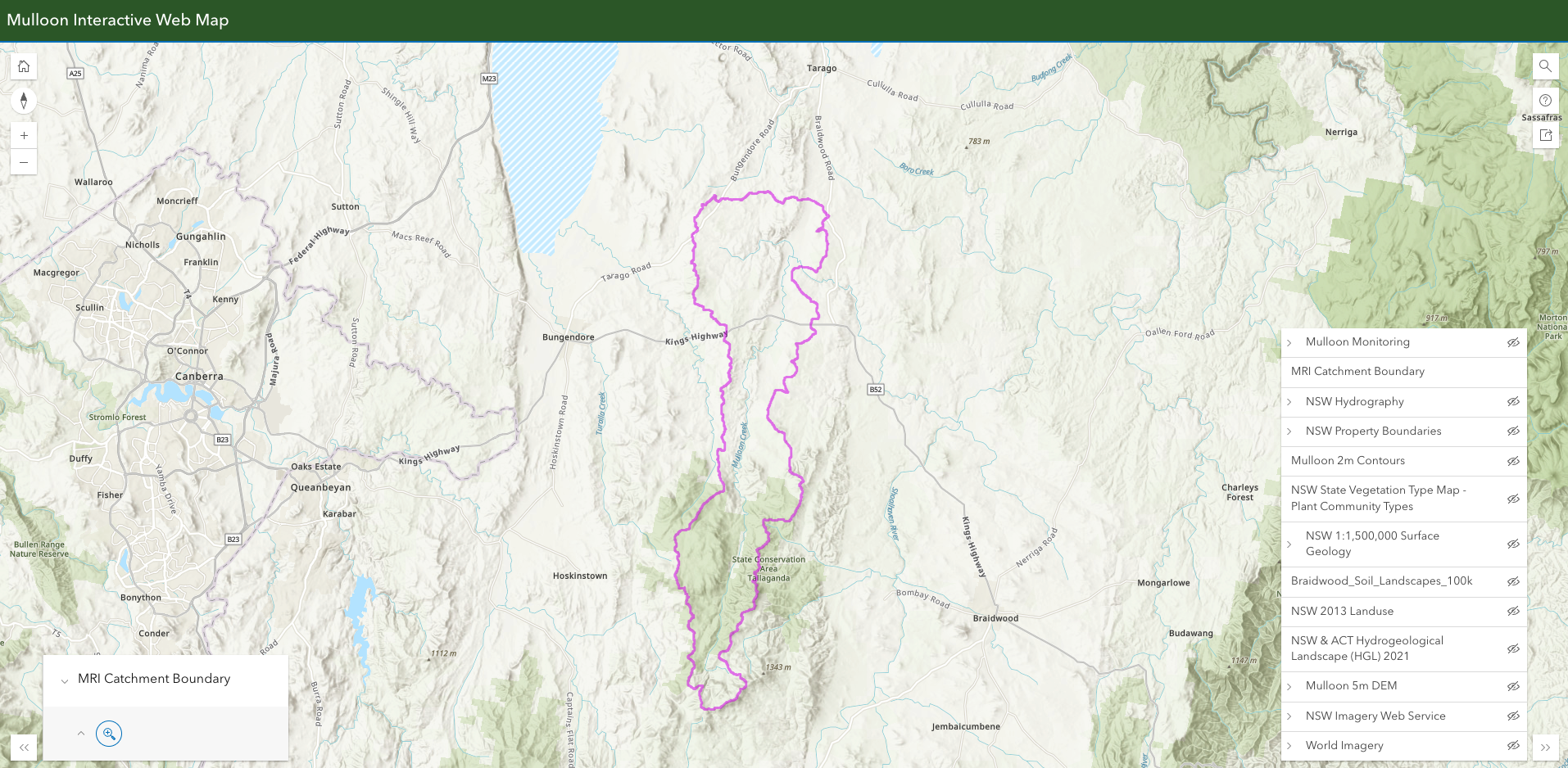
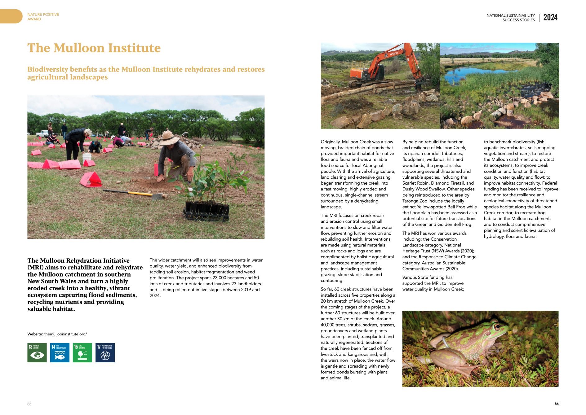
The preliminary data from the Mulloon Rehydration Initiative is now being released and some of the results are very promising.

My favourite takeaway is how this data seems to indicate that repaired landscapes containing leaky weirs do not decrease the flow of water down a catchment. Further, they seem to lead to increased flows through the system. To revisit the slides that show this data, see Peter Hazell’s blog post here.

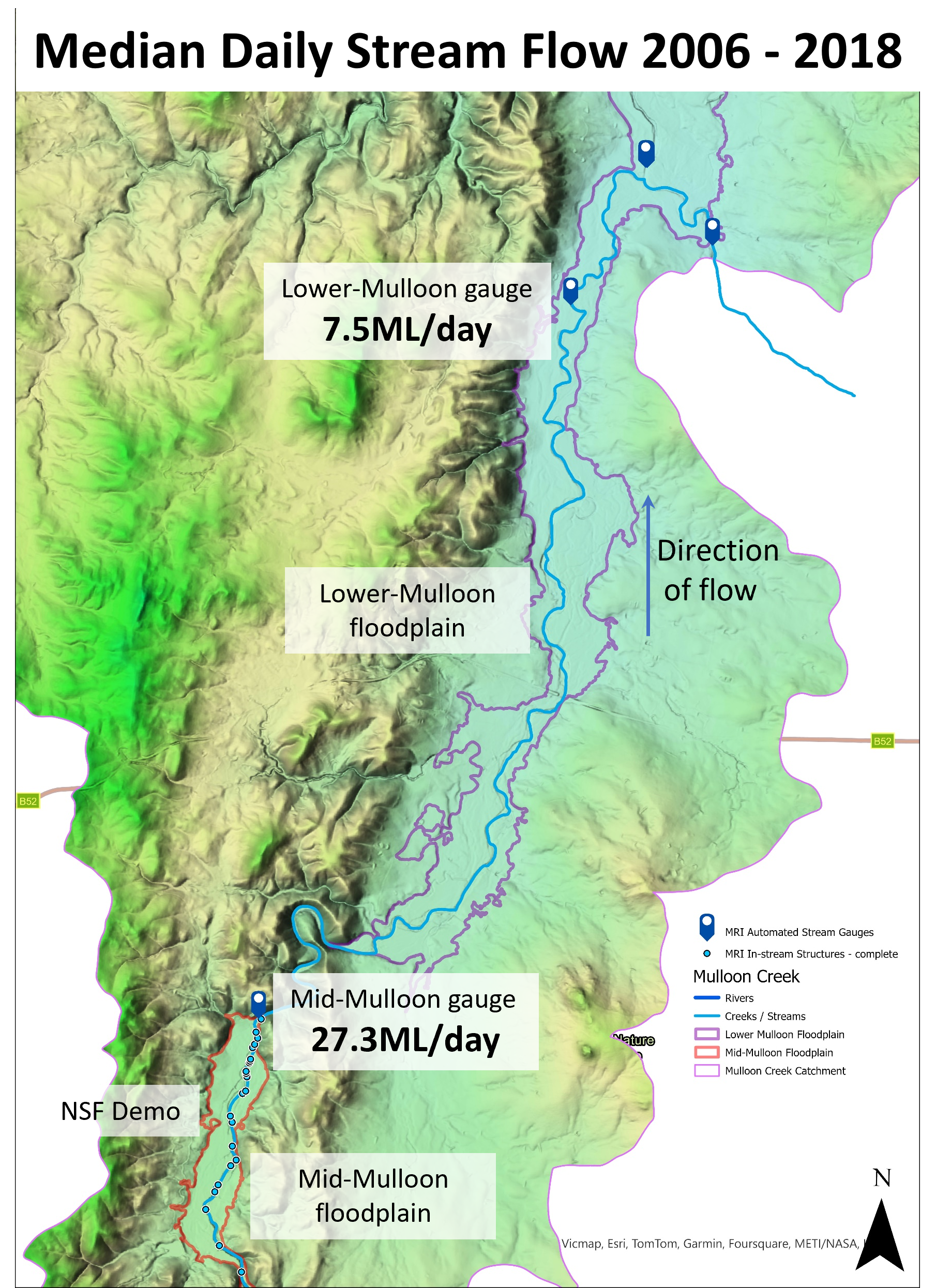
A theory we are considering that explains the difference between the median flows at the two gauges in the first slide is that the Mid Mulloon floodplain pocket was already partially ‘sponge-filled’ during this period, due to the prior installation of leaky weirs in 2006. As this section was already ‘sponge-filled’ it was not taking water from the system, rather, it was likely to be contributing water. This water was then absorbed by the ‘dry sponge’ floodplain section of the Lower Mulloon floodplain (which was not ‘sponge-filled’ – it had no leaky weirs at this time), or it simply evaporated. This was a very dry period after all. As a result, an average of only 7.5 megalitres of water per day made it to the Lower Mulloon gauge. That is an average of 20 megalitres per day less than the flow that left the ‘already sponge-filled’ Mid Mulloon floodplain section.

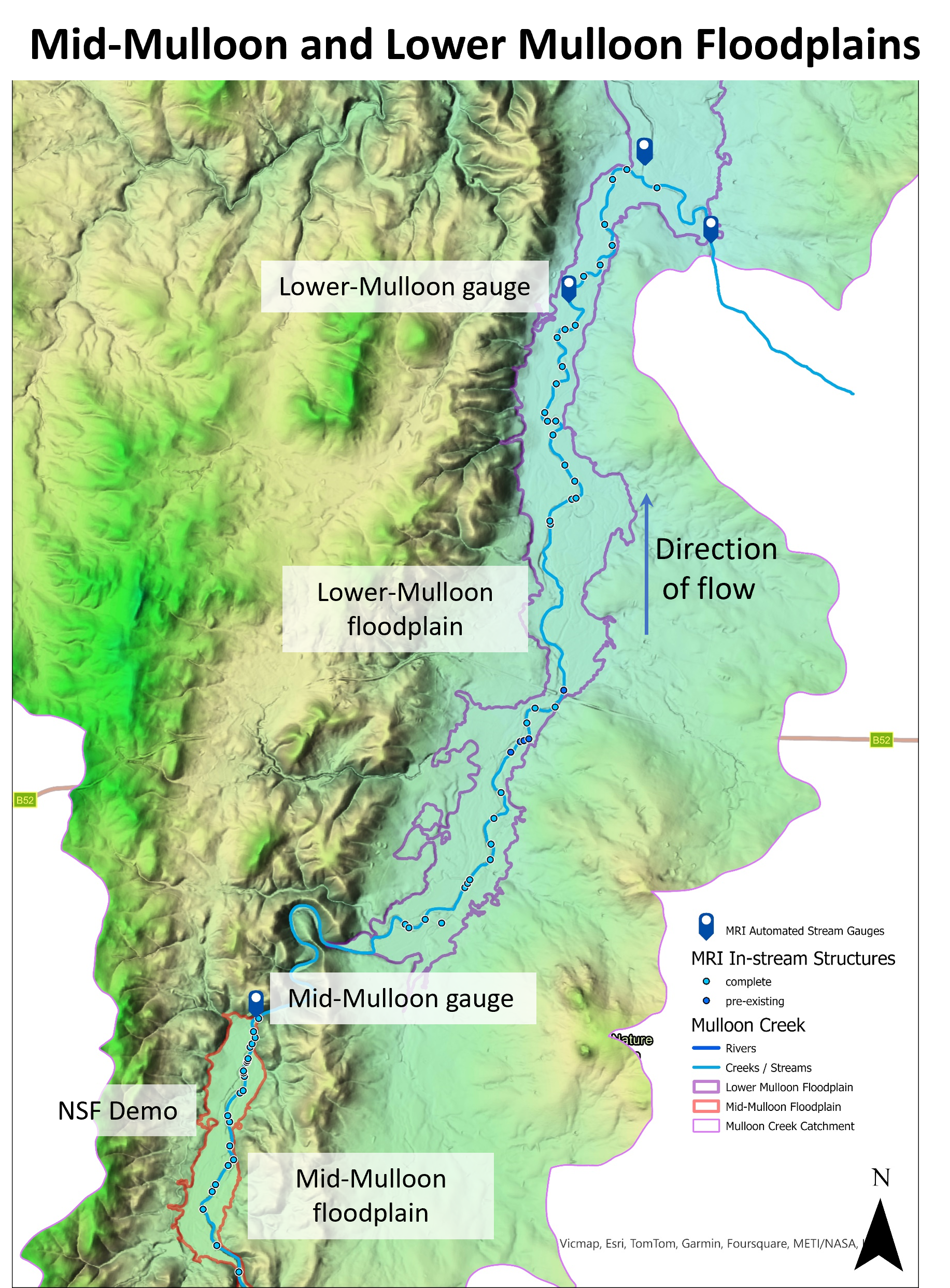
The second slide (from 2018-2024) covers a ‘wetter period’ (when plenty of rain fell over the east coast of Australia). It also covers the period after we installed 35 leaky weirs along the 10km of Mulloon Creek between the Mid Mulloon gauge and the Lower Mulloon gauge.

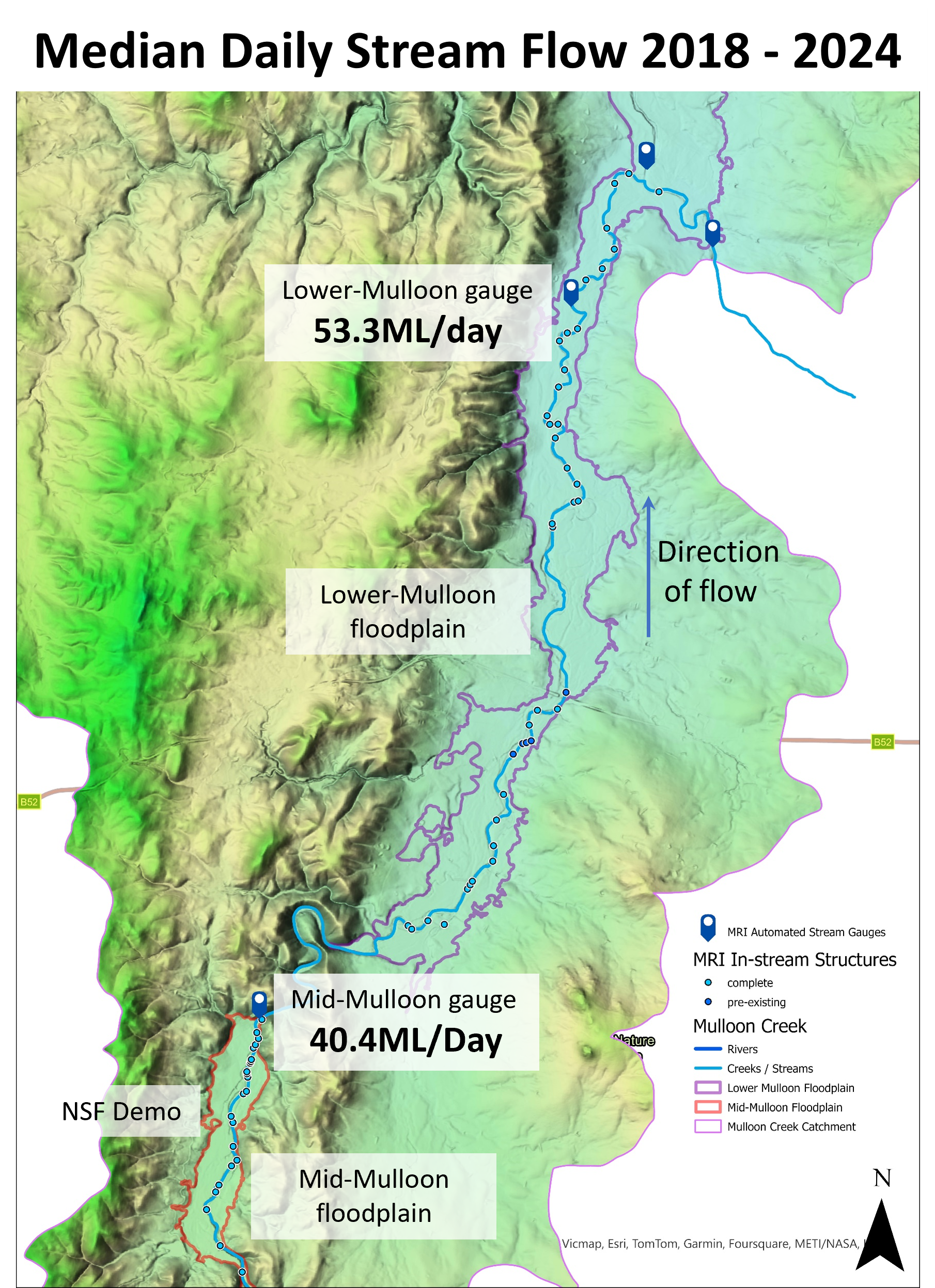
Between 2018 – 2024, the median daily flow at the Mid Mulloon gauge immediately downstream of Mid Mulloon floodplain was 40.4 megalitres (an increase of 48% from the previous dry period – which would be expected during a wet period).

On the other hand, the lower-Mulloon gauge (below 35 newly installed leaky weirs) shows a median daily flow of 53.3 megalitres – an increase of 610% from the previous dry period median of only 7.5 megalitres per day.

So, how might we interpret this significant change?

It is possible, likely even, that the Lower Mulloon section has become ‘sponge-filled’ for much longer periods during this time due to the installation of 35 leaky weirs throughout this 10km section. This has banked water in the floodplain aquifers and created a pressure response from the raised water level of the stream, which is slowing recharged groundwater movement into the stream. As a result, the whole of the mid and lower Mulloon sections of the catchment are now more fully charged than prior to the installation of the weirs. This allows more water to flow through the system.

This data suggests the leaky weirs have had a significant and decisive impact. Even though it was a period of wet weather, if we compare the 610% increase in median flow at Lower Mulloon with the 48% increase at Mid Mulloon gauge, it is hard not to infer that these increased flows have something to do with the introduction of 35 leaky weirs into the Lower Mulloon floodplain.

So, what might we conclude from this?

  1. The introduction of leaky weirs does not stop water flowing through a catchment. Given that leaky weirs are sometimes confused with dams, and some people believe they ‘impound’ water, this is important information.

  2. Landowners who have installed leaky weirs appear to be giving the gift of more water to their neighbours further down the catchment while also hydrating their own land. How many more landholders might be in this situation if this method was scaled across the country!

  3. Government regulation should be amended to encourage actions that rehydrate the entire landscape, especially our creeks and streams (see our draft Code of Practice and please spread the word!)

It is wonderful to see the fruits of the good decisions made by Tony Coote to support this ambitious experiment back in 2006.

Who says science is boring – these are exciting days!

Best to you all,

Matt

Matt Egerton-Warburton

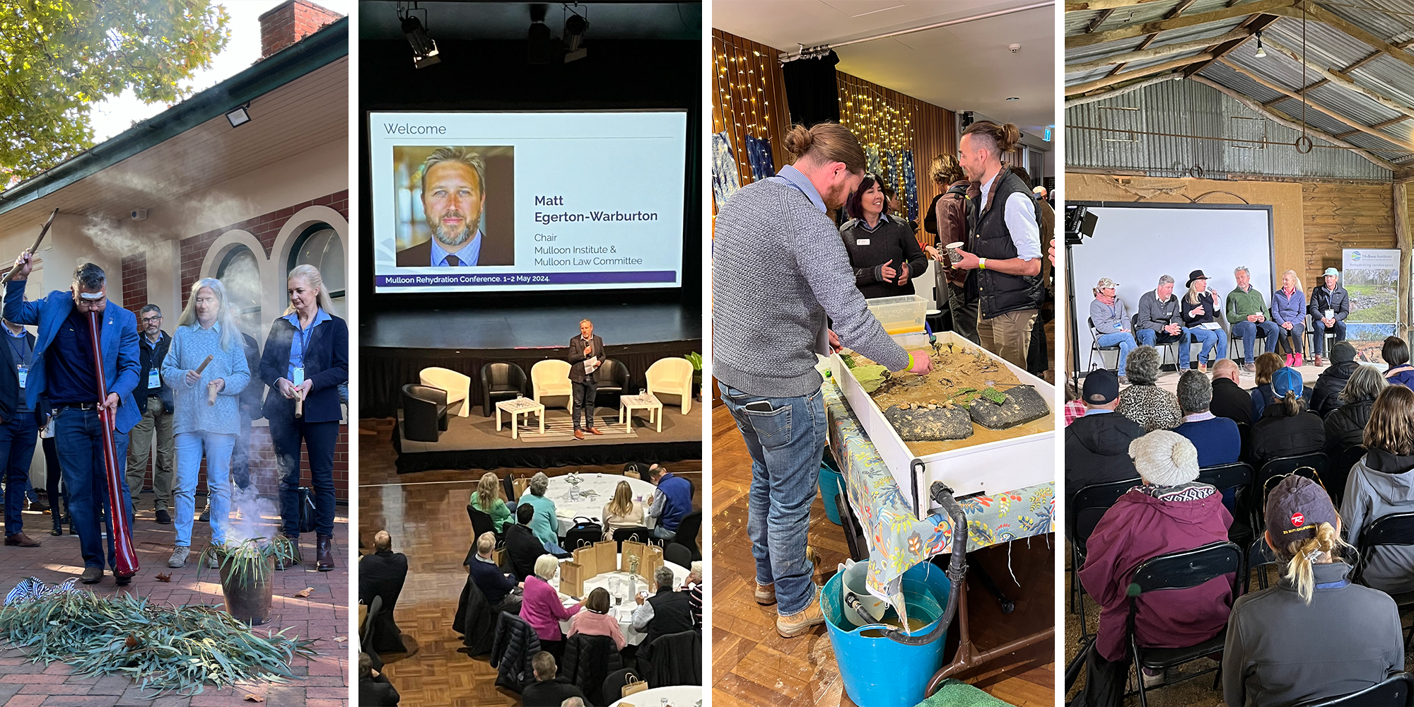
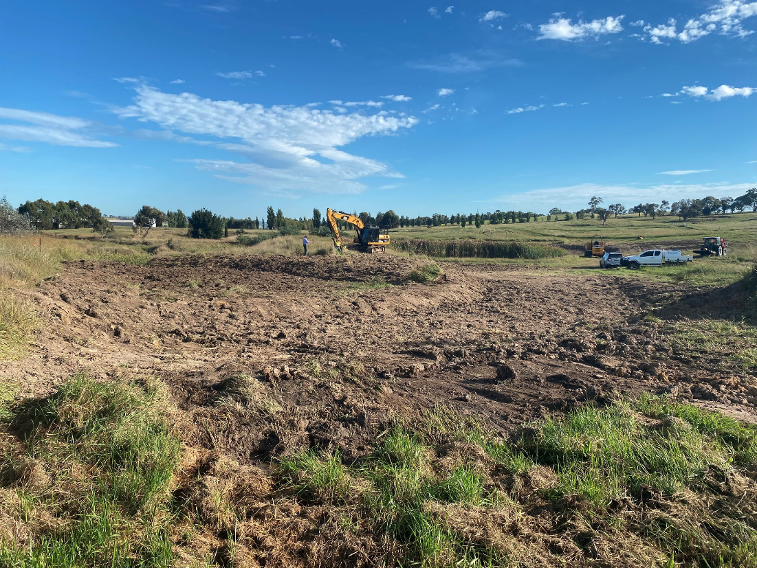
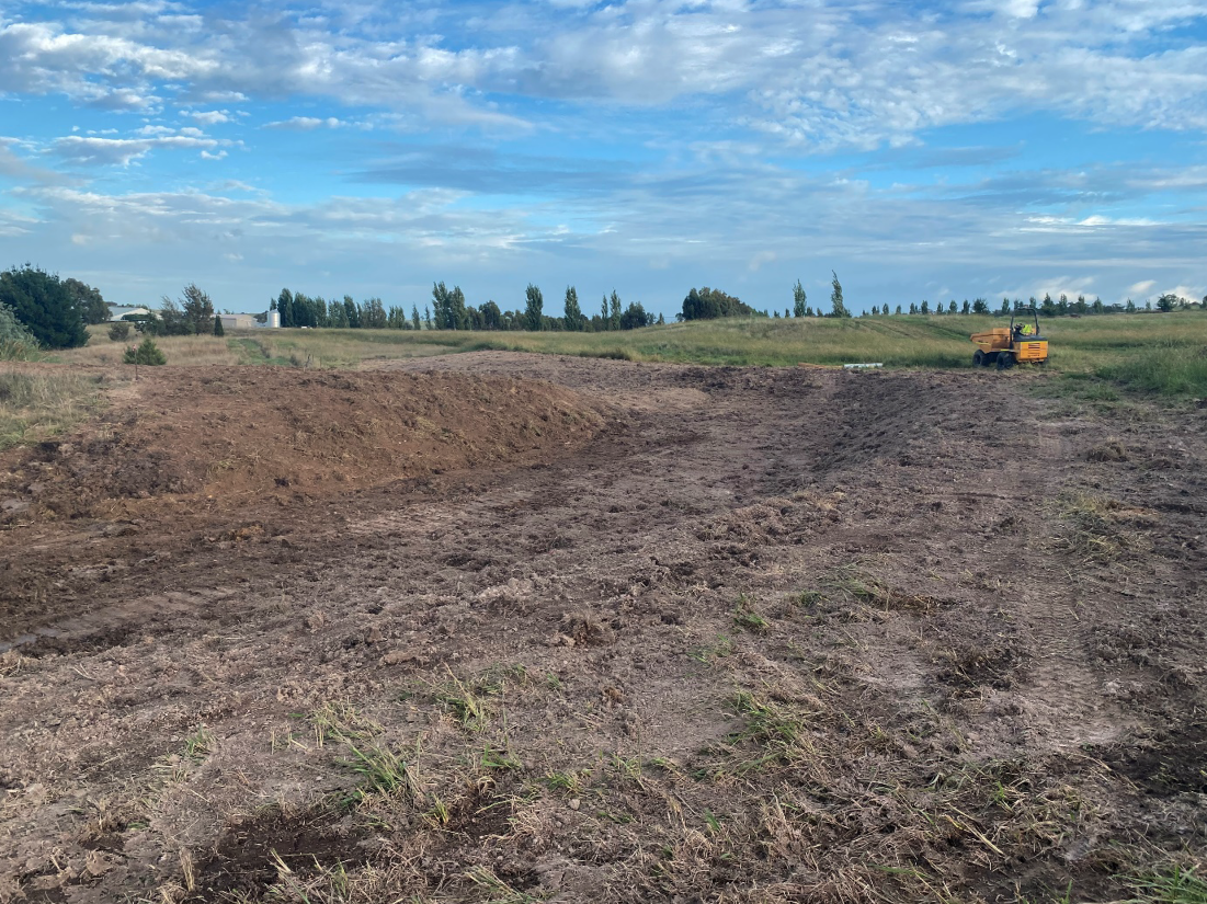
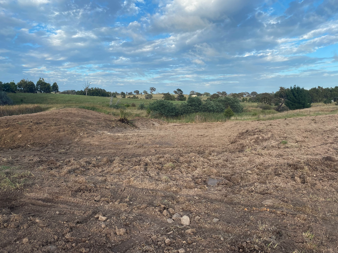
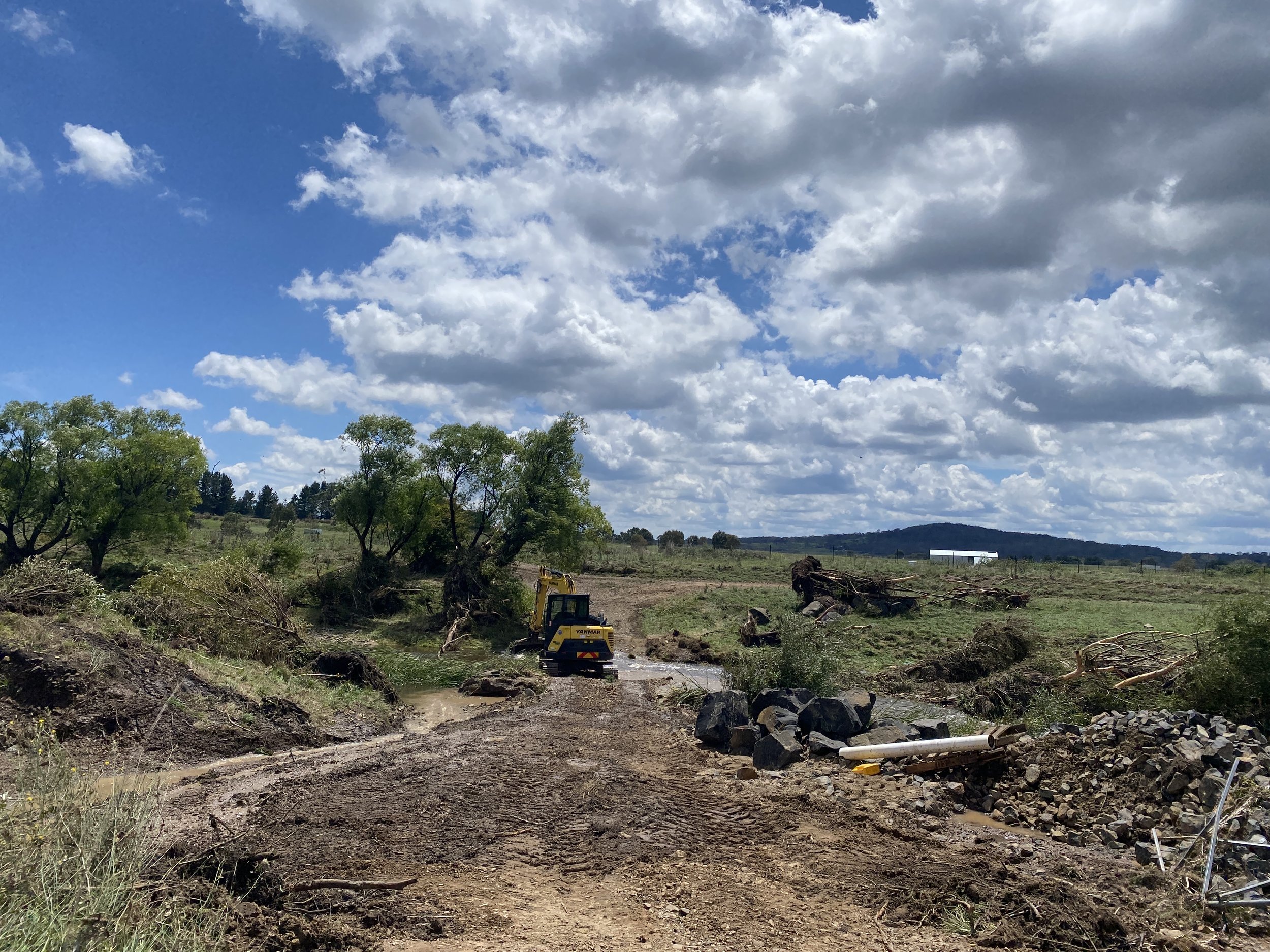
Snapshots from an amazing 2 days presenting our nature-based solution of landscape rehydration to eager Conference attendees.

The Mulloon team.

At the recent Mulloon Institute Rehydration Conference, we presented a small but robust sub-set of the hydrological data collected as part of the Mulloon Rehydration Initiative monitoring program.

We presented this data in the context of the Mulloon Interactive Web Map (Figure 1.) which can be viewed by anyone at this link

Figure 1. Screenshot of interactive web map showing the Mulloon catchment boundary.

To keep the conversation going with those who are interested, here is a brief overview of the presentation.

Pictured below (Figure 2.) is a Digital Elevation Model of the section of Mulloon Creek in which in-stream structures have been installed between 2006 – 2020.

Figure 2: Digital Elevation Model (DEM) showing the approximate extent of the two floodplains outlined in black and the location of the Mid and Lower Mulloon stream guages.

Pictured below (Figures 3 and 4) are two slides showing the volume of water flowing through the Mulloon Creek catchment between two streamflow gauges that are 10km apart. The upstream gauge is called Mid Mulloon, the downstream gauge is called Lower Mulloon.

The Mid Mulloon stream gauge is immediately downstream of the original 2006 Home Farm ‘Natural Sequence Farming’ demonstration completed in 2006. This demonstration installed 14 in-stream structures and many more gully structures built along a 2.5-km stretch of creek and several tributary gullies within the 100 ha Mid Mulloon floodplain pocket.

The Lower Mulloon stream gauge is downstream of 35 in-stream structures installed between 2018 and 2020.

Figure 3: Median daily flows at both Mid Mulloon stream gauge and Lower Mulloon stream gauge between 2006 – 2018.

Figure 3 provides the median daily streamflow at each stream gauge between 2006 and 2018.  This corresponds to a relatively dry period, after the Home Farm ‘Natural Sequence Farming’ demonstration structures were installed into the Mid Mulloon floodplain pocket but before any leaky weirs were built further downstream along the Lower Mulloon floodplain. During this period, the stream gauges show us that a median flow of 27.3 megalitres of water per day left the Mulloon Home Farm Mid Mulloon floodplain pocket whereas a median of 7.5 megalitres per day flowed from the Lower Mulloon floodplain.

Therefore, plenty of water (27.3 megalitres a day) left the Mid Mulloon floodplain pocket between 2006 – 2018, but only 7.5 megalitres a day reached the Lower Mulloon stream gauge 10km downstream.

What happened to the 20 megaliters of water per day lost between the two gauges? Most likely, it infiltrated into the aquifers of the Lower Mulloon floodplain. A reasonable amount would have evaporated as well.

Figure 4. Median daily stream flow 2018-2024.

Figure 4 covers a much wetter period on the east coast of Australia. This slide covers the period after 35 leaky weirs were installed along the 10km of Mulloon Creek between the Home Farm Mid Mulloon gauge and the Lower Mulloon gauge.

The median daily flow at the Mid Mulloon gauge immediately downstream of the Mid Mulloon floodplain during this period was 40.4 megalitres a day (an increase of 48% from the previous dry period – which would be expected during a wet period). The median daily flow at the Lower Mulloon gauge was 53.3 megalitres – an increase of 610% from the previous dry period median of 7.5 megalitres per day.

The data shown in Figures 3 and 4 proves that the installation of structures in the Mulloon Catchment has not reduced streamflows. Rather, the increased median flows recorded at the Lower Mulloon gauge potentially represent a net increase of surface water moving through the system.

We look forward to sharing more data stories soon.

To learn more about the Mulloon Rehydration Initiative’s history and monitoring framework, please read the following article: https://onlinelibrary.wiley.com/doi/full/10.1111/emr.12549


The Mulloon Interactive Web Map has been supported by the Australian Government through Citizen Science Grant funding. 

The Mulloon Rehydration Initiative is jointly funded through the Mulloon Institute and the Australian Government’s National Landcare Program, with assistance from the NSW Government’s Environmental Trust.

We’re captivated by these photos of the Mulloon landscape model! Master craftsman Gary McGuigan has nearly finished this mammoth task. There’s a reticulated water system, spongey floodplain inserts and tiny magnetised components that can be added and removed. Gary’s talent for simulating landscape features with intricate materials (and the handy Dremmel) is off the charts.  

The model will be showcased at our upcoming Mulloon Rehydration Conference (details and tickets here). After that we’ll be touring it for some special events, including the NSW Geography Teachers’ Association conference later in May. We’re looking forward to everyone having a tinker, and meeting Gary in person as well.  

This project has been supported by the Australian Government through Citizen Science Grant funding. 

Cara Harrington (Marketing Manager – Vitasoy), Sangeerni Iyer (CEO – Vitasoy), Cass Moore (Mulloon), Carolyn Hall (Mulloon), Kathy Kelly (Mulloon) and Richard Campbell (Managing Director – HydroTerra).

Mulloon Institute recognised as a Finalist in the Nature Positive Award at the 35th National Banksia Sustainability Awards 2024

We were up against an incredibly strong field in the prestigious Nature Positive Award, and while we haven’t taken out the top gong this year, we sincerely congratulate Vic Catchments for their wonderful work in restoring waterways while uniting communities and building biodiversity – their work is truly inspiring and worthy of this award.

This prestigious award celebrates achievements in conservation, habitat restoration and species protection. It recognises individuals, organisations and initiatives leading the way in sustainable management practices, ecosystem rehabilitation, and innovative research and technology for preserving biodiversity.

This recognition as a Finalist is a testament to our incredible team at Mulloon Institute, Mulloon Consulting and Mulloon Creek Natural Farms. Their unwavering dedication and hard work have been instrumental in getting us here tonight.

2024 may not be our year for the win, but the pursuit of excellence continues. We are grateful to Banksia Foundation for amplifying our mission of restoring landscapes to benefit biodiversity and agriculture, and for sharing our story of hope for the farming future of Australia.

A BIG thank you to the Banksia Foundation and judges. This national recognition at these 35th National Banksia Sustainability Awards builds on our story of hope, attracting increased visibility to our work, and opens doors to new partnerships, collaborations and expanded funding opportunities.

The Mulloon Institute’s flagship project is the Mulloon Rehydration Initiative (MRI) in southern New South Wales which is helping rebuild the functionality and resilience of the Mulloon catchment, its riparian corridor, tributaries, floodplains, wetlands, hills and woodlands, and is forming a critical biodiversity corridor in the region.

The MRI has provided a story of what can be achieved when grassroots rural communities come together and aspire to make change in how their landscapes function and how they manage their landscapes. It has shown communities that catchment-scale projects are possible, that funding can be found and that support from natural resource managers, regulators, scientists, and politicians can coalesce around participatory projects.  It demonstrates how rural communities can deliver a better future that combines safeguarding the richness of nature, with sustainable and financially productive agriculture and adaption to climate change.

A huge thank you to Cara Harrington (Marketing Manager – Vitasoy), Sangeerni Iyer (CEO – Vitasoy) and Richard Campbell (Managing Director – HydroTerra) for joining Mulloon at the Awards Ceremony.

The autumn edition of our eNewsletter Resilience is now available for reading so grab a cuppa, find a bench under a shady tree and enjoy the Mulloon team’s adventures during the the summer months across Australia.

Previous editions of Resilience can be accessed here.

Mulloon Consulting’s (MC) Jack Smart and Max Brunswick recently completed construction of works at Cadfor near Binda in the NSW Southern Tablelands in early March 2024. The works involved two rock chutes (the primary rock chute being 16m wide by 27 m long) with accompanying diversion channels and spillways to safely manage the return of flows to the Binda Vale Creek.

Historically, flows had been diverted out of the creek upstream of Cadfor in the 1970s to manage creek erosion issues with flows directed via a network of dams and contour banks back to the Binda Vale Creek. Unfortunately, the original works failed several times resulting in localised erosion issues and recent efforts to address the problem were unsuccessful.

The works completed by MC were designed to manage baseflows through the existing dam’s trickle pipe while providing multiple flow points to safely re-enter flows during large flood events to assist in spreading and dissipating the energy of the flows across a larger area.

The top diversion channel directs flows towards the dam. Base flows re-enter Binda Vale Creek through a trickle pipe in the dam while larger flows will engage the primary rock chute top right-hand corner). During extreme flood events, some water will exceed the diversion channel spill level and safely re-enter via a secondary ‘repaired’ rock chute (top left-hand corner).

Bottom diversion channel downstream of the dam with the sill of the primary rock chute in the distance. Photo taken immediately after construction after topsoil had been re-spread.

Primary rock chute during construction with rock rip rap and topsoil being applied progressively up the rock chute.

Primary rock chute (looking from upstream) immediately after construction and re-spreading of topsoil.


We are thrilled to be named a Finalist in the 35th National Banksia Sustainability Awards (2024) in the Nature Positive category.

This prestigious award celebrates achievements in conservation, habitat restoration and species protection. It recognises individuals, organisations and initiatives leading the way in sustainable management practices, ecosystem rehabilitation, and innovative research and technology for preserving biodiversity.

The Mulloon Institute rehydrates and restores landscapes to create healthy ecosystems that are full of biodiverse habitat, more resilient to climatic extremes, and capable of ensuring food and water security.

Mulloon’s world-class scientific research is recognised globally by the United Nation’s Sustainable Development Solutions Network which has chosen it as one of five demonstrators of sustainable agriculture and environmental regeneration.

The Institute’s flagship project is the Mulloon Rehydration Initiative (MRI) in southern New South Wales which is helping rebuild the functionality and resilience of the Mulloon catchment, its riparian corridor, tributaries, floodplains, wetlands, hills and woodlands, and is forming a critical biodiversity corridor in the region.

Spanning 25,000ha and involving 23 landholders, the initiative supports several threatened and vulnerable species, including the Scarlet Robin, Diamond Firetail, and Dusky Wood Swallow. Other species being reintroduced to the project area by Taronga Zoo include the locally extinct Yellow-spotted Bell Frog.

The MRI has provided a story of hope, of what can be achieved when grassroots rural communities come together and aspire to make changes in the way their landscapes function and the way they manage their landscapes. It has shown communities that catchment-scale projects are possible, that funding can be found and that support from natural resource managers, regulators, scientists, and politicians can coalesce around participatory projects. It demonstrates how rural communities can deliver a better future that combines safeguarding the richness of nature, with sustainable and financially productive agriculture and adaption to climate change.

This national recognition by the Banksia Foundation builds on our story of hope, attracting increased visibility to our work, and opens doors to new partnerships, collaborations and expanded funding opportunities.

The Winners are announced in Melbourne on Thursday 4 April 2024. We will keep you informed across our news pages and social media channels.

We presume most, if not all, readers are aware now of the change in structure and composition of the Board that occurred recently because of Gary Nairn’s illness.

In brief, I have accepted the role of Chair with Gary remaining on the Board as director. We also welcome Wilfred Finn as a new director. Statements from Gary and myself in relation to the change can be read here and here.

The Board meets approximately 10 times a year to set strategy and vision, oversee and take care of the assets of the Institute and assist Carolyn and her team in fulfilling our strategy and vision.  Our priorities this year are to:

  • provide funds to Carolyn and our excellent research, education and media teams so we can continue to conduct scientific research, improve our techniques and educate schools, communities, government and other organisations on our solutions;

  •  lobby governments across Australia to make significant regulatory change to facilitate the rapid implementation of our interventions into Australia’s waterways; 

  • support Mulloon Consulting in their work with landholders across Australia; 

  • support Mulloon Creek Natural Farms as it provides first-rate nutritious eggs and beef to the public; 

  • finalise our strategic plan for the next five years; and 

  • grow our membership, corporate sponsorship and philanthropy programs.

The change in Board provides an opportunity for the new Board to review, reset and rethink as we build on our solid foundations. It’s always good to periodically test your assumptions, challenge your methods and be creative in considering new strategies (as long as you don’t throw the baby out with the bathwater). In my experience, an energised, informed, collaborative group (with a balance of optimism and scepticism) makes better decisions overall than individuals. 

It’s time to bank that water into our landscapes to create healthy, vibrant ecosystems.

Matt

Matt Egerton-Warburton

Nolani McColl, Executive Landscape Planner had the pleasure of hosting Mark Hopkinson and Helena Darragh at the Mulloon Creek Natural Farms in February.

Helena is visiting from the UK where she works for the Countryside Regeneration Trust as their Head of Conservation and Land Management, supporting conservation delivery and regenerative farm practices across their properties.

They visited plantings and contours on the hilltop overlooking the Mulloon floodplain and two of the instream structures in Mulloon Creek installed as part of the Mulloon Rehydration Initiative.

With the MRI Conference coming up on 1-2 May, we will take participants on a similar tour on Day 2.

EARLY BIRD tickets for the Conference are available now.

Summer was a mixed bag with Boxing Day bringing one of the worst floods of the Sandhills Creek we’ve seen down at Duralla which caused widespread damage to infrastructure and significant impact to our egg production. Temperatures were mild and rainfall and soil moisture was well above average which led to prolonged periods of water logging across the farms. Towards the end of February soils started to dry out and pastures grew rapidly leaving us in a good position with plenty of feed moving into the cooler months.

The abundant and green pastures have certainly been a highlight of an otherwise challenging few months. Our redevelopment program continues down at Duralla and we’re hoping to make good progress on key infrastructure upgrades with some favourable conditions forecast. More news on this soon.

We’ve been busy building new exclusion fencing and repairing damaged fences from the floods, and autumn will bring plenty of work with egg production increasing, new flocks coming into production, weaner sales and preg testing for the heifers and cows. 

In other news, our Poultry Manager, Anna Teghini, took out a swag of prizes at the Tarago Show for her homegrown, no dig vegetables! Well done Anna. 

That’s about all for now. Wishing everyone well for weaner sales, an autumn break, planting and whatever else you’ve got on in your patch this autumn. Great time of year in the Tablelands. Catch you in June.

Matt

Some of the damage from Sandhills Creek following the Boxing day flood damage.