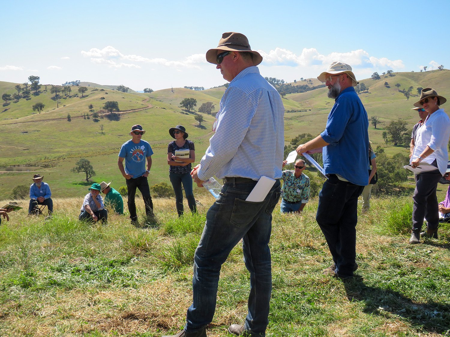
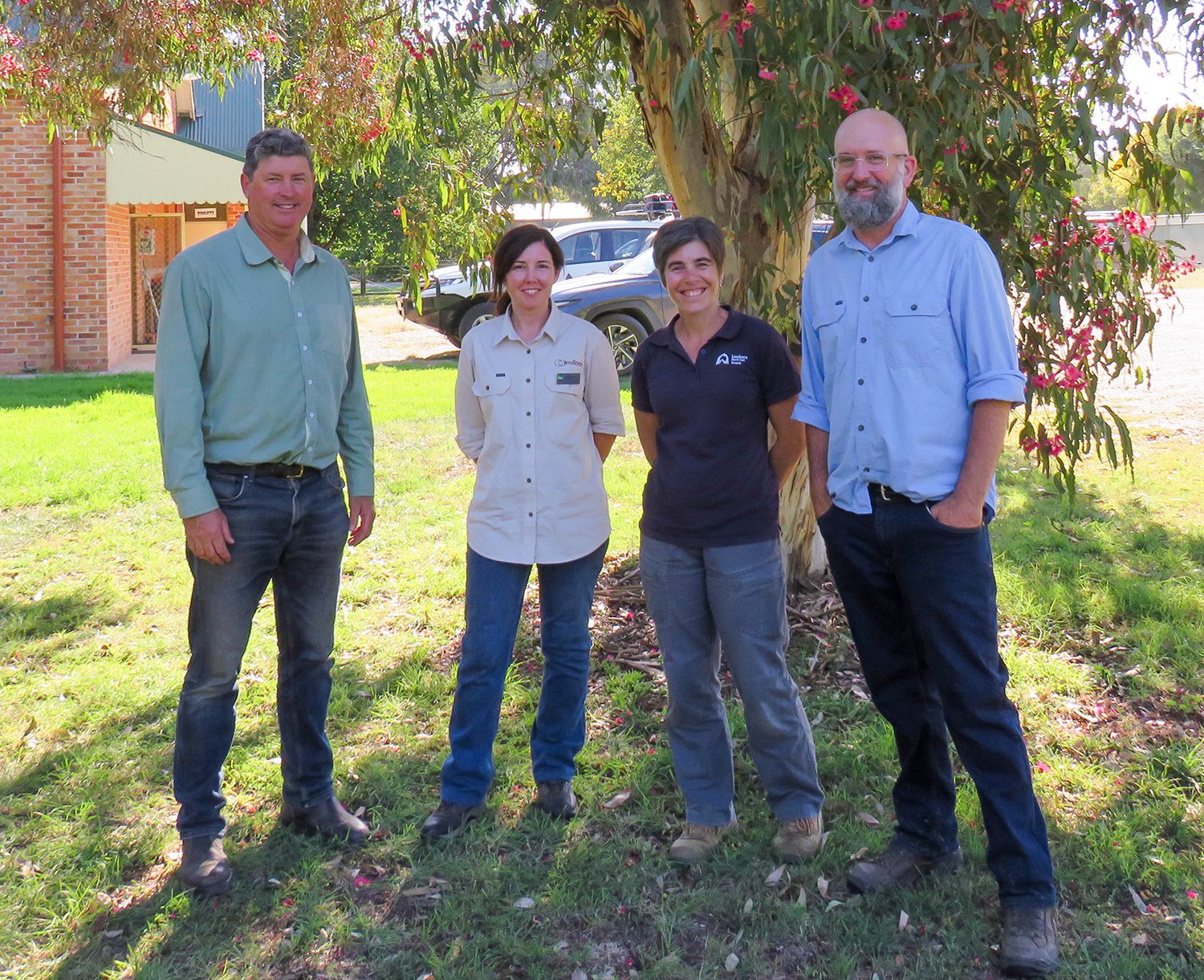
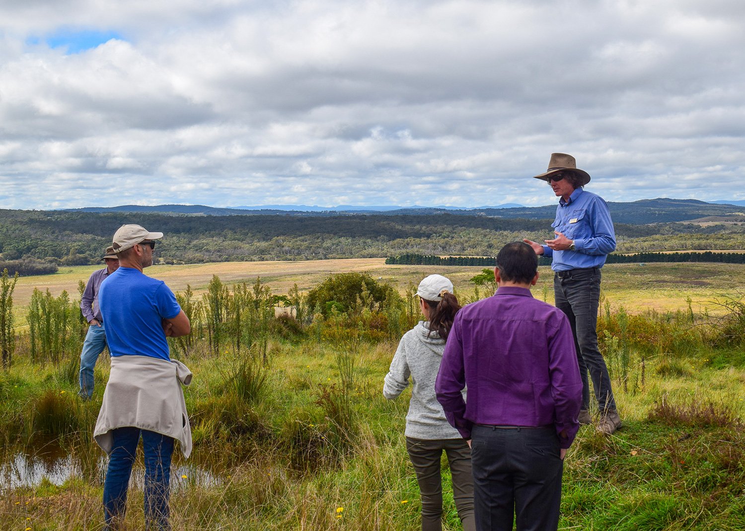
Peter Hazell and David Hardwick presenting outdoors.
Rehydrating Your Farm Landscape
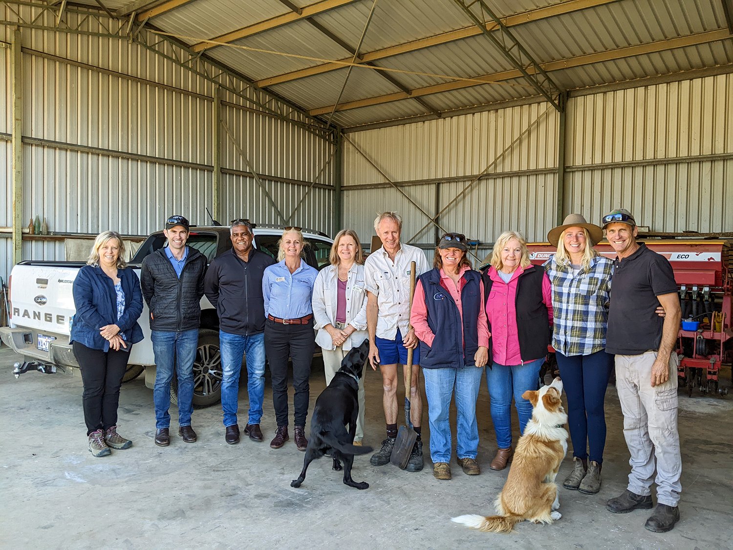
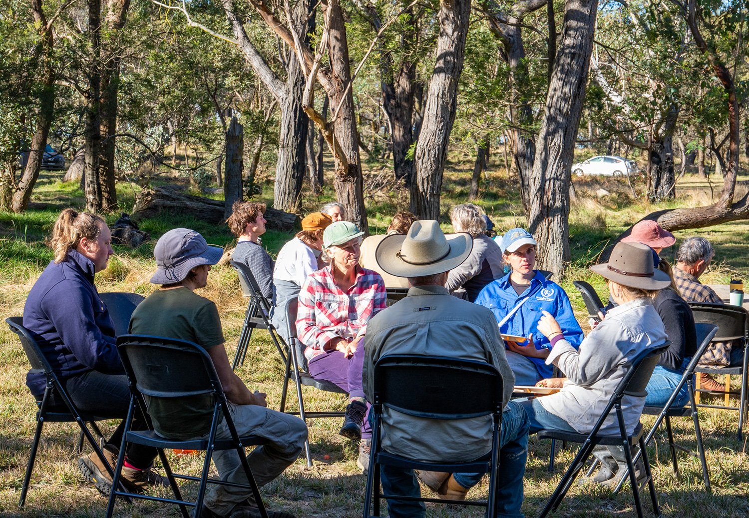
In March this year, the Greta Valley Landcare community were the first cohort to experience the Mulloon Institute Learning Program’s newest Bootcamp – ‘Rehydrating Your Farm Landscape’. Over two days, the Institute’s Peter Hazell and Tam Connor along with Soil Land Food’s David Hardwick, led landholders through a series of informative presentations, discussions and engaging activities on how landscape rehydration benefits their farms.
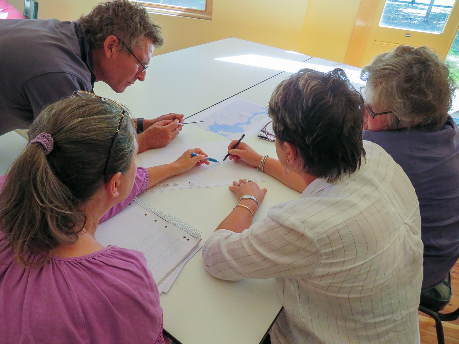
Geared towards growing our understanding of how water moves through landscapes, we ran a series of fun and interactive skills-building activities to hone our understanding of landscape form, function and their interconnectedness across times and scales. We explored the fundamentals of energy and the effect on the small and large water cycles, before launching into a hydrological map reading activity.
View fullsize
View fullsize
View fullsize
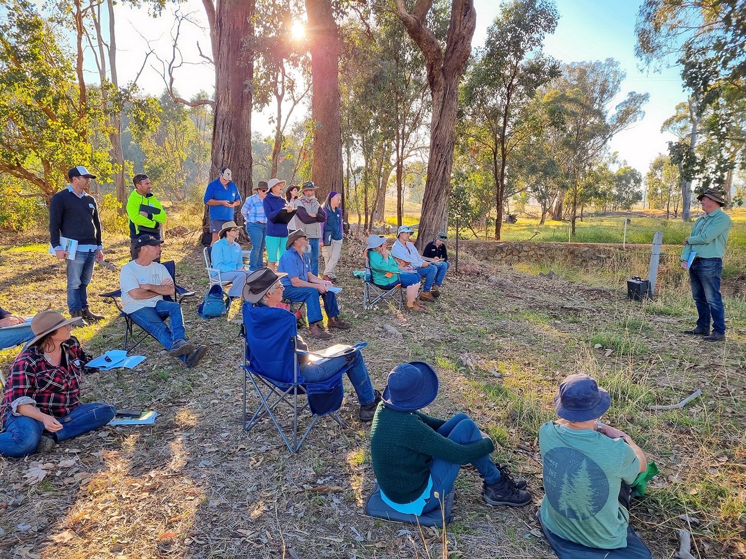
All about the action, we headed back out to a property to assess a healthy and eroded drainage line using simple soil and terrain indicators and discussed how landscape rehydration interventions, in combination with other strategies, can help restore function. Peter stepped through the Institute’s scientific approach using modelling for in-stream structures and the benefits of community action with catchment scale works.
We rounded out the bootcamp with a review of how this understanding of a landscape’s hydrological function can apply to identifying priority issues for your property and steps that can be taken to achieving landscape rehydration that works towards your vision and goals.
“Great course. The skills and knowledge of the presenters have given us confidence to make the changes we need. Very enjoyable.” – Participant testimonial.
Funded through the WA State Government’s State Natural Resource Management program, the project will plan and implement landscape rehydration works to restore landscape function on three properties in the agricultural areas of WA.
The final three properties were chosen from seven properties from across the Wheatbelt in south-west Western Australia that took part in the initial site assessments.
The chosen sites are:
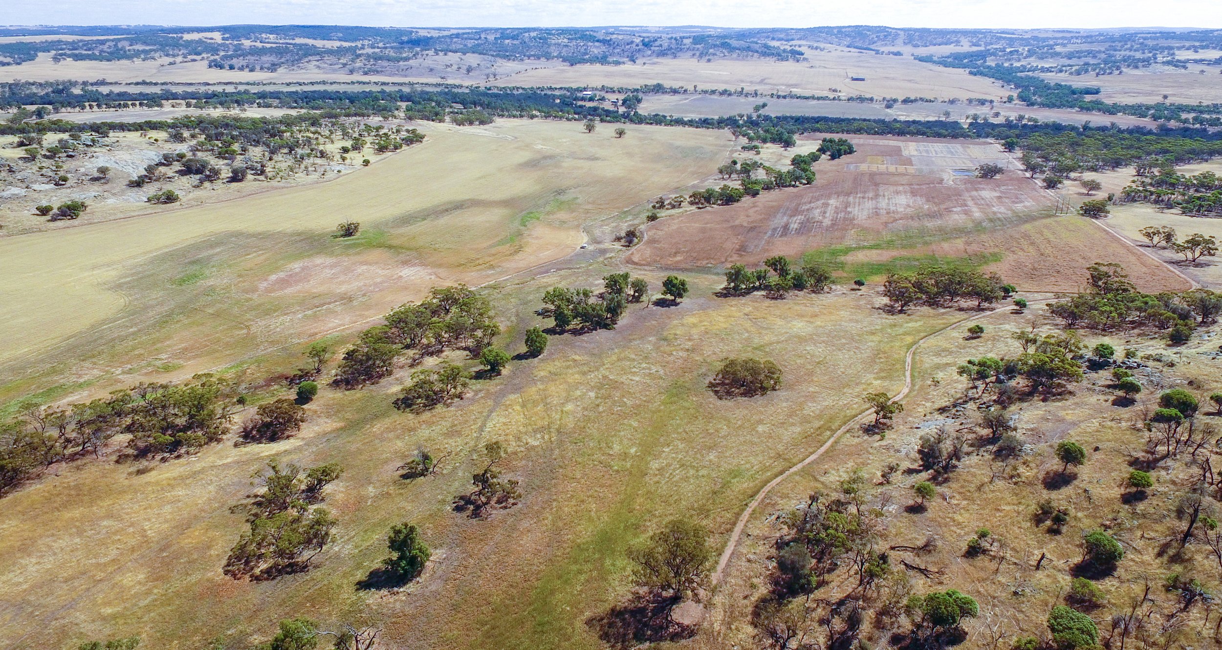
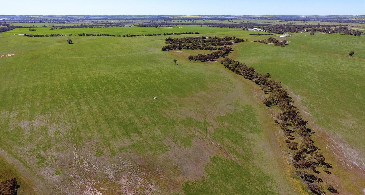
‘Muresk Institute’ – middle and lower north catchment, looking toward the Avon River.
‘Muresk Institute’, WA Department of Training & Workforce Development – Northam, WA
This is the training farm for the WA Department of Training & Workforce Development, located south of Northam on granite country. It is a demonstration farm for regenerative agriculture and rehydration, providing diploma courses to undergraduates, short term courses to industry and offering function/training facilities with accommodation available. It incorporates real-life farming operations, including raising sheep for wool and meat, cattle for meat and winter crops. The steeper property has two similar catchments, both flowing into the adjacent Avon River. One property could be fully rehydrated with regenerative practice while the other remains conventional.
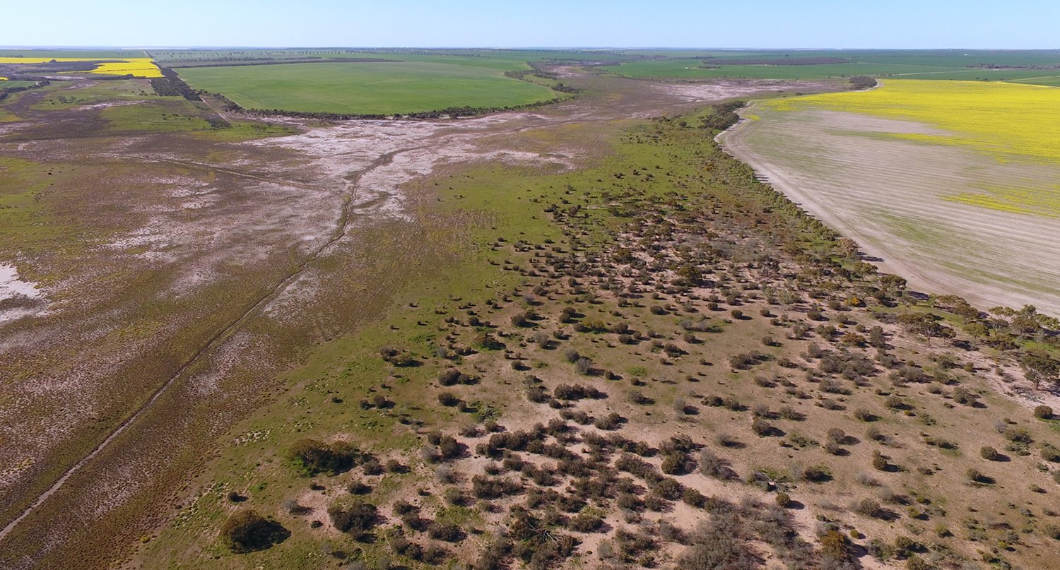
‘Cooinda’ – valley floor and adjacent slope.
‘Cooinda’ – Stuart McAlpine – Buntine, WA
Stuart practices regenerative agriculture at his property, maintains cover over his soil and is working to increase soil carbon and biology. Cropping is the main enterprise, but he is also planning to swing back to grazing cattle. The property has some exciting prospects for landscape rehydration work, including 2000 ha in the upper part of a large catchment, with salinised valley floors. Soils are sandy with gravelly ridges, on gently rolling hills and valleys. Waterlogging is prevalent along the edges of the valley floors. Salinity varies from mild to severe In the valley floors themselves, depending on elevation relative to the waterway. Gully water erosion is not a significant or a high risk, though sheet water erosion and wind erosion are an issue.
‘Wayneflete’ – south west paddock and creekline.
‘Bazil’s’ and ‘Wayneflete’ – Bev, Geoff and Jeremy Kowald, Katanning WA
The Kowalds have recently purchased the neighbouring property after leasing it for three years and are keen to implement landscape rehydration on it. They practice holistic grazing and have been working to build their soil carbon and biology. They are about to build a composting facility that will process manure and feed residue from the local abattoir. Their two properties have the scope to become one site, opening up the potential for good trials of landscape rehydration methods in the WA Wheatbelt/cropping context.
Queensland update
Date published: 18 May 2022
Natural wetland area threatened by erosion in the Lansdown catchment.
Late season heavy rains fell over the dry tropics in May bringing a sigh of relief from graziers all over the region. Undeterred by rain, Sam and Joe are running at full tilt on the Lansdown Catchment Rehydration Initiative (LCRI) and Weetalaba Landscape Rehydration Demonstration Site. Sam has also presented at the two day Goondiwindi Region Agribusiness Summit, discussing landscape rehydration, landscape pattern, rehydration and how to kick start building productivity and resilience.
The Lansdown Catchment Rehydration Initiative (LCRI) is a catchment scale project that is building drought resilience into the Lansdown community by empowering graziers to undertake landscape rehydration measures in their landscape. The Mulloon Institute is working with six landholders to identify opportunities for landscape rehydration and undertaking detailed designs of leaky weirs, contours and fencing plans. The Mulloon Institute is delivering the LCRI in partnership with NQ Dry Tropics and it is funded by the Future Drought Fund.
Dam to be enhanced in the Lansdown Catchment Rehydration Initiative.
The Weetalaba Landscape Rehydration Demonstration Site near Collinsville is set to have construction completed by mid-September 2022. Landscape rehydration works will focus on restoring the natural landscape function of an extensively eroded gully system. This will increase production values on the property by reconnecting the landscape with historic overland flow patterns whilst halting the movement of polluting sediment into the Great Barrier Reef. This project is funded by NQ Dry Tropics through the Great Barrier Reef Foundation.
Extensive gully system on Weetalaba Station.
Unfortunately, a workshop scheduled for the Upper Herbert Sediment Reduction Project has had to be postponed due to COVID and poor weather. The workshop was designed to introduce the audience to key concepts of landscape rehydration. We are working with Terrain NRM to reschedule to a later date. The Upper Herbert Sediment Reduction Project is funded by the partnership between the Australian Government’s Reef Trust and the Great Barrier Reef Foundation.
Come and work at Mulloon!
Date published: 16 May 2022
JOB TITLE: Science Officer
JOB TYPE: Part-time
LOCATION: Bungendore; travel may be required; some work can be carried out remotely
CLOSING DATE: Saturday 25 June 2022
MAIN DUTIES/RESPONSIBILITIES:
You will be part of a small team that manages the scientific and technical monitoring and reporting of the Mulloon Rehydration Initiative (MRI). Your role will include fieldwork, data collection and analysis, reporting, along with communication of data to stakeholders and the broader community. Your role will also include attendance and activities at field days for TMI. This role will involve a broad range of monitoring methods, that we hope the applicant will have skills and experience with as many as possible, particularly in hydrology, flora and fauna or the ability to quickly learn from training.
Assist with project management of the delivery of the MRI and associated grant reporting requirements.
Manage the monitoring components; Landscape Function Analysis (LFA), Ephemeral Drainage Line (EDL) assessments, and Rapid Appraisal of Riparian Condition (RARC) transects, analyse data and report to stakeholders.
Assist with various scientific monitoring as required, surface and groundwater, climate, frogs, fish, birds, aquatic invertebrates, soils.
Assist with reporting scientific results to a broad range of stakeholders, examples such as annual project reporting, TMI Science Advisory Committee, scientific papers, technical reports, formal and informal presentations.
Attendance and assistance at TMI field days.
Manage the digital data management system in liaison with industry partner HydroTerra, and associated data management.
Assist with conducting group tours and educational activities with a broad range of stakeholders, landholders, community groups, schools and universities.
Assist in other duties as required.
SKILLS & EXPERIENCE
Qualifications and Experience:
Minimum requirement Undergraduate Science Degree.
High level of scientific knowledge and application in the field regarding environmental monitoring of flora, fauna, soils, and surface and groundwater. Please see TMI website for information about MRI monitoring activities.
Experience with digital data management, analysis and reporting systems.
Good level of experience with technical and scientific analysis and reporting.
High level of communication skills appropriate to a broad range of stakeholders.
Experience with GIS and map production is advantageous, preferably ArcGIS and related use of satellite or aerial imagery.
Ability to operate independently at times, and with a small high-functioning team.
Experience with project management is preferred.
Abide by workplace health and safety policies and procedures.
Highly desirable skills and experience –indicate experience with as many as possible
Monitoring, analysis and reporting of:
Landscape Function Analysis (LFA)
Ephemeral Drainage Line (EDL) assessment
Rapid Assessment Riparian Condition (RARC)
Groundwater and surface water monitoring
Hydrological monitoring equipment e.g. stream gauges, piezometers, soil moisture sensors
Soils – field analysis
Bird surveys
Frog surveys
Aquatic macro-invertebrate surveys
Fish surveys (electro backpack and bait traps)
GIS and remote sensing and associated data management and analysis Satellite, aerial imagery, drones.
Skills:
Strong experience delivering high quality projects.
Sound knowledge of landscape rehydration principles.
Organised and able to meet deadlines.
Ability and desire to learn new skills.
Current manual driver’s license for work vehicle, and own vehicle preferred.
4WD skills an advantage.
Strong written and verbal communication skills.
Highly motivated and demonstrates initiative and a flexible approach to work.
PERFORMANCE GOALS:
Delivery of the MRI scientific monitoring on time and on budget.
Contribution to delivery of successful TMI field days.
Effective management of the MRI scientific and project management reporting requirement.
Deal with landholders and coworkers professionally at all times.
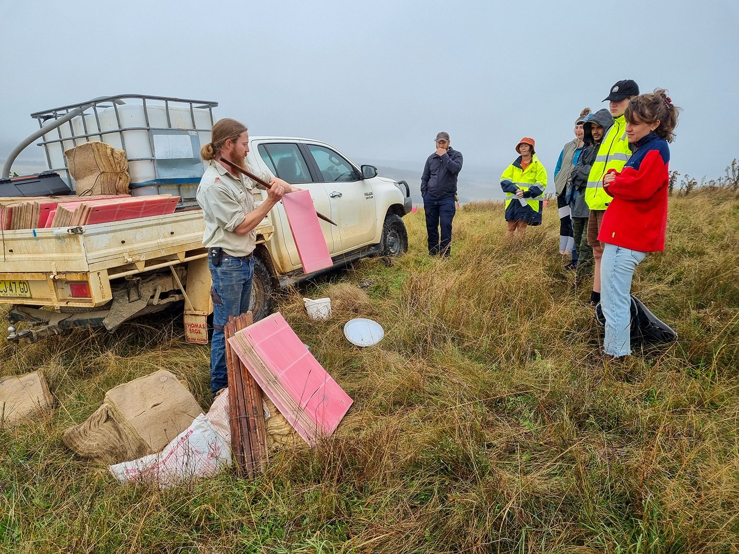
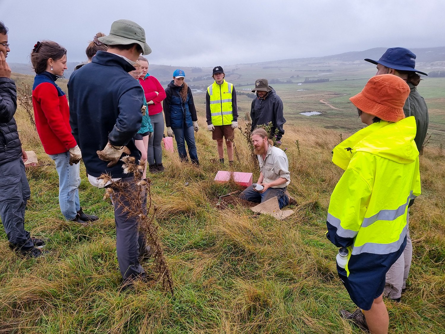
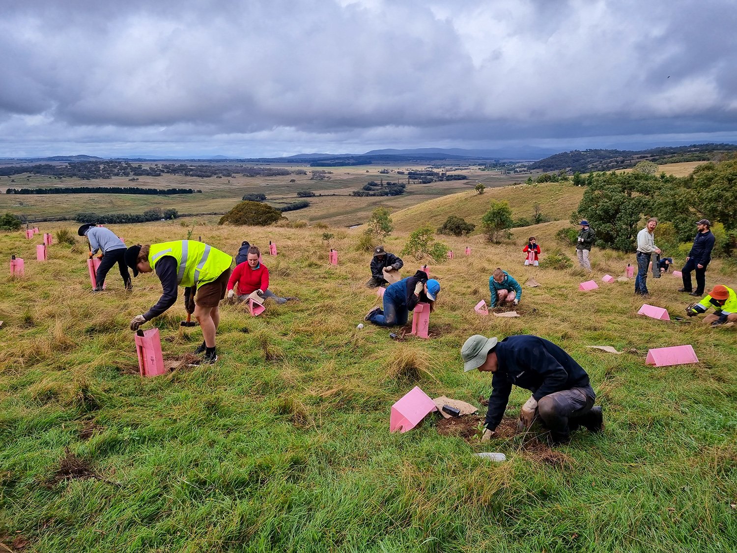
The ANU Intrepid Landcare group are a mix of ANU students and non-students who volunteer their time to contribute to environmental management projects in order to gain experience from, learn about and contribute to environmental projects.
The Mulloon Rehydration Initiative is a catchment scale project in the Mulloon Creek catchment which aims to restore landscape function to improve stream flow reliability, climatic resilience, ecosystem function and agricultural productivity. It is jointly funded through the Mulloon Institute and the Australian Government’s National Landcare Program with support from the NSW Government’s Environmental Trust.
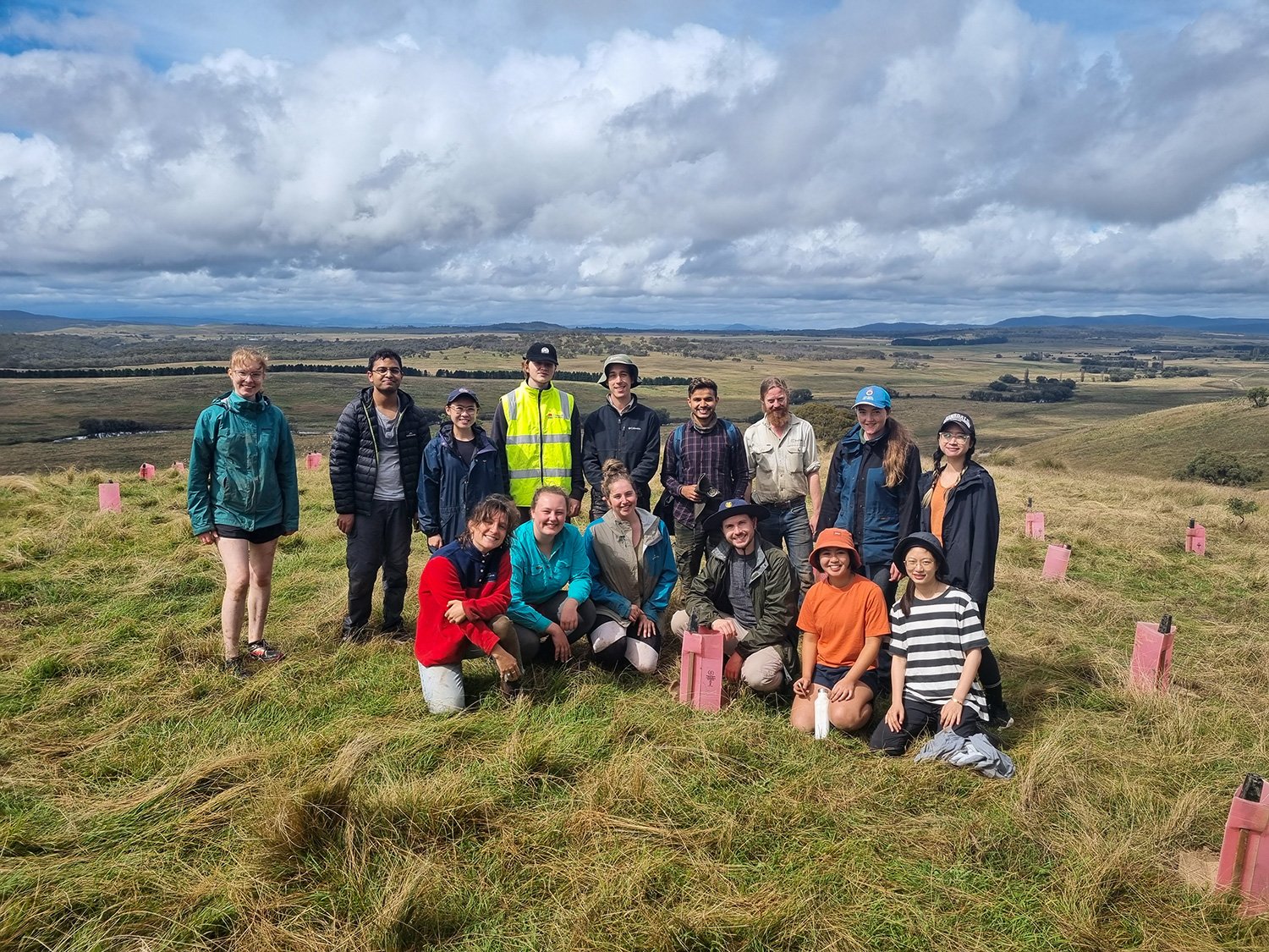
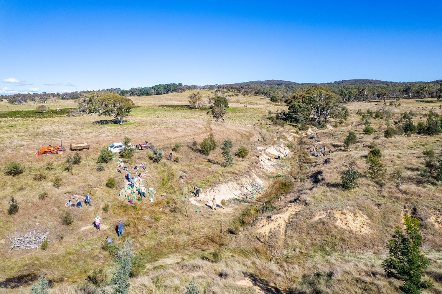
The ANU Intrepid Landcare group braved cold and wet conditions to plant over 150 groundcovers, shrubs and trees. The plantings form part of the hilltop contour plantings at Duralla which began in 2017. As they grow they will become an important part of restoring native habitat on a previously overgrazed and denuded ridge which spans the length of the property.
The volunteers were supervised on the day by the Mulloon Institute’s Max Brunswick (Technical Officer) and Penny Cooper (Trainee Director of On-ground Works) who were astounded at how quickly the volunteers were able to get so many plants in the ground in only half a day!
The Mulloon Institute are very grateful to the amazing young volunteers who took part and to all those who have contributed to previous tree planting events in the past. While the planting season has ground to a halt for now during winter, similar events will be held in spring. Keep an eye out on our social media pages and ‘Resilience’ Enews for news of future volunteering events.
View fullsize
View fullsize
View fullsize
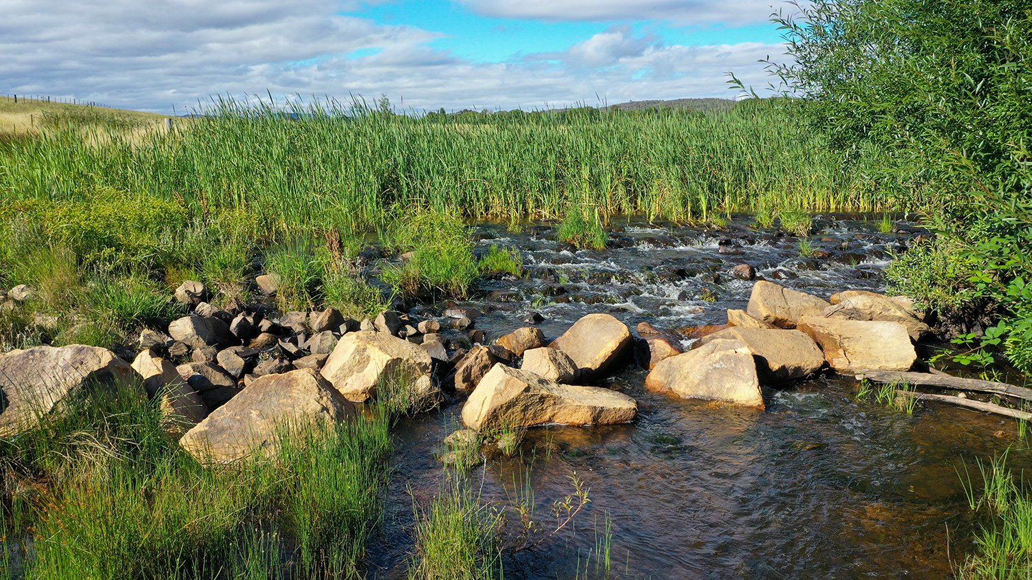
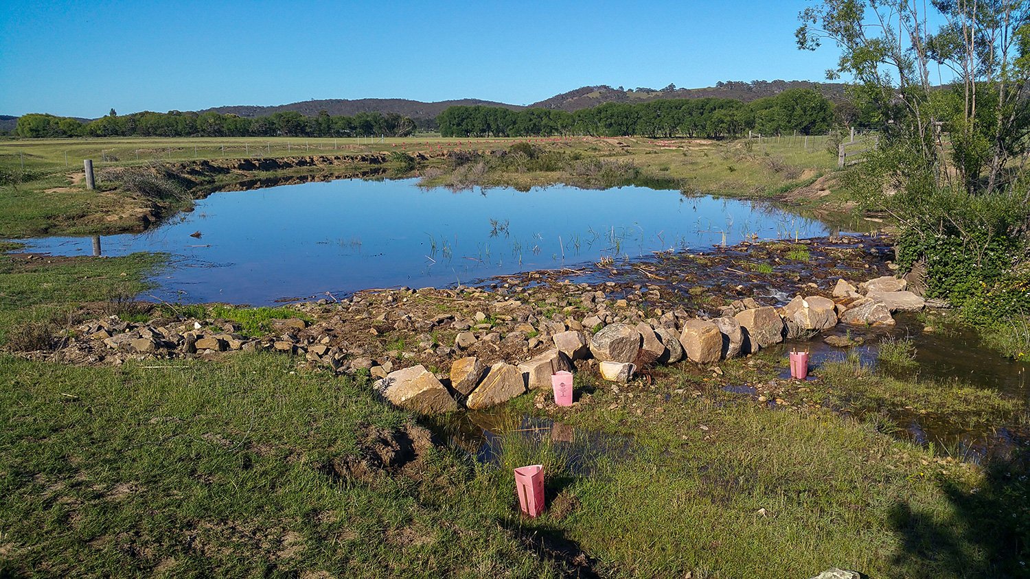
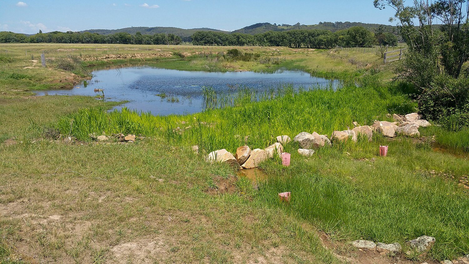
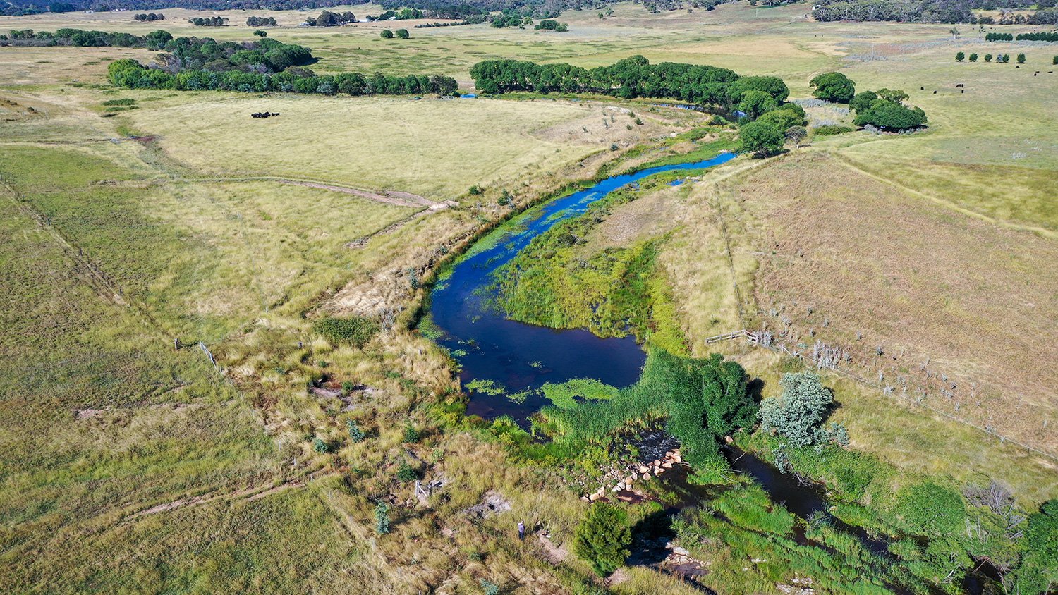
‘Westview’ – Leaky weir diary
Date published: 16 May 2022
Westview leaky weir two years after construction, in December 2020.
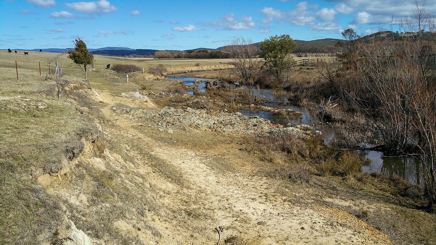
The creek was laterally unconfined and incised through to bedrock. From top bank to top bank, it was a bedload dominated, single continuous channel, flanked by sandy point bars and terraces where the fine floodplain sediments had been stripped away.
Riparian vegetation at the site was poor in density and diversity, with Crack Willow, Blackberry and some Black Wattle and River She-oak. Instream floating vegetation and emergent vegetation included: Phragmites, Cumbungi, Juncus and Marsh Wort. Riparian and instream vegetation was very sparse above this point as the creek became much shallower and livestock had easier access.
Stream condition was poor with the banks upstream and downstream of the site poorly vegetated and showing signs of recent erosion. There was poor vegetation density and species richness within both the aquatic and riparian zones.
Modelling
During the planning phase, current and post-structure modelled hydraulic conditions were calculated. This was required by the NSW Government’s Department of Natural Resources Access Regulator which granted a Controlled Activity Approval for the in-stream works. These approvals are required for in-stream works in higher order streams and help ensure that structures are designed for the stresses they will face.
Hydraulic values were also calculated for the catchment for a given point in the catchment. Point values were calculated for primary channel full, (top) bank full and post-structure (top) bank full. The calculated hydraulic parameters include:
August 2015
Discharge (Q) – Volume of water flowing past a given point in cubic metres per second (m3/s).
Average stream velocity (V) – Speed of water flowing past a given point in metres per second (m/s).
July 2017
Hydraulic radius (R) – Cross sectional area divided by wetted perimeter. The higher the R value the less flow that is in contact with the wetted perimeter of the stream, therefore, the faster the flow.
Annual exceedance probability (AEP) – a prediction of the likelihood that a given discharge will pass a given point in a catchment. For example, a 2% AEP is akin to a 1-in-50-year flood event.
October 2018
Catchment yield – Modelled average annual discharge of a catchment.
Time of concentration – measure of the response of a catchment to a rain event. Defined as the time needed for water to flow from the most remote point in a catchment to a given point.
Mean boundary shear stress (t) – Measure of the drag exerted by the flow across a channel bed – expressed as Newtons per square metre (N/m2) bearing down on the bed and banks of the stream.
Total stream power (Ω) – Measure of potential energy expenditure, expressed as watts, against the bed and banks of a stream. This reflects the total energy available to do work along a river channel.
Unit stream power (ω) – Watts of power per cross-sectional square metre of channel. The threshold for channel instability is around 35W/m2 (Fryirs and Brierley, 2013).
Froude number (Fr) – Dimensionless number to determine if stream flow is sub or super-critical. Number relates to likelihood of sediment movement. At subcritical (Fr <1), flow is relatively tranquil. At supercritical (Fr > 1), flow is high energy and turbulent.
Hydraulic modelling for this structure anticipated a significant reduction in total stream power once the structure was installed. This would be due to the proposed structure reducing the average stream gradient (slope), spreading the flow over a greater cross-sectional area of the channel, and associated riparian fencing and revegetation increasing surface roughness (Manning’s Roughness Coefficient).
During construction
November 2018
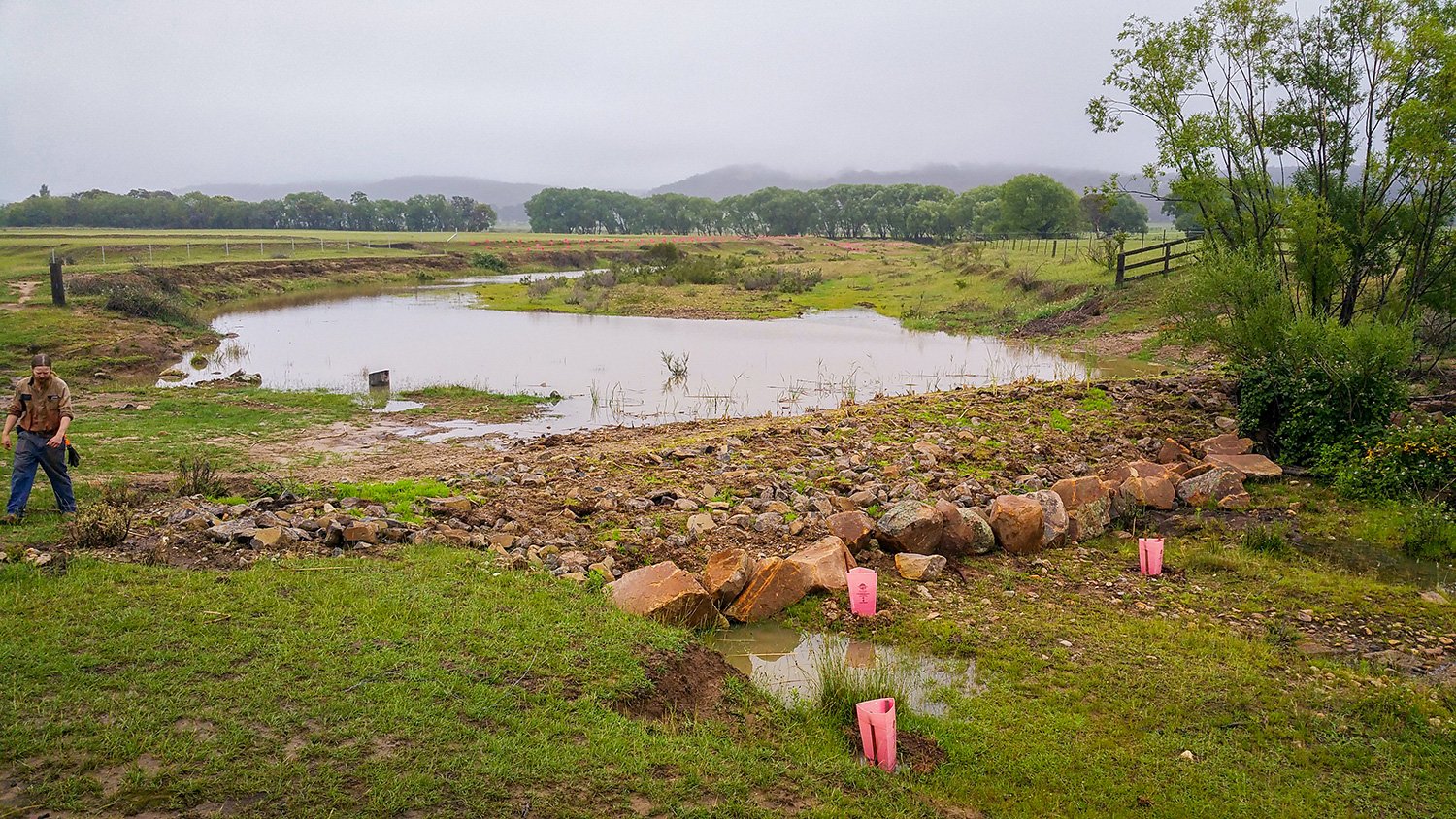
This bed control structure raised the site 700mm above the existing streambed by using a hardwood log sill and an imported rock baffle.
A hardwood log (400mm) was pinned to the bed using hardwood uprights (200mm diameter) which were keyed into each bank. Granite boulders (650mm) were also keyed into the upstream side of the existing bedrock bar to create a rock baffle.
December 2018
A bed of knitted brush mattressing and Poa tussock mulch (400mm high) was installed for undermine protection. Streambed gravel was placed against the upstream side of the structure, into which Typha and Phragmites were transplanted. For scour protection on the flanks, a deep rip rap apron (200mm) was installed on the downstream side (where bedrock is absent), extending to one metre above the low flow channel on both flanks. The banks and bed above, below and on the in-stream structure were extensively planted with native vegetation comprising reeds, sedges, shrubs and trees. This image shows stock exclusion fencing has been installed to manage livestock access.
After construction
December 2018
Flow-over, soon after construction. The width of stream inundation has been greatly increased under baseflow conditions.
February 2019
Millet was planted as a cover crop to provide rapid stability for the rock ramp. This plant will burn off with the first frost.
March 2020
The following spring, native perennial wetland vegetation had taken over, including species such as Cumbungi and Eleocharis.
October 2020
Native perennial wetland vegetation continues to take over.
December 2020
Diverse plant assemblages are colonising the in-stream works, the pond zone and the banks. The vegetation is slowing stream flow, filtering sediments and nutrients, improving water quality, moderating the micro-climate, improving the water cycle and creating a more complex ecosystem. Plants include Cumbungi, Umbrella Sedge and Marsh Wort.
Making connections, healing Country
Date published: 16 May 2022
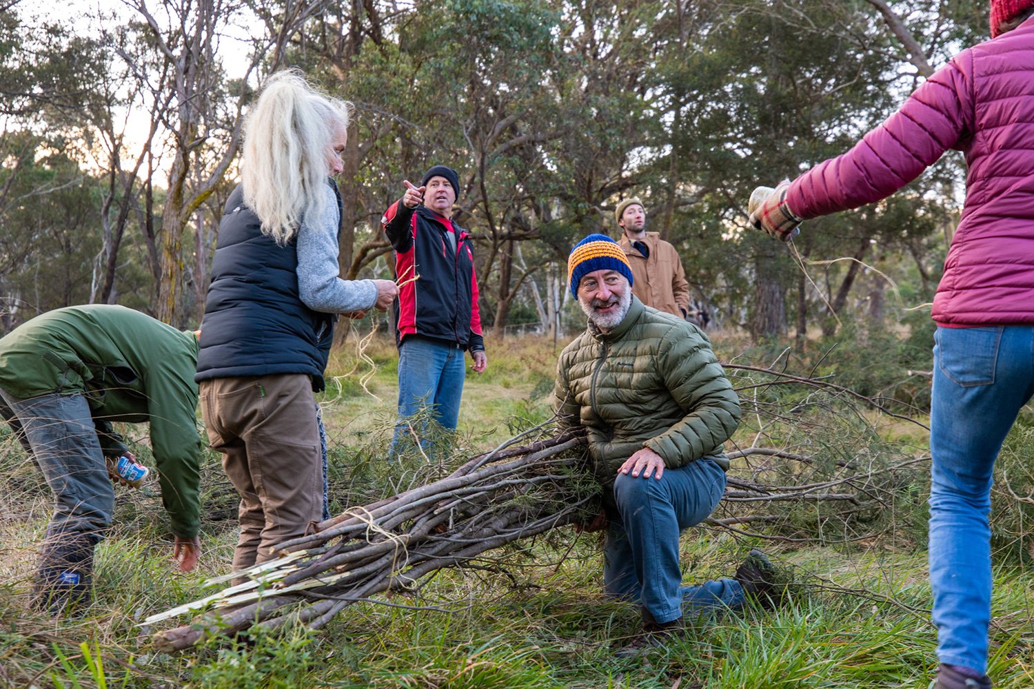
Looking at the gully system – brushpacks are placed throughout the gully floor with native plantings along the banks.
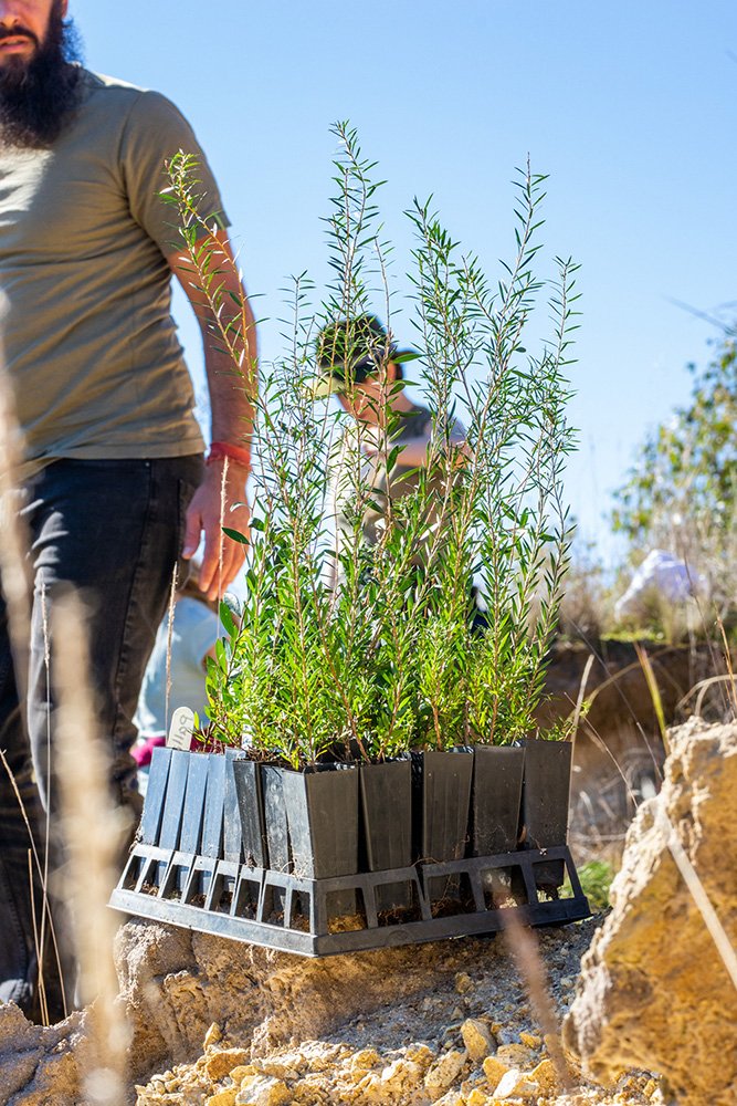
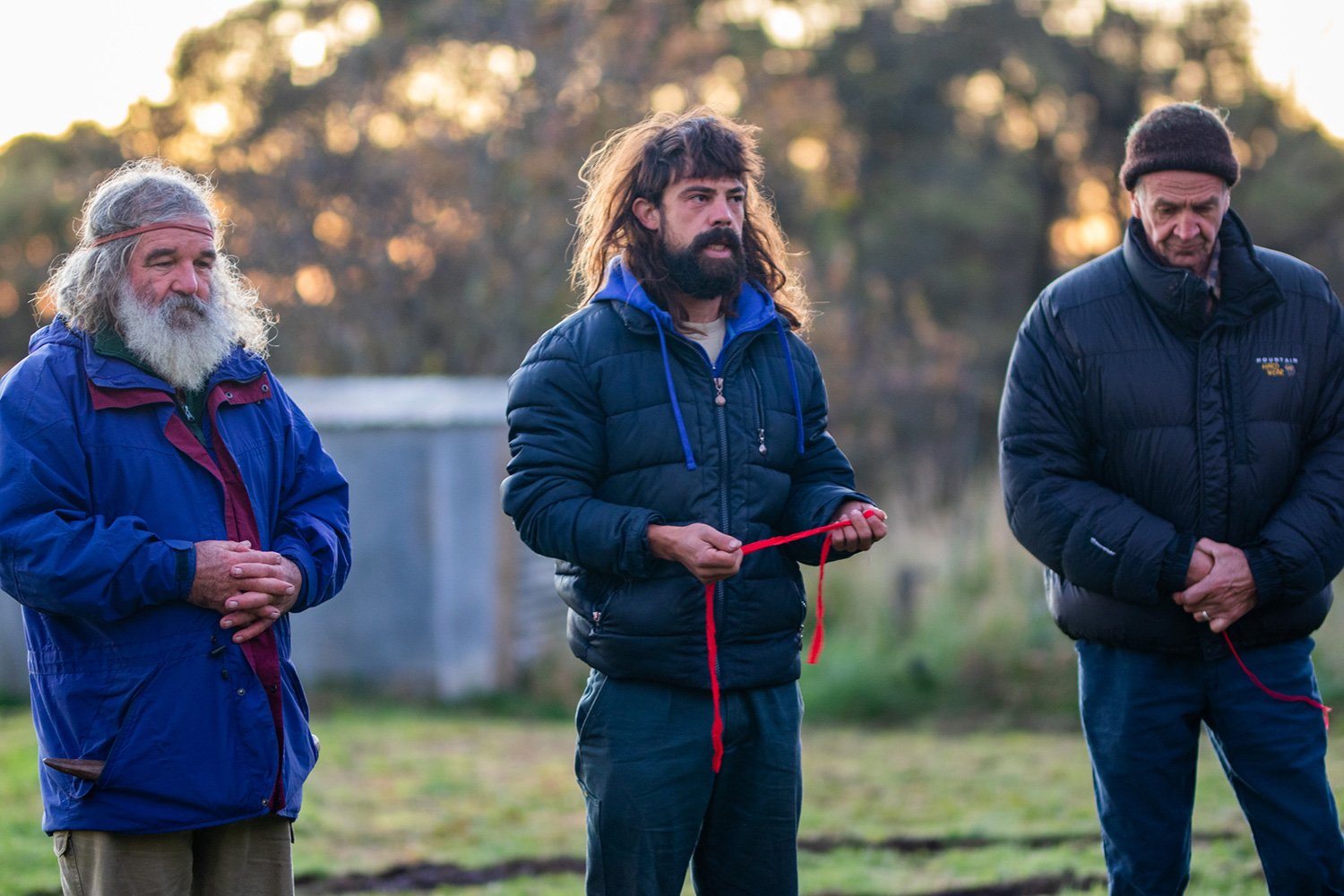
Over a weekend in early May 2022, the Mulloon Institute (TMI) and Back to Country (BTC) held a workshop as part of ‘The Mulloon Institute – Back to Country Co-Educational Project’ to share knowledge of landscape rehydration and cultural awareness between the organisations.
Back to Country is an Aboriginal Corporation established under the guidance of the late Yuin Elder Uncle Max Harrison to deliver projects and activities that pass on knowledge and connection to environment and country. Their vision is to heal Country and people by providing opportunities for Aboriginal and non-Aboriginal peoples to learn about traditional Yuin culture. They provide activities, programs and events centred around passing on traditional knowledge and learnings, such as cultural camps, tours, ceremonies and land management.
Native trees were planted as part of the workshop.
The co-educational project aims to bring about on-the-ground changes for the ecological health of the Mulloon catchment in southern NSW via workshop activities and further develop key partnerships between the organisationsand with local landholders. A key component of the cultural education is understanding that caring for Country is about giving back. Caring for Country provides a relationship to the living world, informing purpose, belonging, meaning and identity.
Hosted at Tom Gordon and Martina Shelley’s property ‘Birkenburn’ near Bungendore in NSW, the weekend involved hands-on, on-ground works to increase ecological health, and cultural activities which strengthened partnerships between participants.
Greg Smart (Back to Country – Senior Knowledge Holder)
L-R: Greg Smart (BTC) with Paris Capell (TMI)
What a wonderful opportunity it was for people to come together. To initiate further progress toward the healing of Country and people. The damage has been done, we can see it and feel it and the game is up, no longer is complacency an option.
Back to Country and the Mulloon institute met to further the story line of remembering, responsibility and repair. It is in the healing of Country that we are also healed. We can have a balance between food and water and resources for the human species while honouring and incorporating the important living elements of country.
We were met on arrival to Birkenburn by a massive flock of crows, maybe close to 200, I have never seen a bigger group. I remarked to the men present that this is not a murder but a massacre of crows. We have to witness and acknowledge the damage done to the Country and people before we can repair and heal.
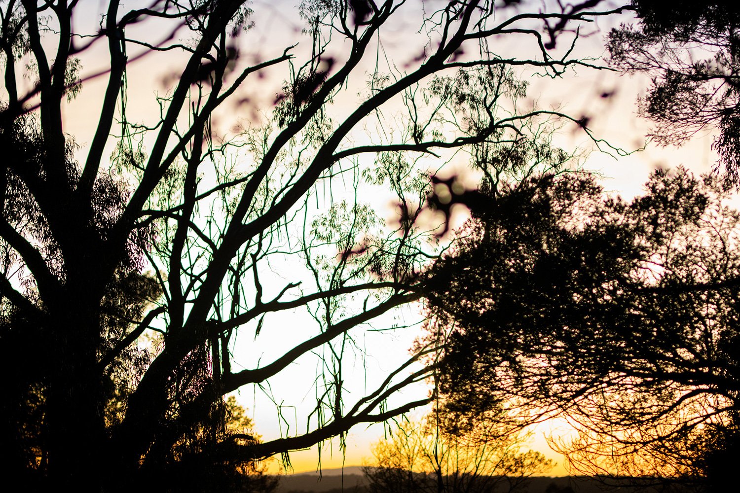
Sunrise at Birkenburn.
The spirit of the gathering was so real, we were led by the wombat, that ancient carer of country. Both in the correct way to move through country in silence and respect. Also, wombat’s important role in connecting deeply into country and water.
The very respectful period of silence we held before commencing was to reflect on the old people of this country. Uncle Max in particular, for the time is short, to remember our individual and collective roles and responsibilities, to bring some hopefulness back to the Country and its people.
The silence of our reflection was punctuated by sounds of the black cockatoo and children’s laughter. It is only by being attentive to the timeless messages, such as from that old water bird, can we be more confident of a future time to come, where the children will once again connect to life and Country, without fear but with joy.
As Richard Swain (BTC) said, when asked what advice does he have for children, he replied, “to hold the adults to account”. If we allow the Country to continue to bleed away the water reserves, we are all in trouble. The weekend was a message of hope. That many people do care and need direction from the likes of the Mulloon Institute and Back to Country. Through the mother.
Working together to plant native trees and shrubs along the banks of the gully floor.
My personal reflection of healing
Penny Cooper (Mulloon Institute – Trainee Director of On-ground Works)
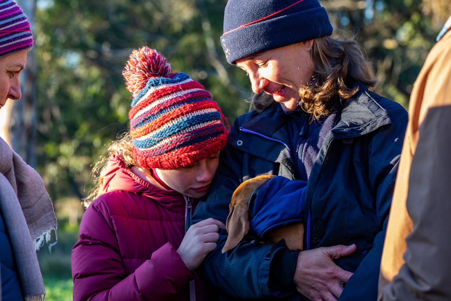
Penny Cooper (right) with her daughter Grace (centre) and TMI CEO Carolyn Hall (left).
As a non-Indigenous primary school student in a small country town, I was taught about Aboriginal Australians in history lessons. We learnt about Aboriginal foods, tools and types of shelter. We also learnt that Aboriginal Australians hunted and gathered from the land in one place and then moved on to another area to hunt and gather there. Little was taught about the impact on Aboriginals when the ships of the First Fleet arrived. We were taught that there was conflict and Aboriginal and British people lost lives, but the main message was one of discovery, pioneering and exploration of a new land. Not a story of massacre, dispossession, displacement, greed and ignorance.
So, it came as quite a shock to me when I took a subject at university which required the reading of Dark Emu Black Seeds by Indigenous author Bruce Pascoe. This was quite an awakening read and the shame I felt stung like a slap. I realised just how ignorant I was on the truth of the civilisation that existed before European settlement in Australia. The truth of the sophisticated social, economic, and agricultural structures that existed in a peaceful harmony. The truth of truly ecologically minded people who saw themselves as nothing more than a part of the natural environment. Not as conquerors or dominators, who believe themselves somehow more powerful and cleverer than mother nature herself.
The workshop included formal and informal knowledge sharing between participants.
I had to learn more, so I took another subject on Contemporary Indigenous Australian Realities which educated me on the devastating impact of European settlement and the ongoing, transgenerational trauma. I also learned the meaning of terra nullius and how this concept was wrongly used to justify British occupation. Although I grew up on a farm, my world was devoid of Aboriginal people and although I loved the natural world and would relish lessons on native trees, plants and animals, the lessons lacked something. They lacked the knowledge and wisdom held by Indigenous Australians who know and love the land and its inhabitants, like one knows and loves their mother.
After university, the very rare contact I had with Indigenous Australians left me feeling awkward, ignorant and ashamed. However, I was determined to find a way to connect, show respect and continue my learning. So it was with high expectations, a heavy load of shame and my own personal understanding of the meaning of transgenerational trauma, that I attended the weekend with Back to Country (BTC) and the Mulloon Institute (TMI).
Ross Knight (centre) explains the significance of the red headband in ceremony, with Greg Smart (left) and Ian Scott (right).
It was the Mother’s Day weekend. We gathered around the campfire on a beautiful, crisp autumn afternoon at the property of Birkenburn which has a shared boundary with Duralla, the Mulloon Institute’s Mulloon Creek Natural Farms. Yuin Senior, Greg Smart welcomed the group and shared lessons on respect and tuning in to Mother Earth and all the signs of the natural world around us. Greg referred to wisdom and teachings of the late Uncle Max (Max Dulumunmun Harrison). Uncle Max was the founder of the BTC organisation. He also had a friendship with the late Tony Coote, TMI’s founder. Uncle Max was the key instigator for the very event we were attending.
As we sat and listened, Greg invited others to speak. I was deeply moved when Tasie from BTC spoke of being respectful to women and treating all women with kindness and care as they are or represent mothers. He likened women to the mother (Mother Earth), and in caring for the mother, she cares for us. I was deeply humbled to be recognised by this Indigenous man although I felt ashamed of my ignorance and unworthy of this respect.
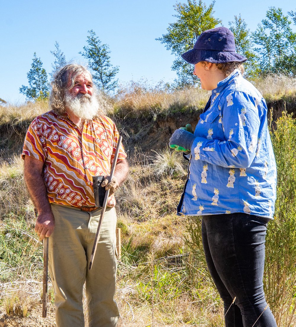
Peter Hazell (centre) directs the harvesting of black wattle found onsite at Birkenburn to build brushpacks – a simple and cost effective method of restoration.
Peter Hazell spoke of the relationship between Uncle Max and Tony Coote and the hope they both shared of the two groups (BTC and TMI) coming together to share knowledge and to work together to heal Country. By the end of the weekend, however, I felt that some members of the TMI team had learnt so much more than we were able to impart.
The Mulloon Institute led an exercise on building brush packs which we later took into a gully to add to pre-existing brush pack weirs from a project in 2016. The leaky brush weirs have been trapping sediment and aggrading the system, and the sides of the gully are beginning to naturally batter and grow vegetation. We planted more shrubs in the gully to further contribute to the repair, and throughout this activity, BTC members contributed knowledge and wisdom which complimented our work of healing the gully. There were also lessons to be learned such as the need to find alternatives to plastic tree guards. The long and silent walk down to the gully was also a lesson in patience and awareness of the living environment through which we were passing. An important skill to have when we are attempting to read a landscape and understand where and how the work needs to be done.
Workshop participants sharing a hug following the sunrise ceremony.
We were all very privileged to attend a traditional sunrise ceremony on Sunday morning, welcoming Grandfather Sun. This was led by Tasie from BTC and is a ceremony in which the participants give thanks for the first day of their life, the day of their birth. This was made particularly special as it was Mother’s Day and the gratitude extended to our mothers through which we began our first day. We stood in three rows facing the rising sun and each person took their turn to thank Grandfather Sun for the first day of their life and express other gratitudes. Another lesson in patience and respect. When everyone had spoken, every person hugged one another.
I am feeling the weight of shame and ignorance is lifting, though I have much yet to learn and understand, as do all non-Indigenous Australians. I am so very grateful for being able to attend this weekend and so awed by the humility of the BTC team who guided the TMI team through such special ceremonies and teachings. Through them I have developed a deeper connection to the land upon which I live and work. I also glimpsed the deep, binding, spiritual connection Indigenous Australians have to this amazing country. Thank you to all who attended for making this weekend one of connection, sharing, mutual respect and healing.
Workshop participants preparing the gully for planting.
ANU & Watershed Organisation Trust field trip to Mulloon
Date published: 26 April 2022
At Peter’s Pond on Mulloon Creek
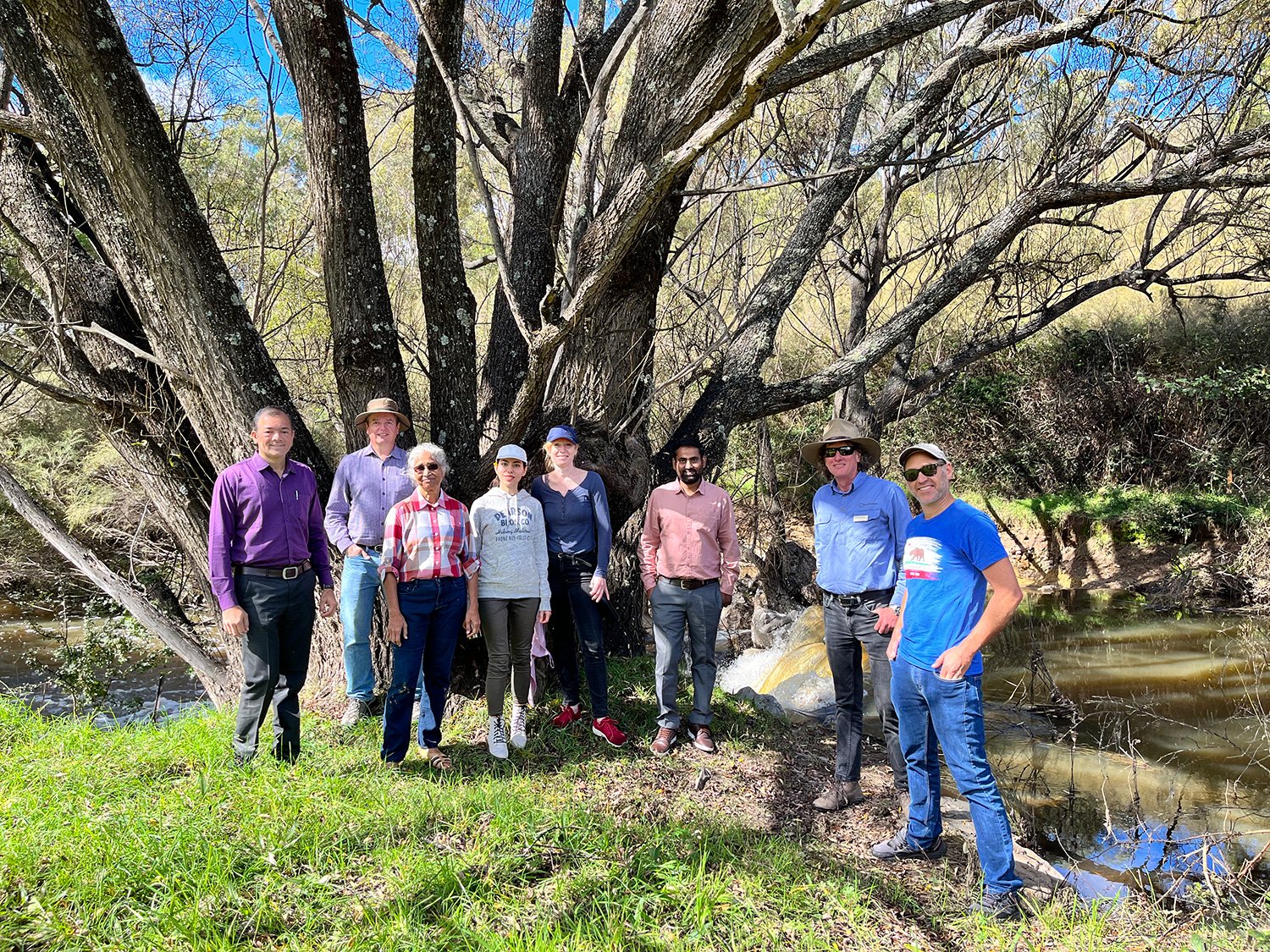
On a sunny autumn morning the Mulloon Institute’s Research Coordinator Luke Peel and Graduate Landscape Planners Erin Healy and Paris Capell met with members from WOTR, the Borevitz Lab and GIZ for a tour of Mulloon Creek.
The team from the Watershed Organisation Trust (WOTR) had travelled from India to see the landscape rehydration works being undertaken as part of the work at the Mulloon Rehydration Initiative. The MRI is a catchment-scale project that aims to rebuild the natural landscape function of the Mulloon catchment and boost its resilience to climatic extremes. It is jointly funded through the Mulloon Institute and the Australian Government’s National Landcare Program and with support from the NSW Government’s Environmental Trust.
Dr. Marcella D’Souza, director of the WOTR Centre for Resilience Studies, shared some of the contextual challenges and learnings taken from the Indian landscape and climate that have similarities with many regions across Australia. It was great to discuss common challenges such as raising awareness and ecological education in communities within dehydrated landscapes. WOTR are leading rehydration and social transformation projects in India, and the team at Mulloon looks forward to strengthening our relationship with WOTR into the future.
TMI were also delighted to be joined by representatives from Australian National University Professors Justin Borevitz and Jamie Pittock, and Dr Firouzeh Taghikhah who is leading the development of the farm model DAESim (Dynamic Agro-Ecological Simulator) for natural capital assessment. After the tour at Mulloon Creek and further discussions between the group, Firouzeh looks forward to integrating some of concepts presented at Mulloon into her model to better simulate the interactions between soil, plants, and water.
Viewing the ponds at Duralla on the ridge-line contour.
The group commenced their tour at the Duralla ridge-line contours and tree-planting, with a brief stop in front of the pasture raised chicken and cattle grazing operation which prompted a great discussion point for how integrated livestock management within farming systems to maximise production systems and the pasture. The group then travelled to Mulloon Creek Natural Farms (Home Farm) to view the pilot project sites and landscape rehydration works and resultant vegetation growth in the riparian zone and adjacent floodplain pastures. The group were enthusiastic to learn more from Luke about TMI’s extensive monitoring work and the data is expected to be trialled with Firouzeh’s model.
After a wet couple of years, it was great to see how well the Mulloon landscape has responded. Our visitors were impressed with the dense groundcover across the ridgeline and hillslopes below the contours at Duralla. They were equally impressed with how the contours have become small wetlands attracting animals and self-propagation of native wetland plant species. Much of the tree plantings occurred from late 2017 to 2019 during the extreme drought yet have had extraordinary growth due to the rehydration works and expert planting managed by TMI’s team of Peter Hazell, Max Brunswick, Penny Cooper and numerous volunteers.
Thank-you to Justin Borevitz and his team for organising the visit. We look forward to hosting more national and international partners at Mulloon as Australia lifts its travel restrictions.
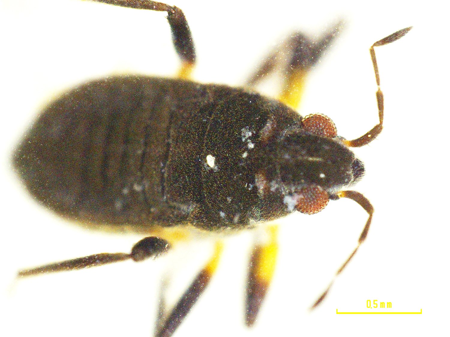
Aquatic macroinvertebrates survey (2019-20)
Date published: 22 April 2022
Veliidae from Black Jackie pond on Mulloon Creek. [Photo: Dr Paul Cooper, ANU]
Dr Paul Cooper from the Australian National University has now completed analysing the aquatic macroinvertebrates survey data collected in 2019-20, after Covid restrictions delayed earlier identification efforts in the lab.
The survey forms part of the ongoing monitoring for the Mulloon Rehydration Initiative, where the Mulloon Institute is working with 23 landholders in the Southern Tablelands of NSW to rebuild the natural landscape function of the Mulloon catchment and boost its resilience to climatic extremes. This will result in more reliable stream flows, improved ecosystem functioning and enhanced agricultural productivity. Crucial to the MRI is the development and implementation of a comprehensive Integrated Monitoring Plan.
Keeping in mind that the data was collected during the final year of an extreme drought (2017 – Jan 2020), the results are not overly surprising. We had expected the macroinvertebrates to reflect the drop in water quality and quantity (flow) due to the drought conditions, but where leaky weirs were already installed and had been in for longer, there was not as much a drop in principal component analysis. This analysis evaluates and interprets the relationship between water quality and macroinvertebrates and has remained steady between 2015-16 and 2019-2020 at sites where the leaky weirs had already been installed.
Conditions were quite extreme during the drought period and the drop in aquatic macroinvertebrates showed that the ecosystem was really struggling, but the creek didn’t go dry where the leaky weirs were installed, giving the aquatic macroinvertebrates and other creatures somewhere to live while they waited for conditions to improve. Without these remnant pools in place the survey would have been sampling dry creek bed where no aquatic macroinvertebrates could live!
Two Hydroptilidae from Black Jackie pond on Mulloon Creek. [Photo: Dr Paul Cooper, ANU]
Six survey sites were chosen along Mulloon Creek, with invertebrates collected by sweep nets as the creek had no water flow. Monthly samples looked at water temperature, dissolved oxygen, conductivity, pH and water flow.
Overall, 8992 aquatic macroinvertebrates were identified, falling into 30 different taxa. The highest number of individual aquatic macroinvertebrates collected came from Peter’s Pond while Triple Ponds and Reedy Creek had the most diverse taxa collected.
With no water flow in the creek and all the ponds isolated during the survey because of the drought, results revealed that the species which dominated were those that did best when water was not flowing.
The survey suggested that it would be beneficial to see more overhanging vegetation in the riparian zone, to help protect and enliven water conditions. The presence of leaves, wood and rocks contribute to aquatic macroinvertebrate diversity, and various functional groups (e.g. shredders and grazers) use the wood and leaves from surrounding overhanging plants to enhance biodiversity in the creek. The MRI is actively planting native trees, shrubs and vegetation along the creek to help boost this diversity.
Following the recent amazing wet period that has recharged the system over the last two years, we look forward to the next monitoring survey reflecting good results and showing whether the macroinvertebrate populations have really improved or recovered after the end of the drought.
The Mulloon Rehydration Initiative is jointly funded through the Mulloon Institute and the Australian Government’s National Landcare Program. It is also supported by the NSW Government through its Environmental Trust.
Black Jackie pond on Mulloon Creek. [Photo: Dr Paul Cooper, ANU]
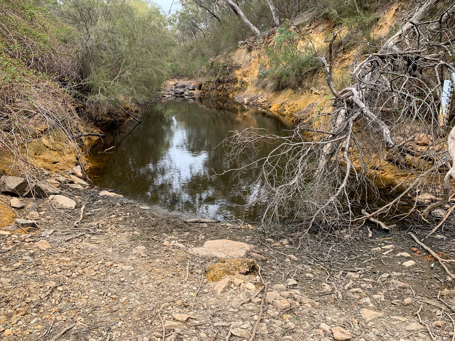
Science in the field
Date published: 15 April 2022
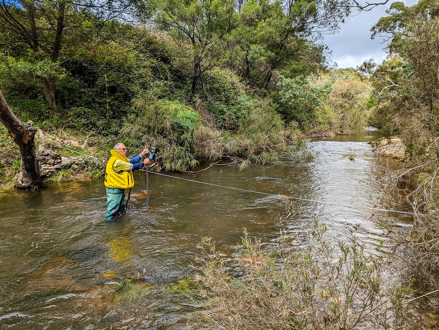
Ventia team surveying the Black Jackie stream gauge at Mulloon Creek Natural Farms.
TMI’s science team has been compiling historical hydrological data for the DataStream system with major partner HydroTerra and working with Ventia on cross section surveys for the stream gauges installed as part of the Mulloon Rehydration Initiative.
The Mulloon Rehydration Initiative is a catchment-scale project that aims to rebuild the natural landscape function of the Mulloon catchment and boost its resilience to climatic extremes for more reliable stream flows, improved ecosystem functioning and enhanced agricultural productivity. It includes the development and implementation of a comprehensive Integrated Monitoring Plan.
TMI has been busy working with major partner HydroTerra on compiling the historical hydrological data collected so far during the Mulloon Rehydration Initiative in readiness for upload into the data management system DataStream. TMI thank all at HydroTerra involved, particularly Richard Campbell for managing and leading, with great assistance from Matthew Potter, John Morton and Gleidson Guilhem.
TMI has also been working with Ventia to conduct cross section surveys at all six stream gauge sites in the MRI to recalibrate the sensors that measure depth of water to enable calculation of water volume. Many thanks to all the team at Ventia with their important work particularly the field operations Gavin Ryan and Paul Niebling, with analysis and generating ratings curves managed by Mark pickles and Matthew Bamford.
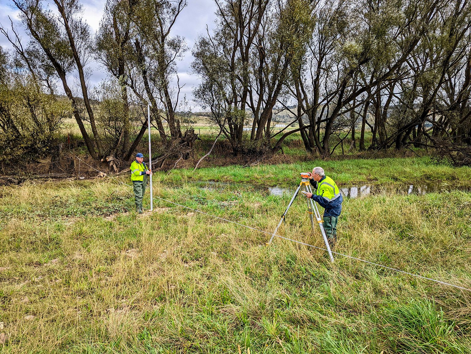
The science team worked with local Bungendore group PHL Surveyors (Nicholas Johnston & Alan Longhurst) to survey all the hydrological instruments and leaky weirs to accurately geo-locate which will enable analysis of ground and surface water levels. This will greatly improve the ability to assess the expected positive influence leaky weirs have on ground and surface water (creek levels), and the ability to analyse and model these interactions.
The Mulloon Rehydration Initiative is jointly funded through the Mulloon Institute and the Australian Government’s National Landcare Program. It is also supported by the NSW Government through its Environmental Trust.
Ventia team surveying the stream gauge at Sandhills.
Due to the continued wet and boggy conditions instrument maintenance has been challenging to conduct, especially with inquisitive animals continuing to chew cables or dig up instruments no matter how much the team protects cables in conduit and bury them underground.
TMI’s hydrologist Tony Bernardi has finally been able to enjoy his Covid-delayed travels to Europe for two months and trust the wait has been worthwhile with many adventures.
TMI are sad to announce our science officer Ira Dudley-Bestow is moving onto a new role due to his university studies requiring work experience with a registered engineer. Ira will be greatly missed as part of the science team having gained much experience and skills during his time with TMI and wish him all the best in his future endeavours. TMI have advertised for a replacement and hope to bring a new person into the role in the very near future.