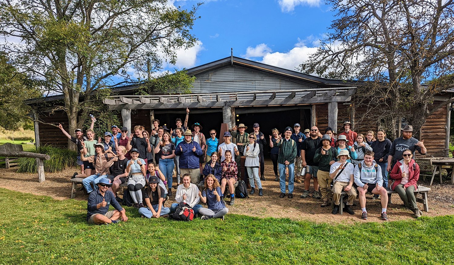
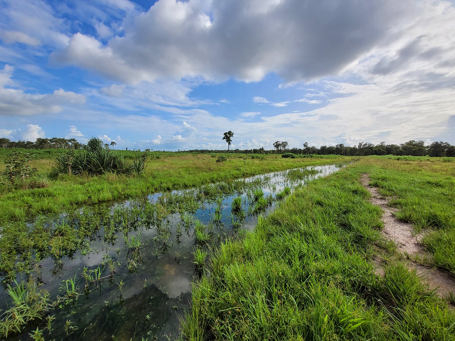
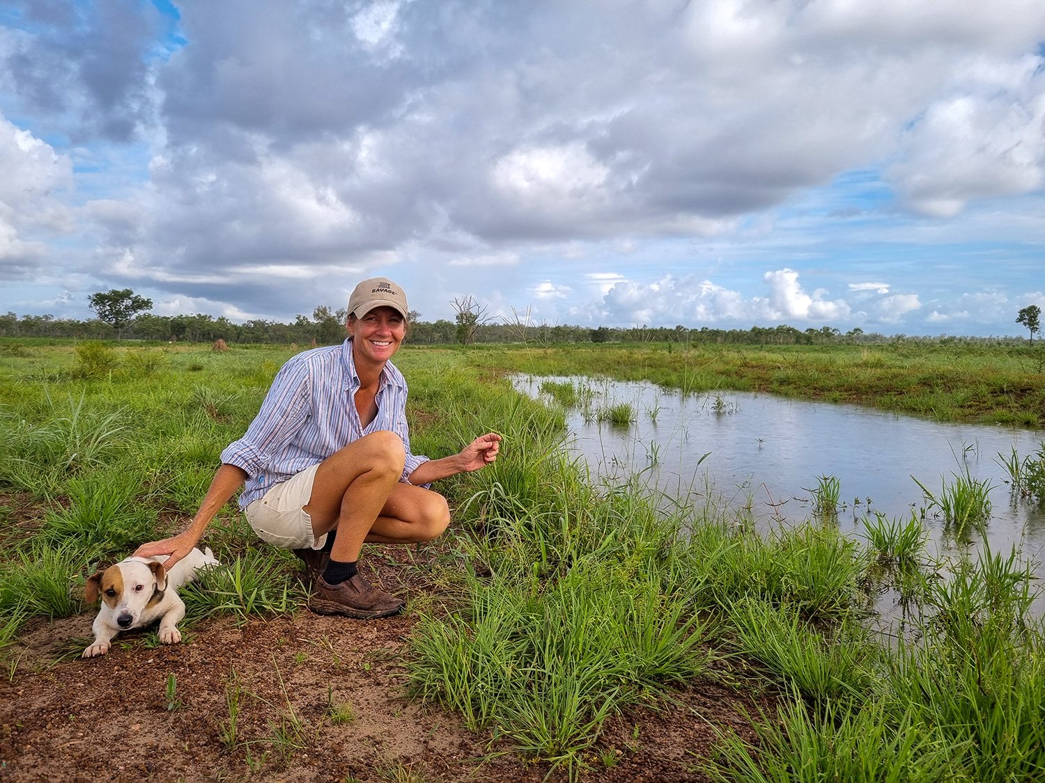
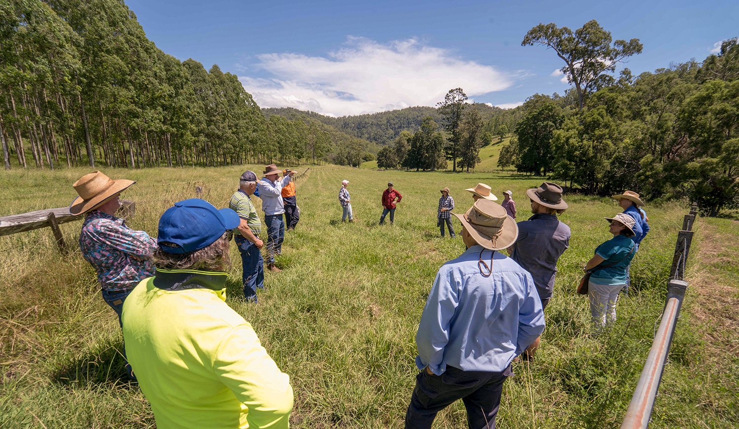
In early April 2022, the Mulloon Institute hosted over 50 students and staff from the University of Canberra for education and training on identifying soils and geomorphology at Mulloon Creek Natural Farms (Home Farm).
Led by UC’s Associate Professor Duanne White, the students split into groups and dispersed across the catena sequence (sequence of soils down a slope), from hillslope across the floodplain valley floor and across to the opposite hillslope. Students dug holes down through the soil profile and assessed the various layers, collecting important information of texture, colour, composition, pH, and presence of organic matter. These are important factors to determine the type of soil, its health (pH and organic matter) or ability to function (water infiltration and water holding capacity), and what this reveals with respect to land use and management.
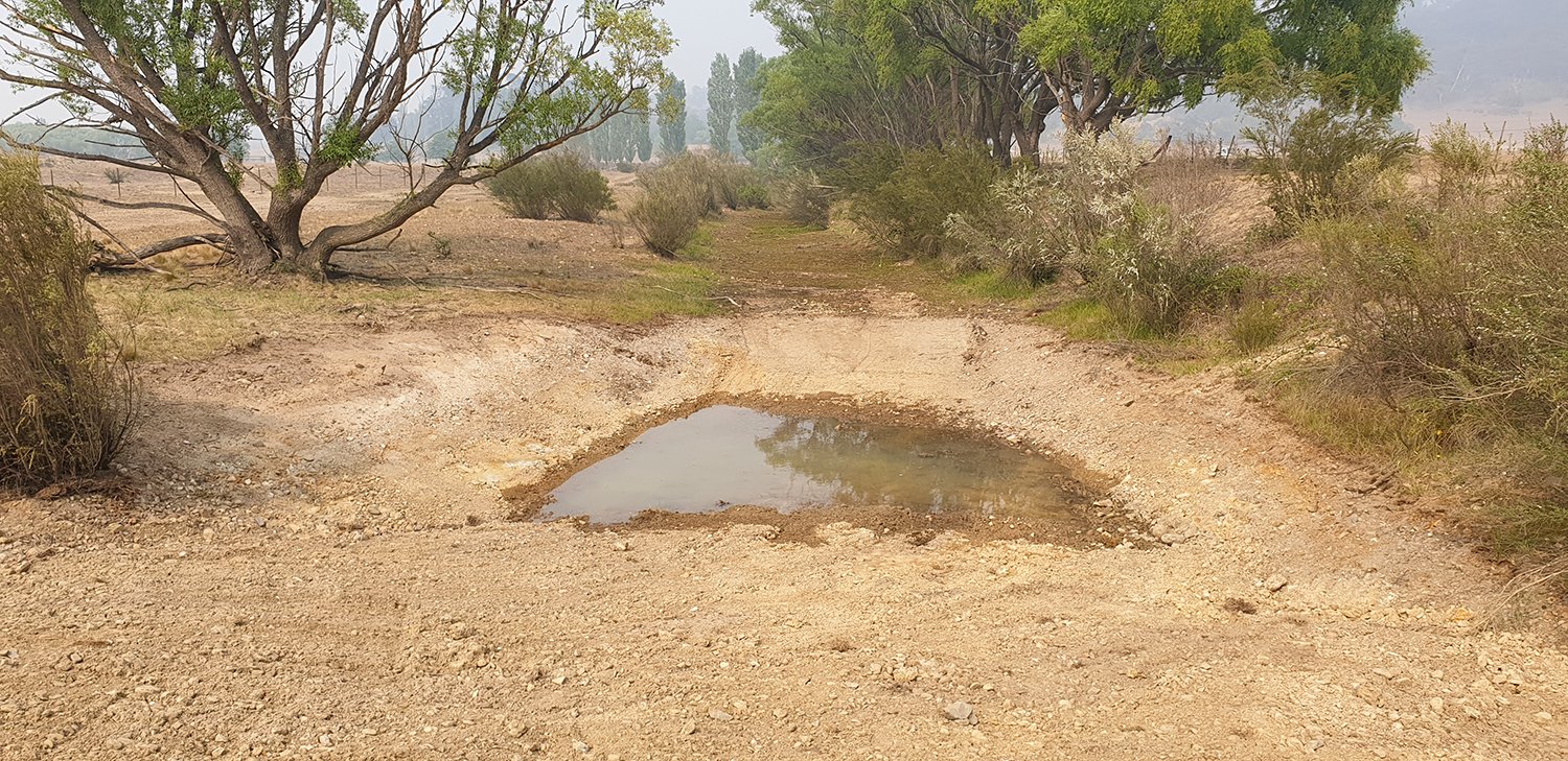
Soil profiling on Mulloon floodplain
Group photo at the Barn
The students found a range of soils that were shallow (0.5m depth) on the hillslopes, and greater than 2m depth in the floodplains with pasture plant roots regularly found to 1m depth. Soils were generally in good condition with pH consistently in the neutral range, and good soil texture and aggregation in the upper root zone. In some soil profile locations on the floodplains, students encountered a sandy or gravel lens buried that indicates a previous shallow waterway that has since been buried due to morphological processes and as the floodplain soils build over time.
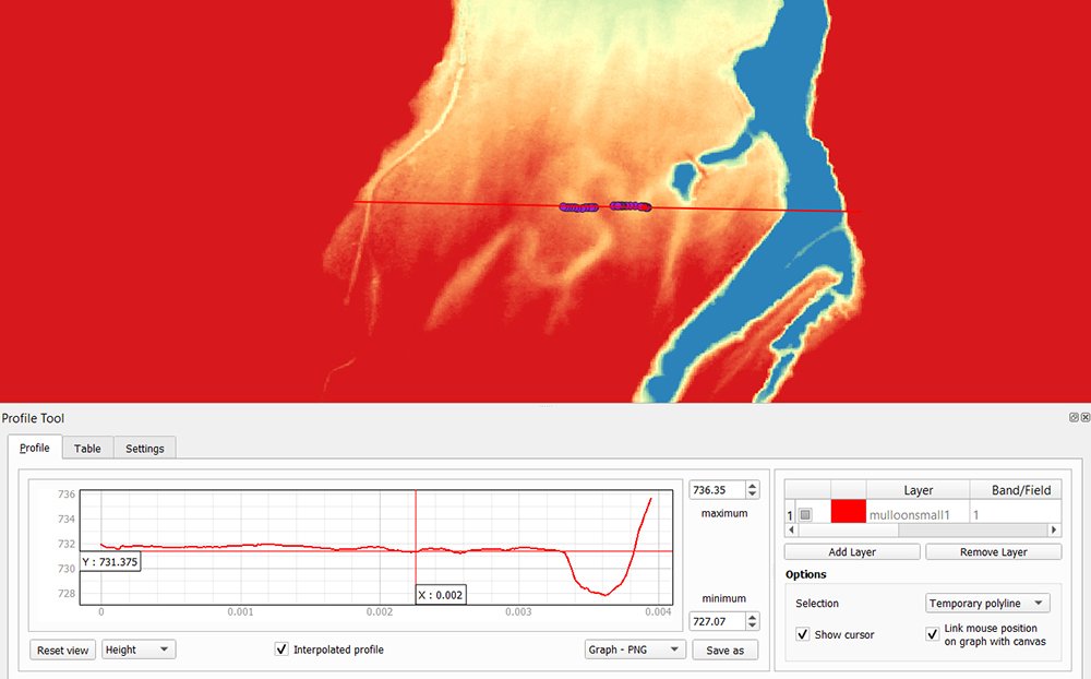
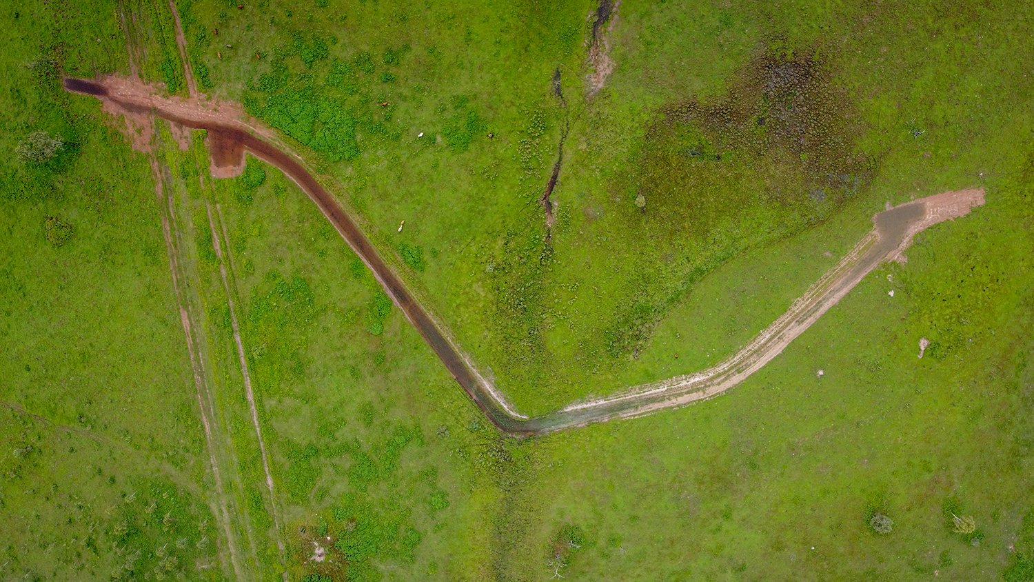
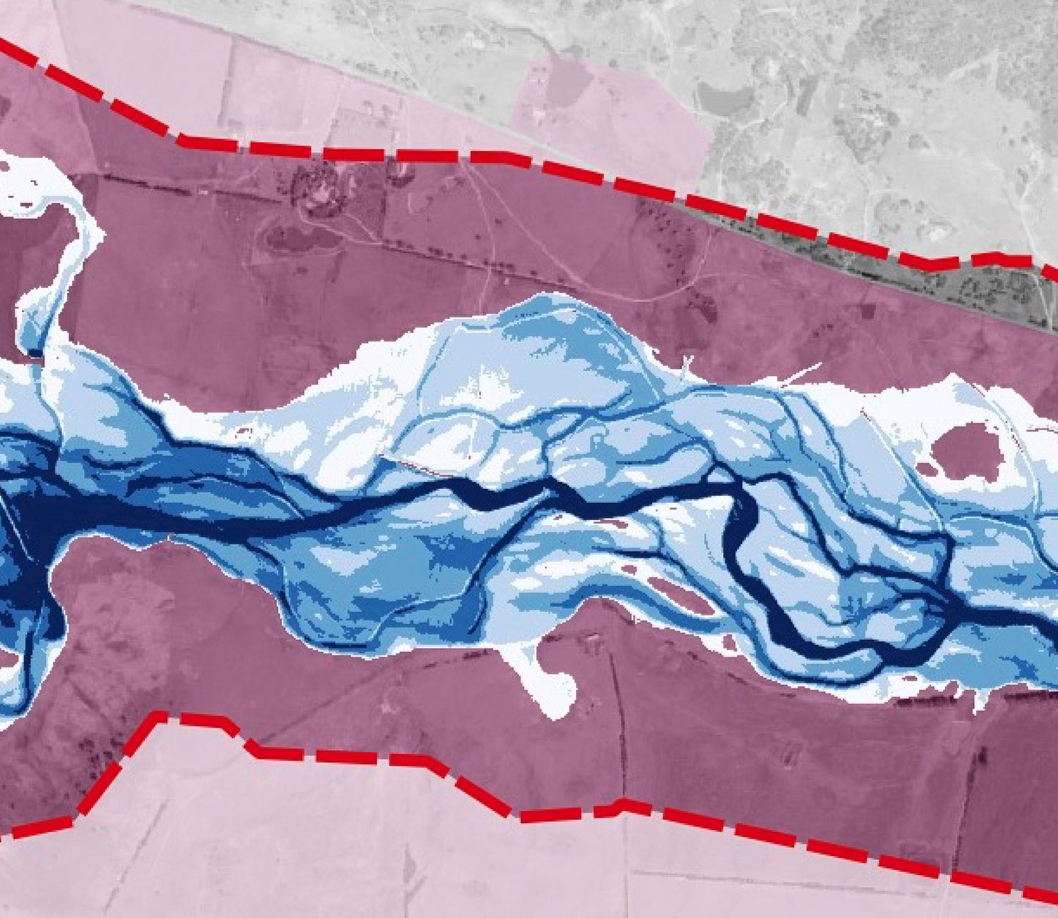
Figure 1: GPR transect across the floodplain at Mulloon Creek Natural Farms.
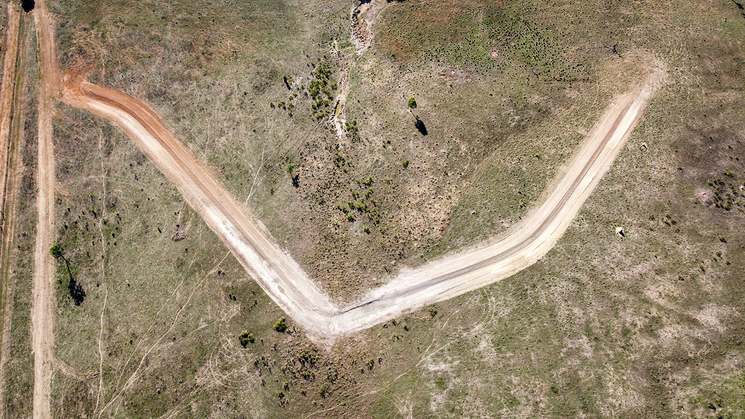
UC Honours student Celine Anderson used a portable ground penetrating radar (GPR) to detect the subsurface structure of the soil that may indicate different soil layers including shallow aquifers. The GPR data indicated some paleochannels (buried old alluvial channels) in the floodplain (see image 1 below). Duanne cross-referenced this against the topographic data using the LiDAR derived DEM (see image 2), with both datasets confirming the channels existence, and the GPR data provides information of depth and extent.
The value of this data is understanding the location and size of such paleochannels and how they function to help move and store water within the floodplain and whether they connected to the stream. These paleochannels play an important role when the creek floods and spills onto the floodplains for storing water naturally in the landscape that increases plant available water and soil microbial processes. These processes are vital for plant vigour, nutrient cycling, building soil, sequestering carbon that in turn increases the soil water holding capacity.
Figure 2: Digital Elevation Model of the topography of the floodplain at Mulloon Creek Natural Farms.
This work forms part of the Mulloon Rehydration Initiative which is jointly funded through the Mulloon Institute and the Australian Government’s National Landcare Program, with support from the NSW Government’s Environmental Trust.
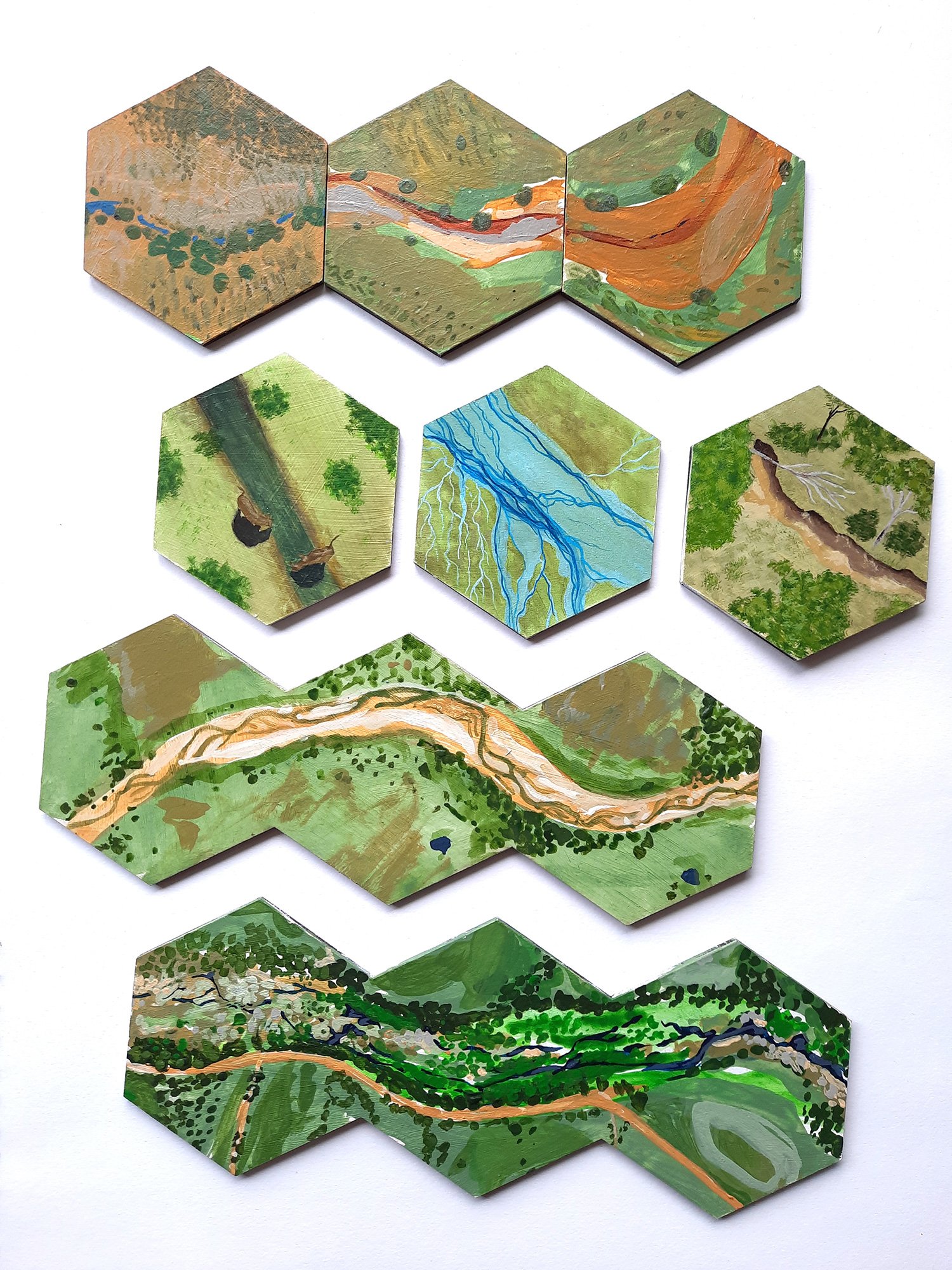
Every week when the Mulloon team engage with landowners, students and the community we ‘paint a picture’ of how landscapes were in the past, how they might look in the future, and the connections between different parts of a landscape. With our Citizen Science project, Laura Fisher is keen to develop visual tools to support these conversations.
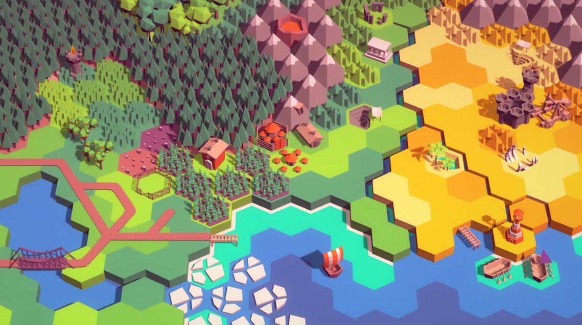
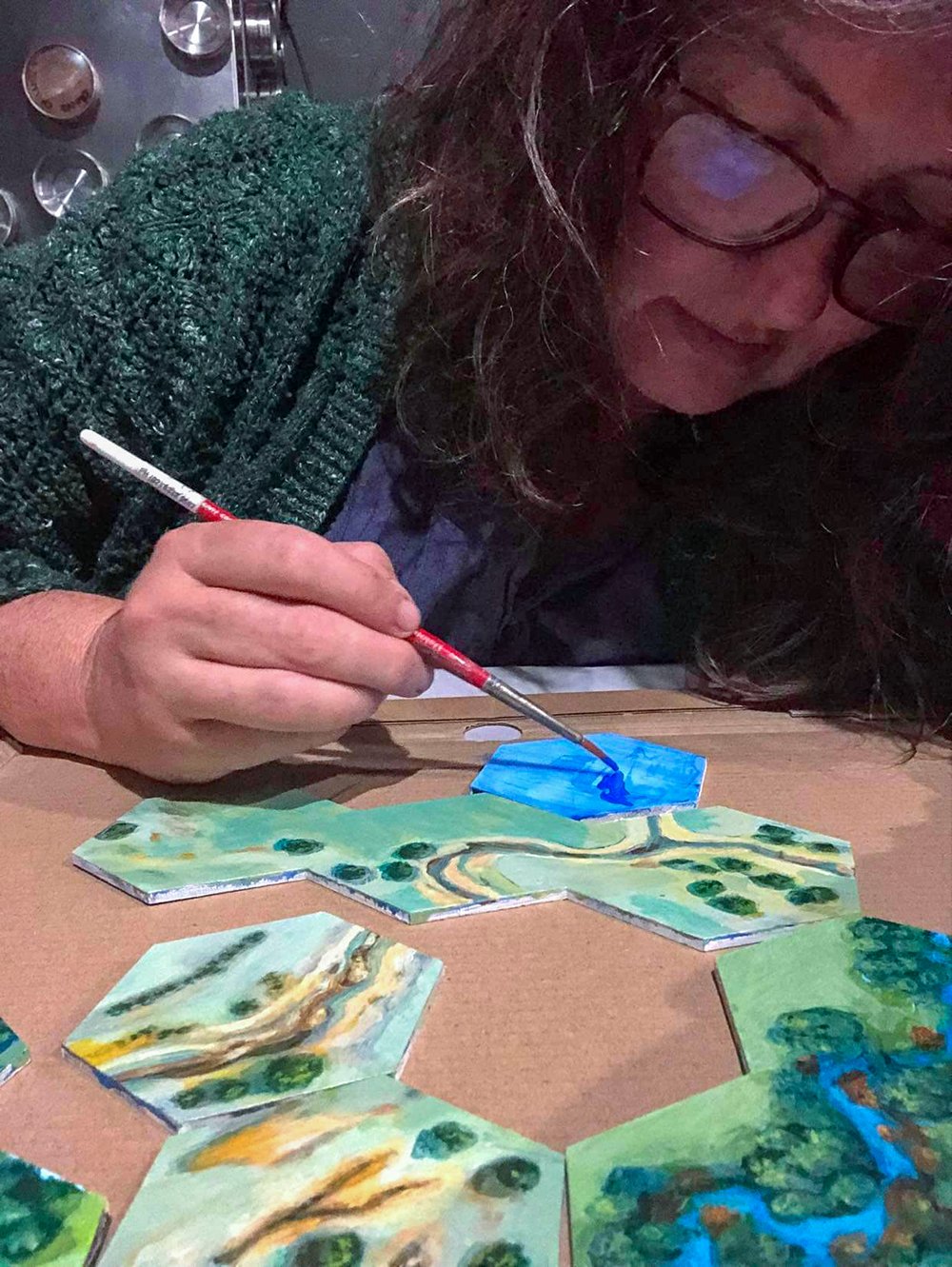
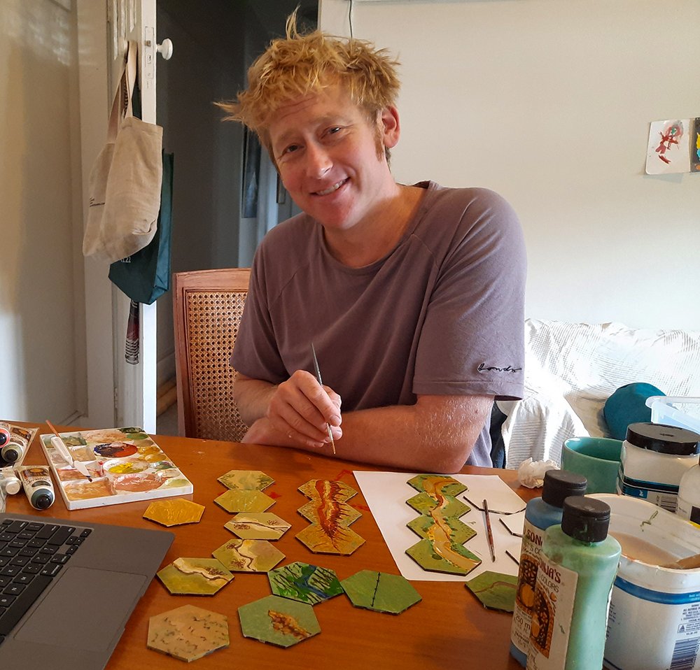
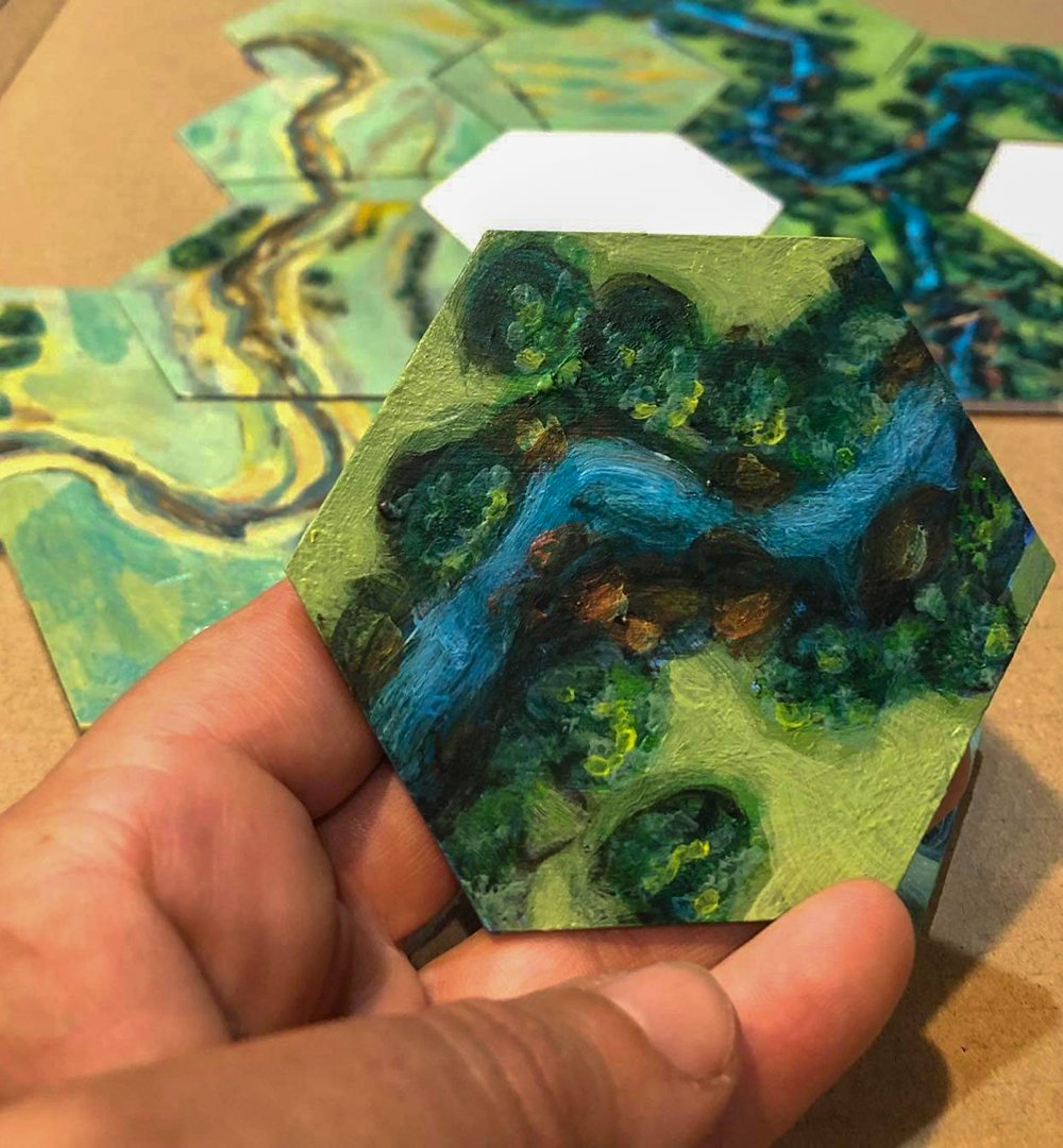
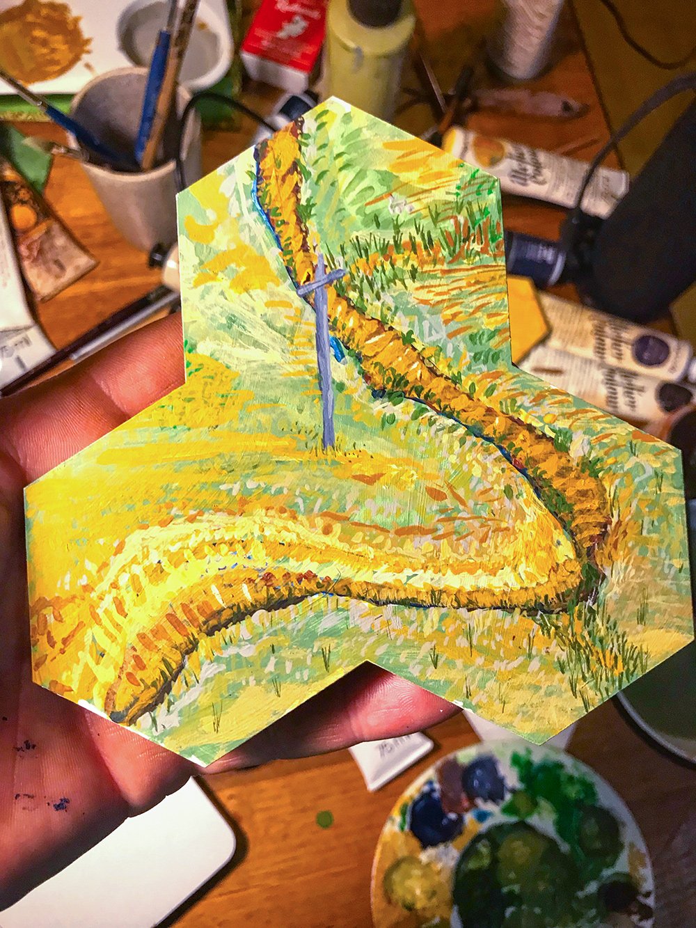
One of our art/science collaborators Josh Harle proposed we look at boardgames in which players build a landscape, piece by piece, and swap landscape features in and out (like Carcassonne and Settlers of Catan). We also looked at video games like Sim City which allow you to build a virtual landscape and transform it in response to certain events, like a flood. An idea was sparked when we saw that video game designers often work with hexagon tiles to depict landscape features because they tessellate, offering six potential edges of interaction between the tiles (as shown below).
Creating landscape tiles
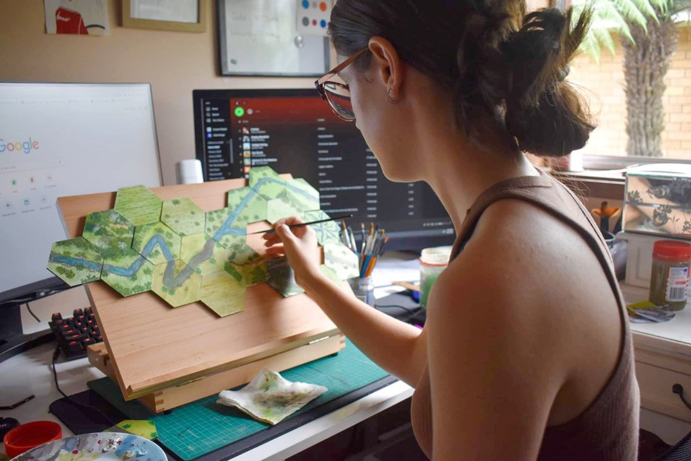
Laura ordered some wooden hexagon tiles and invited artists Angela South, Georgie Pollard and Hugh Tory to participate. She shared images of the features of healthy and unhealthy catchments, like erosion gullies, riparian zones, swampy meadows and degraded streams. Each artist has produced tiles that are strikingly different and beautiful.
View fullsize
Angela South
View fullsize
Georgie Pollard
View fullsize
Hugh Tory
A tile by Georgie Pollard.
Angela South said, “The process of depicting these landscapes in an educational way is new to me and was an exciting challenge. It’s allowed me to branch out and experiment with new materials and a modular display format.”
Hugh Tory, “found it really fascinating learning about geomorphology through the painting process”.
And Georgie Pollard shared these thoughts: “It’s nice to think in terms of relationships and layers. What is done to one tile has to be applied back to the other ones. It makes me think about in the landscape, what we do over here has an effect over there.”
A tile by Hugh Tory.
Tackling landscape ecology, one hexagon at a time
Ecologists Metzger and Brancalion tell us that landscape ecology is about, “understanding the landscape as a mosaic of interactive landscape units” (1). Knowing how the landscape is spatially structured is a key to planning effective restoration projects, and that structure can be described in terms of patches, corridors, steppingstones, mosaics and plant assemblages. The way Angela, Hugh and Georgie have tackled this art/science challenge suggests we might be experimenting with a new kind of landscape painting that can illustrate these concepts in a very engaging way.
Tiles by Angela South and Hugh Tory.
Our Landscape Rehydration puzzle will keep evolving, with high school students contributing later this year. Eventually we hope we can construct a variety of landscapes, and swap tiles in and out to talk through different scenarios of change, plant communities and rehydration strategies. We’d also like to see if we can develop more sophisticated modelling features or develop a digital version with design students at university. It’s an iterative, co-creative process!
This ‘Modelling Landscape Rehydration for Catchments, Communities and Curriculum’ project has received Citizen Science grant funding from the Australian Government.
RESOURCES
Metzger, Jean & Brancalion, Pedro (2016) ‘Landscape Ecology and Restoration Processes’ in M. Palmer et al Foundations of Restoration Ecology Island Press, Washington, 90-120.
Here are some fantastic photos from Old Cameron Downs Station in Batchelor, NT where the Mulloon Institute visited in 2021 to do on-ground works in collaboration with Territory NRM as part of a workshop on erosion control. The original workshop was funded by the Australian Government’s National Landcare Program while the follow up on-ground works were funded by the landholders.
These photos were taken 72 hours after rain and show a contour bank and swale with ponds at either end with a spill edge on the contour. Over time as the grasses re-establish these spill points will build up as they catch rack and other organics, allowing more water to be held in the swale.
The results have been fantastic and landholders Fiona McBean and Pete Cogill are very happy with this landscape rehydration capacity building outcome and great vegetation response.
View fullsize
View fullsize
“It just looks so good! Looking forward to seeing the grass growth in that area once the water subsides!” – Emily Hinds, Territory NRM
Huge thanks to Fiona McBean of Eva Valley Meats and Emily Hinds from Territory NRM for their hard work and for sharing these photos with us. It’s looking fantastic out there!
Happy landholder Fiona McBean.
In this video, Territory NRM’s Regional Agriculture Landcare Facilitator Emily Hinds and pastoralist Fiona McBean describe the process and benefits of contour building to landscape function, prevention of soil loss and pasture productivity.
Territory NRM is supporting those in agriculture across the NT through building land manager capacity and knowledge in soil health and conservation.
After hosting an erosion control landscape function workshop in July 2021, TNRM staff returned to Old Cameron Downs in October to oversee the installation of a contour across one of the paddocks. In disturbed landscapes, introducing contour banks is a way of intercepting overland water flow and distributing that water across a wider portion of the landscape. It also helps to capture nutrients, providing conditions favourable to increased plant growth and quality.
The practical workshop presented by the Mulloon Institute in collaboration with Territory NRM provided practical and theoretical learning for participants to achieve landscape rehydration and restore function and productivity to landscapes.
Mulloon Consulting update
Date published: 18 March 2022
The team has been super busy over the summer with several scoping reports for catchment scale projects, initial site inspections for properties and a farm plan for a client near Mittagong NSW.
Swan Brook Catchment Project, Invervell NSW
A scoping report has been completed for Gwymac Inc. Landcare for the Swan Brook Catchment project near Inverell, NSW.
The scoping study aims to identify a site-appropriate approach to achieving landscape-scale rehydration in the Swan Brook catchment. This was done by listening Swan Brook catchment landholders and other stakeholders about their views on the catchment’s current health and what they think could be done to improve it. We also identified existing functional strengths and limitations of the Swan Brook catchment, and then identified and presented a range of possible interventions to achieve landscape rehydration via future landscape rehydration works.
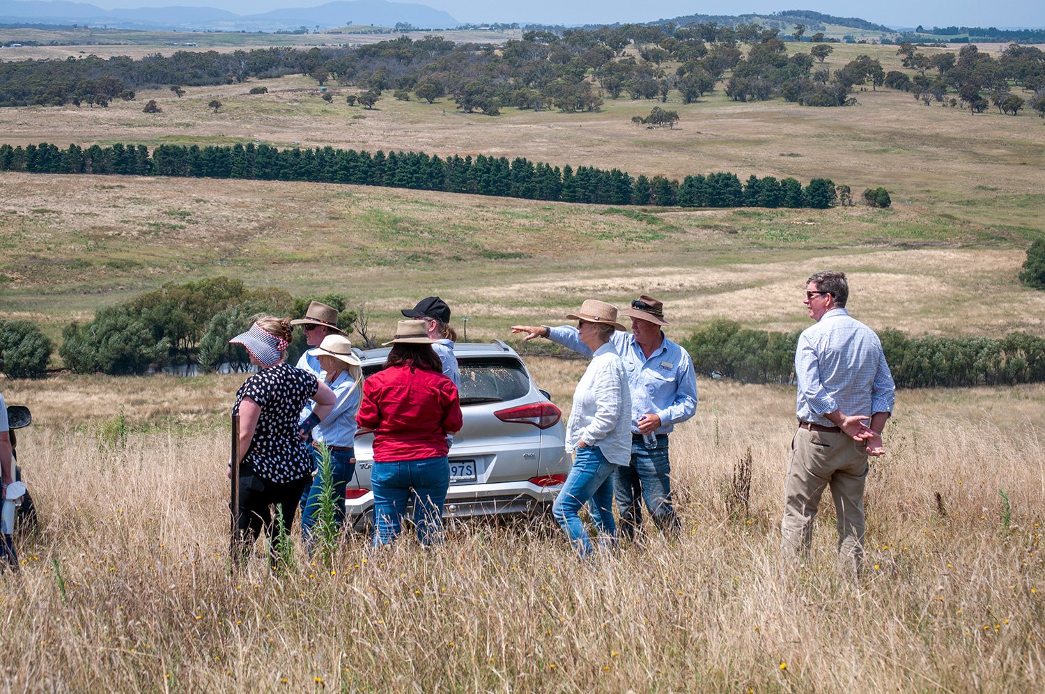
Peter Hazell and Sam Skeat explaining landscape patterns in a landholder workshop in 2021.
Roseberry Creek Catchment Project, Kyogle NSW
Our thoughts are with everyone in the Northern Rivers region impacted by the recent major flood event.
Roseberry Creek Landcare and Border Ranges Richmond Valley Landcare Network have been working towards a better understanding of their local landscape, landscape rehydration opportunities and erosion control within the local catchment. Observations by local primary producers of the impacts of more frequent intense rain events and an extended drought that led to the Richmond River ceasing to flow, prompted this investigation.
As part of this process of improving their understanding, Mulloon Consulting have delivered a landholder workshop and a scoping report of landscape rehydration opportunities in the catchment.
These are steps towards a better understanding of this catchment, identifying and delivering works as examples of what can be achieved and educating landholders on the types of interventions and management that they can undertake to improve landscape condition. This is also relevant to the many creeks that feed the Richmond River in the northern rivers of NSW, rated D minus in a 2014 EcoHealth report.
The creek is what connects residents, whether it be swimming holes, habitat values, stock and domestic water supply or irrigation for primary producers.
Improved management of the whole catchment will contribute to a more resilient creek, landscape and community.
This project has received funding from the Australian Government’s Future Drought Fund.
Hydrological modelling from a section of the Molonglo River Floodplain used to inform the rehabilitation design process.
Work continues on the Molonglo Catchment Rehydration Initiative near Captains Flat with the design for Carwoola finalised and the regulatory process underway, and with construction hoping to start in winter, weather depending. Ultimately, this project will include the installation of leaky weirs and other works across two properties at Captain’s Flat, NSW to improve habitat for the endangered Green and Golden Bell Frog and to improve floodplain hydration and pasture growth.
TMI have also been busy working in a consortium with Australian Holistic Management Co-operative on development of a landscape hydration index project for the Lismore City Council which has the potential to inform on-ground management decisions and wider scale catchment approaches. TMI has been contributing specialist expertise on supporting hydrology and landscape hydration.
This project is being delivered by a consortium led by the Australian Holistic Management Co-operative with funding from the Lismore City Council.
Initial site inspections
The Mulloon Consulting team have also prepared various initial site inspections, including:
Braidwood, NSW
The owners are keen to use landscape rehydration techniques to improve the movement of water down Brushy Hill Creek, improve water for stock and are building towards the property being self-supporting. They have a very beautiful old house garden which includes peacocks.
Oallen, NSW
This property was impacted by the 2019–20 bush fires. The owners are aiming to set up the property using permaculture and regenerative agriculture principles to produce food for the family and sell surplus products at local markets. They hope to run ducks, geese, chickens, sheep, cows and pigs for maximum diversity and to improve soil and ecological health. We are assisting them with water management across the property including installing a series of leaky weirs, dam expansion and contours.
Two large sheep and cropping properties were visited near Wellington.
Both these landholders are experienced regenerative farmers. We are honoured to have been asked to assist them with advice on landscape rehydration to improve water retention, manage water that is causing erosion and landscape issues.
If you would like Mulloon Consulting to your property, please get in touch. Prior to the visit we collect information on the property through digital layers to understand the stream order, digital elevations, soils, geology and vegetation. Following the visit to the property, we prepare a report describing the on-ground conditions and potential suitability for landscape rehydration. Following this stage, a more detailed design can be completed for rehydration, or this can be included in a landscape rehydration farm planning process.
If this sounds like something that you would like to invest in, please contact Nolani McColl on nolani@themullooninstitute.org
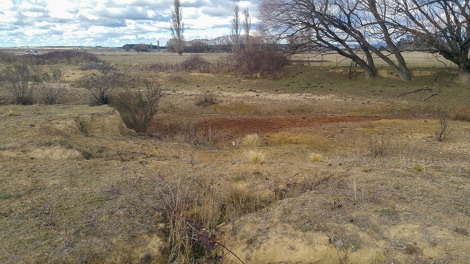
Palerang leaky weirs – before + after
Date published: 17 March 2022
‘Palerang’ – PM4 – 2018
‘Palerang’ – PM4 – 2022
This series of before and after photos depicts three of 15 leaky weir sites at ‘Palerang’ – one of the properties taking part in the Mulloon Rehydration Initiative (MRI). This component of the MRI was undertaken with funding support from the NSW Government through its Environmental Trust. The broader Mulloon Rehydration Initiative is jointly funded through the Mulloon Institute and the Australian Government’s National Landcare Program.
‘Palerang’ – PM7 – 2018
‘Palerang’ – PM7 – 2022
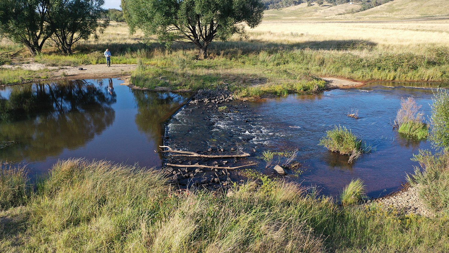
The structures were built in November 2019, while much of the east coast was in the grip of an unprecedented drought that culminated in the Black Summer bushfires. Note, that in one before image the air around the structures is thick with smoke. Two months after the structures were built, the rains came. Ash and silt were washed from the upper catchment. Ponds were instantly created behind each of the fifteen structures on ‘Palerang’. Since the first rains in February 2020, Mulloon Creek has experienced record breaking rainfall, many major flow pulses and two once-in-a-generation floods (see hydrograph below).
‘Palerang’ – PM13 – 2019
‘Palerang’ – PM13 – 2022
The images paint a picture of a system that is becoming more resilient to both droughts and floods. Water is retained in the system for longer into the dry periods. During wet periods the flows are low energy, spreading and deposit sediment, rather than high energy and erosive. Dry, bare sand banks are now revegetating with native plants. The water is clear and water plants are emerging. The scene is repeated throughout the entire length of Mulloon that has now been treated with landscape rehydration infrastructure.
Future Drought Fund visit
Date published: 17 March 2022
After a few false starts, representatives from the Future Drought Fund (FDF) were able to visit Mulloon on a perfect, sunny day in February.
Chair of the FDF’s Consultative Committee Brent Finlay and fellow committee member Dr Kate Andrews were taken for a tour of the Mulloon Rehydration Initiative along with Stephanie Helm (Assistant Director Future Drought Fund Strategy & Engagement), Louise Palfreyman (Strategy & Engagement Director) and Kimberley Shrives Hubs (Executive Director).
TMI’s CEO Carolyn Hall was excited to share the project’s journey up to now. Principal Landscape Planner Peter Hazell and Research Coordinator Luke Peel were also on hand to provide amazing insights into the MRI and how the project has formed a model to demonstrate how landscape scale repair can contribute to building natural capital and increasing agricultural productivity across Australia. TMI’s Chief Operating Officer Kathy Kelly also joined the tour, always ready to assist guests in appreciating our major project.
They also learnt about TMI’s National Rehydration Initiative that is rolling out similar projects across Australia, with works already underway in northern Queensland and Western Australia.
Maia Field Day – Growing our Natural Capital
Date published: 17 March 2022
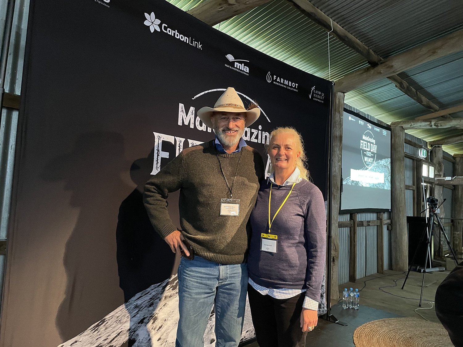
Dick Richardson (Grazing Naturally) and Carolyn Hall (CEO Mulloon Institute).
The Mulloon Institute’s CEO Carolyn Hall joined 300 guests for a wet Maia Grazing field day at Wilmot Cattle Co’s Hernani property. Stuart Austin and his team hosted another great event that has become a fixture on the regenerative field day calendar. Event partners included RCS Australia, MLA, Carbon Link, Farmbot and Land to Market Australia. A very special Welcome to Country kicked off the event and an opening address by Alasdair McLeod of the Macdoch Group provided a global perspective. We all enjoyed a packed day that focussed on building natural capital. The presentations by Dick Richardson from Grazing Naturally, Stuart Andrews from Tarwyn Park Training and Kerrie Sagnol, RCS set the scene for the day with a focus on landscape function.
As always, the day included tales of graziers changing their management to benefit their enterprises and the environment. Charlie Arnott and Bart Davidson from Maia Grazing provided some light relief and then things got serious with Stacey Curcio’s presentation focussed on wellness. A great farmer from across the ditch Doug Averygave us the four Cs and reminded us all of the importance of mental health.
It was raining so hard by now it was hard to hear the presenters. A panel discussion with representatives from PWC, MLA and the NFF explored Macdoch’s Farming for the Future Initiative – an ambitious research project – data collection linking business profitability to natural capital. The day finished strong and long with a catchment champion Johannes Meirs from Danthonia demonstrating a focus on natural capital and landscape function does make farms more resilient to drought. The ambitious Packhorse team presented their vision for scaling grazing management and good environmental management across Australia! Shanna Whan the 2022 Australian local hero of the year did not leave a dry eye in the house with her story of creating sober in the country – it is always “OK to say no” to booze.
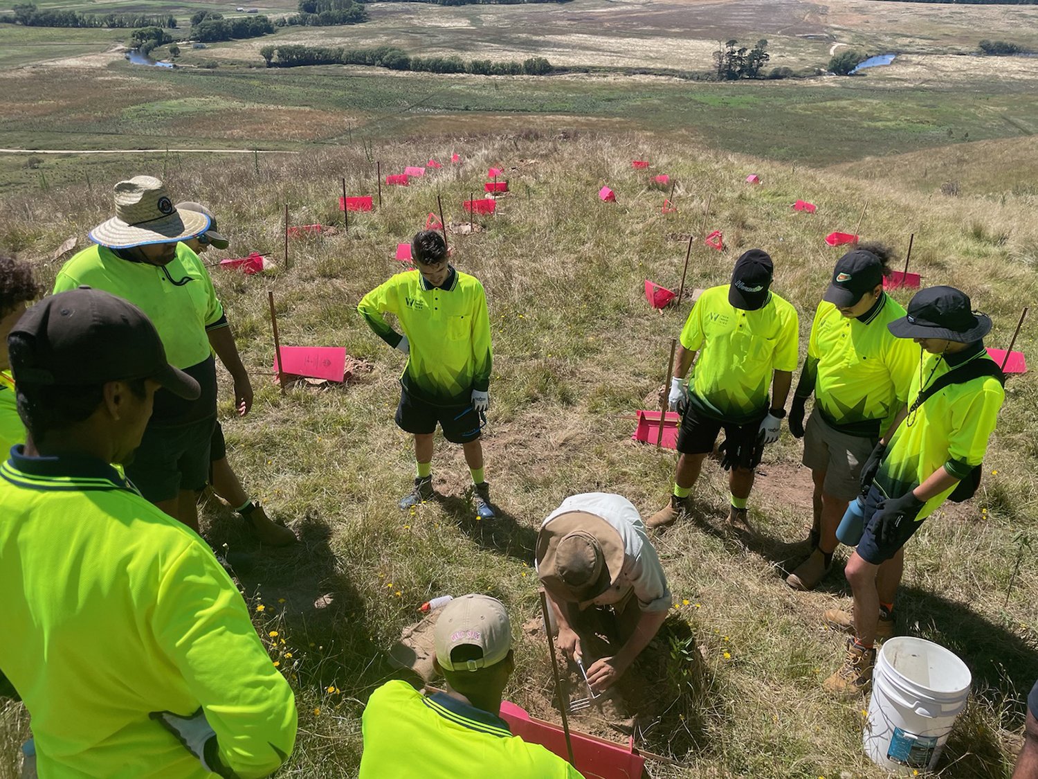
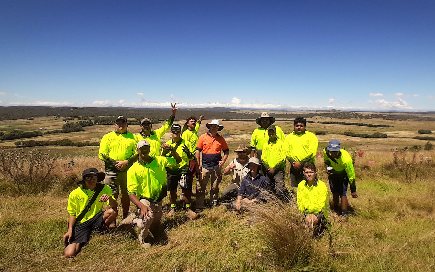
In mid February 2022, a team of ten young Indigenous men from the Worldview Foundation visited the Mulloon Institute’s ‘Duralla’ property to learn about and participate in landscape function restoration as part of the Mulloon Rehydration Initiative (MRI). They were joined by the foundation’s mentor and Team Leader Albert Barker and Employment Manager Ciaran Keating from the Worldview Foundation along with the institute’s Technical Officer Max Brunswick and Trainee Director of On-ground Works Penny Cooper.
The Worldview Foundation’s team come from many areas, ranging from the Cape York Peninsular in far north Queensland, to Condobolin in western New South Wales.
Their visit began at a site on the hill at Duralla where landscape rehabilitation began in 2016. This meeting place affords an excellent view of the broader Mulloon Creek catchment. Here, the landscape features of the catchment are visible – from Mount Palerang at the head of the catchment, to the braided network of Mulloon, Sandhills, Shiel and Reedy Creeks – allowing a perspective to be developed on the scale of work undertaken at TMI. The group took time to consider the Indigenous history of the area and the original function of the landscape, compared with the altered post-colonisation, landscape function evident today.
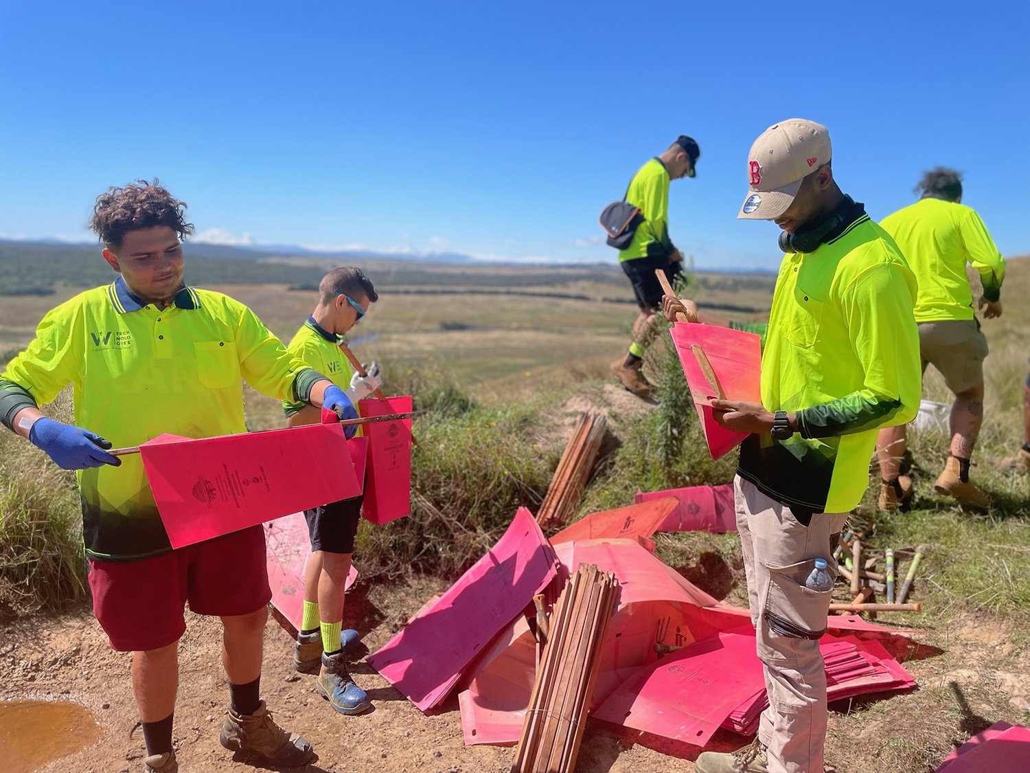
The Worldview Foundation delivers holistic life management programs and employment training, education and opportunities for disadvantaged Aboriginal and Torres Strait Islanders. The young Indigenous men were proud to be working on Country and healing Country through participating in revegetation with the MRI. They assisted in the setup of a planting site and learned the particular method of planting used by the MRI team. Despite the hot and often rocky planting conditions, together they installed 100 native trees, shrubs and groundcovers in just a few hours. The TMI team were impressed with the way in which individuals engaged with the project, asked questions, took on new skills and information, and worked with a spirit of commitment, interest and fun.
Constructing tree guards.
Mentor and team leader Albert Barker said, “We all love to be out on Country and in nature, learning about the environment”.
The MRI project spans 23,000 hectares and 50 kilometres of creeks and tributaries. The ridgeline where the work is being carried out is a conservation zone and the ongoing work of the initiative is continuing to revegetate this area. The revegetation of this area will improve the quantity and quality of native habitat, and the cycling of water and nutrients in the broader landscape, which will in turn will deliver multiple benefits for the farming enterprise.