MCNF was ‘jampacked’ with eggs during June with weekly production numbers up near 120,000 eggs. Increased production has meant the need to increase our storage capacity, office and staff facilities with further infrastructure such as fencing, water and laying sheds also underway. Despite the increased production, our organic, pasture-raised hens will still have room to roam freely at our Duralla property under the protective eyes of our Maremma dogs. Our stocking rates will continue to be no more than 250 birds per hectare.
We also farewelled Farm Manager Michael Fitzgerald this month and his wife Wendy. Michael has been with MCNF for over four years and has overseen a virtual doubling of egg production during that time. He has embraced TMI’s landscape rehydration and regenerative agriculture principles and will continue to be a great advocate for our work in his future agricultural activities. We wish Michael and Wendy all the very best for the future.
One sector that aligns well with our capabilities is monitoring to improve natural resource management.
The Mulloon Institute is an Australian research, education and advocacy not-for-profit organisation. Learn about their aspirations here.
One of TMI’s research projects is the Mulloon Rehydration Initiative (MRI), which has been recognised by the United Nations Sustainable Development Solutions Network as one of five case studies globally to develop guidelines for sustainable but profitable and productive farming.
We are currently engaged to develop a monitoring strategy and to assist with the turnkey implementation of the specified system. The key has been establishing TMI’s indicators of catchment health and productivity, then documenting the requisite parameters required to calculate these indicators.
data provenance ensured through a metadata framework
remote oversight achieved through appropriate hardware and software selection
streamlined data publishing approaches identified through 3rd Party publishing mechanisms.
The network consists of two climate stations, 80 automated piezometers, five stream gauging and water quality stations and 40 soil moisture monitoring sites.
The outcome is a research site with a monitoring program capable of producing trusted data of known provenance for catchment health and productivity.
The Mulloon Rehydration Initiative is jointly funded through the Mulloon Institute and the Australian Government’s National Landcare Program and is supported by various affiliates.
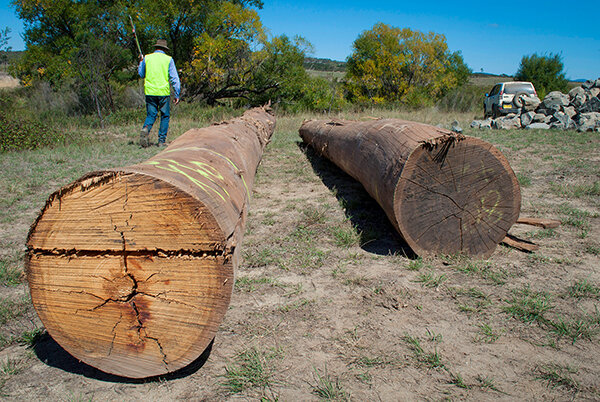
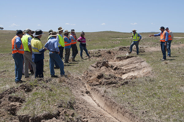
Mulloon Rehydration Initiative Project Coordinator Pete Hazell has been successful in securing logs and rocks for the next stage of on-ground works in the Mulloon Rehydration Initiative. Another four leaky weir structures will be installed along Mulloon Creek at the Duralla property during July with logs from Tumbarumba and rocks from Nerriga.
People have been asking what we species we use when planting out a site. We usually focus on planting and transplanting shrubs, groundcovers and early colonising native plants that are either already growing, or would normally grow, within and on the banks of Mulloon Creek.
These include native species such as Cumbungi, Phragmites, Carex, Milfoil, Marshwort, Eleocharis, Schoenoplectus, Lomandra, Juncus, tea trees, paper barks, grevilleas, bottlebrush, Banksia, Bursaria, Green, Black and Silver wattle, as well as black sally.
We are also compiling a list of non-native plants that we would use depending on the situation.
The Mulloon Rehydration Initiative is jointly funded through the Mulloon Institute and the Australian Government’s National Landcare Program and is supported by various affiliates.
Science & monitoring update
Date published: 8 July 2020
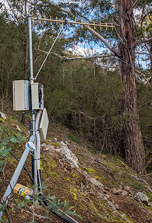
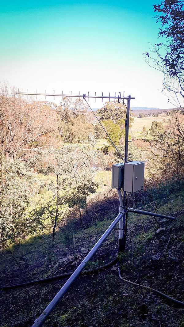
Logger box uphill of a stream gauge in the Mulloon catchment
Research Coordinator Luke Peel has been busy with our Science Advisory Council members and HydroTerra finalising drafts for the ‘TMI SAC Framework paper’ and the ‘Monitoring Plan and System Specifications’ document. These will form the basis of the research being undertaken and detail the monitoring design and implementation that will establish TMI’s long-term monitoring plan.
Negotiations and the procurement of hydrological and climate instrumentation has now begun with the first major purchase of climate stations completed thanks to Matt Probets at Environdata in Qld. Progress with hydrological monitoring components such as automated and manual water quantity and quality instruments, soil moisture and ground water sensors have been ordered.
TMI are proud to be supporting Australian businesses with these purchases.
The Mulloon Rehydration Initiative is jointly funded through the Mulloon Institute and the Australian Government’s National Landcare Program and is supported by various affiliates.
Help support our work today!
Date published: 19 June 2020
The Mulloon Institute is amongst a number of organisations that have been chosen to work with the Global Evergreening Alliance (GEA) on the ‘Restore Australia’ project. This will involve GEA investing $250m over five years to deliver transformational land restoration and carbon sequestration to improve resilience and livelihoods across Australia. Its goal is to have 13 million hectares under restoration, sequester 79 million tonnes of carbon dioxide equivalent into soil carbon and 25 million trees planted over the duration of the project.
Your financial support during this time will allow us to grow our resources and help achieve an even stronger outcome for the environment, for farming and our society.
The Mulloon Institute is a registered Australian not-for-profit organisation with Deductible Gift Recipient status, meaning that donations of $2 or more are tax deductible. The Mulloon Institute is also registered with the Australian Charities and Not-for-profits Commission (ACNC).
Please consider supporting us before the end of this financial year.
NSW Environmental Trust – Education & Training grant
Date published: 4 June 2020
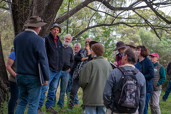
East Gippsland Landcare tour of Peter’s Pond
We are happy to announce that we have been successful in winning a NSW Environmental Trust ‘Education and Training’ grant to develop an advanced curriculum in landscape rehydration, which will help practitioners gain expertise in working within larger scale settings such as whole catchments.
An initial workplan is being finalised for submission and the first year will focus on understanding stakeholders’ concerns, needs and expectations as well as what it means for potential students and teachers.
Natural Sequence Farming course with Tarwyn Park Training
Mulloon Rehydration Initiative – update
Date published: 4 June 2020
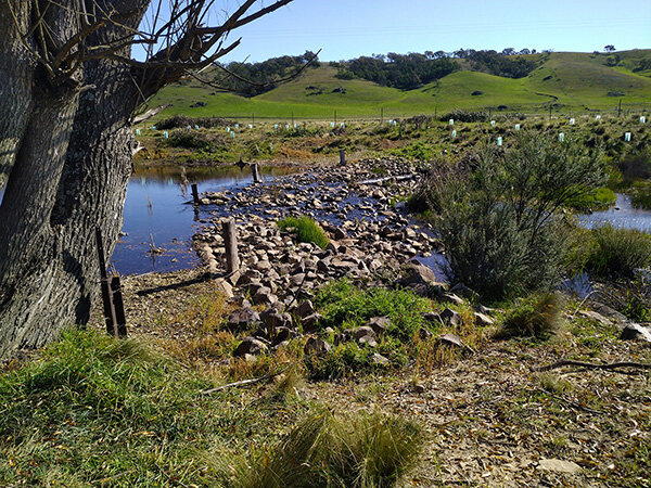
Log and sill structure ‘PM1’ at Palerang
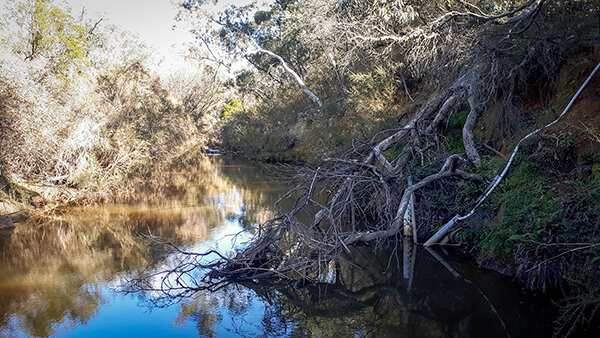
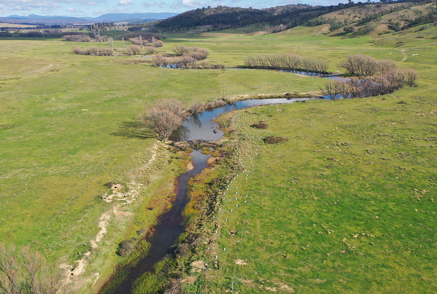
As well as the scientific monitoring work being done for the Mulloon Rehydration Initiative, work has continued on Controlled Activity Applications for the northern end of the catchment. Unfortunately, due to a shortage of logs following bushfires earlier this year we’re still looking forward to finalising creek interventions on the ‘Duralla’ property at Mulloon Creek Natural Farms. Thankfully we’ve recently heard that forests are being re-opened and have placed an order for more logs. As it turns out we haven’t actually been delayed that much as the creek has been flowing at a level that would have prevented in-stream works anyway.
The flowing creek has also given us an opportunity to study more recent works completed at Palerang and at the southern end of Duralla. All of these structures have settled in very well, vegetation growth has been very good and the whole system is functioning just as designed. The slowing of the creek flow is having a positive affect and at peak flows substantial parts of the floodplain have been rehydrated. Each intervention gets us another step closer towards fixing the whole catchment.
Structure PM1 seen from the opposite bank
During May, we also completed our annual report to the Federal Government for the National Landcare Program funding and submitted our workplan for the next year. This was a milestone and a real team effort led by Luke Peel. Covid-19 has certainly had an impact on what we achieved compared to what we had planned to achieve, as did the bushfires. With both increasingly behind us we will be able to make up ground quite quickly. Early feedback from the government has been very positive.
The Mulloon Rehydration Initiative is jointly funded through the Mulloon Institute and the Australian Government’s National Landcare Program and is supported by various affiliates.
Stream gauge monitoring
Date published: 4 June 2020
Tony Bernardi (Hydrologist) and James Diack (Science Officer) have been busy visiting and maintaining the five stream gauges which are stationed at strategic points along Mulloon Creek as part of our ongoing scientific monitoring program in the Mulloon Rehydration Initiative (MRI).
The MRI aims to improve stream water quantity and quality and to reduce extreme fluctuations to more consistent and moderated levels. This improves the health and viability for flora and fauna to survive especially during extreme climatic events. We monitor various parameters to understand the overall health of the system and observe where changes are occurring.
Each of the five telemetered stream gauge stations have four key components:
stilling well – secures the instrument in the creek
logger box – houses the data logger which stores information
telemetry system – sends data via mobile network to data management system
solar panel & battery – supplies power to instrument & telemetry.
The stream gauges monitor water level, water temperature, electrical conductivity (salinity), turbidity (cloudiness), pH (acidity), dissolved oxygen and oxygen reduction potential.
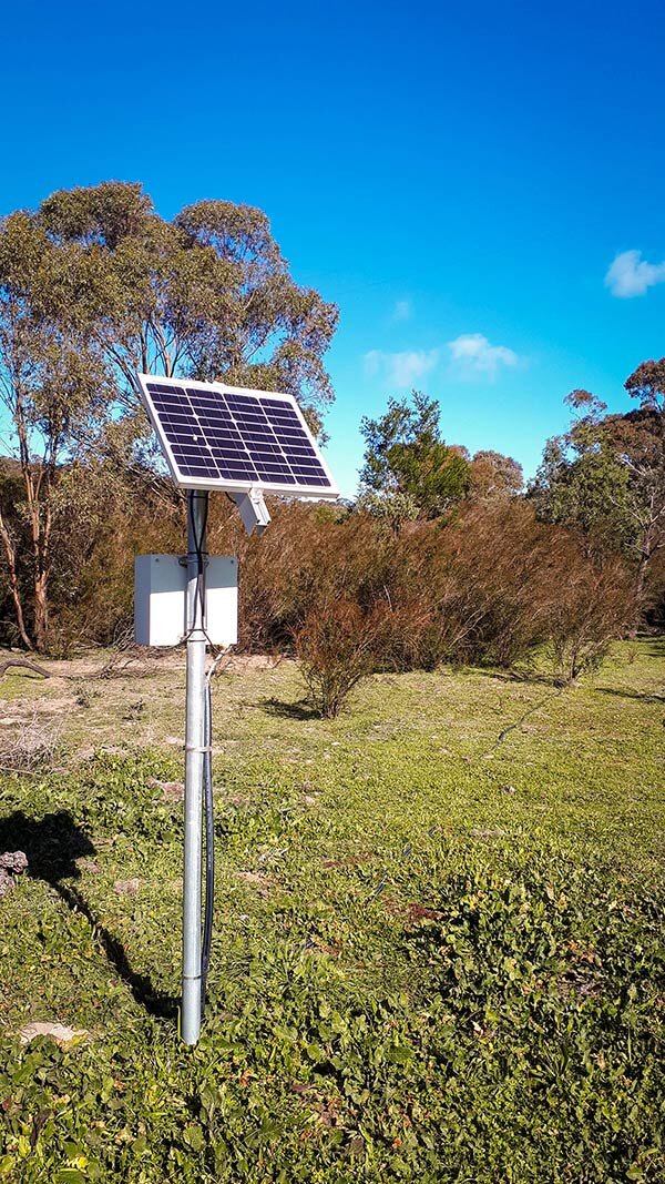
Logger box for the stream gauge at Peter’s Pond sited 50 meters uphill to protect it from floods.
Monitoring water levels is necessary to determine water quantity in the creek by using survey data of the stream profile to calculate volume. The implementation of leaky weirs slows water flow and helps moderate water levels during low flows (low rainfall periods), providing the necessary water levels for flora and fauna to continue thriving. Having good flora and fauna, including microbial and aquatic invertebrates, helps maintain good water quality, and this improved water quality further improves the productivity and health of the waterway.
Water temperature can affect the amount of dissolved oxygen in the water. Dissolved oxygen is also positively affected by aquatic plants and riffle zones (including the leaky weirs), and is important for water quality for creatures such as frogs, fish and insects. Water temperature also affects the rate of aquatic photosynthesis and the metabolic rates of all flora and fauna. Managing stream water to maintain good levels of dissolved oxygen and moderated temperatures provides an indication of health for flora and fauna. This helps maintain a healthy ecosystem and good water quality for downstream users.
Measuring for electrical conductivity (EC) shows us how much dissolved salt is in the creek. While all natural waters contain some dissolved salts including sodium, magnesium and calcium, high levels of EC can cause health issues for flora and fauna, and issues for human use whether for drinking or for farm animals or irrigation for plants.
Turbidity measures concentrations of particulates in the water which impact light penetration, ecological productivity and habitat quality. In streams, increased sedimentation and siltation can occur, harming habitat areas for fish and other aquatic life. Particles also provide attachment places for pollutants such as metals and bacteria. For this reason, turbidity readings can be used as an indicator of potential pollution in a body of water. During a rainstorm, particles from the surrounding land are washed into the river making the water a muddy brown colour, indicating water that has higher turbidity values. Also, during high flows, water velocities are faster and water volumes are higher, which can more easily stir up and suspend material from the stream bed, causing higher turbidity. Turbidity can tell us a lot about possible erosion upstream. When rain fell after the bushfires this summer during February to March 2020, turbidity spiked in the creek due to the lack of effective groundcover in upper parts of the catchment.
Monitoring instruments taking readings in Mulloon Creek. The white cable on the right connects the instruments, which are sitting in the stilling well, to the logger box further upslope.
Most Australian streams have a neutral to slightly basic pH that ranges between 6.5 to 8, where pH can range from 0 to 14, with 7 being neutral. The pH is influenced by the types of rock and vegetation that it flows through in the catchment before reaching the waterway. The pH of water determines the solubility (amount that can be dissolved in the water) and biological availability (amount that can be utilised by aquatic life) of chemical constituents such as nutrients (phosphorus, nitrogen, and carbon) and heavy metals (lead, copper, cadmium, etc.). For example, in addition to affecting how much andwhat form of phosphorus is most abundant in the water, pH also determines whether aquatic life can use it. In the case of heavy metals, the degree to which they are soluble determines their toxicity. Metals tend to be more toxic at lower pH because they are more soluble.
With amazing riparian vegetation occurring along the creek as a result of our rehydration work, we’ve had to relocate some of the solar panels to sunnier spots.
Oxygen reduction potential (ORP) measures how well the creek or waterway can clean itself by breaking down waste products such as dead plants and fish. High readings mean a higher level of oxygen which allows for more efficient breakdown of waste products and a healthier waterway. Its ability to do this is decreased or increased in relation to the other water chemistry variables: pH, total alkalinity, total dissolved solids, temperature, etc. ORP is measured in addition to dissolved oxygen because ORP can provide additional information on the water quality and degree of pollution, if present.
Monitoring how these water quality parameters change over time allows us to assess water quantity and quality, keeping in mind that some of these parameters interact with and influence each other, which influences the overall health of the waterway as an integrated system. When combined with the monitoring of flora and fauna, it helps us build up a bigger more integrated picture of how our revegetation and rehydration works are affecting the creek’s water quantity and quality and the health of the ecosystem.
The Mulloon Rehydration Initiative is jointly funded through the Mulloon Institute and the Australian Government’s National Landcare Program and is supported by various affiliates.
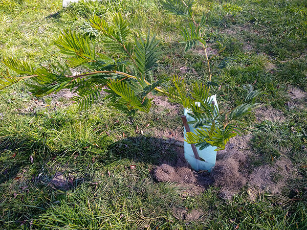
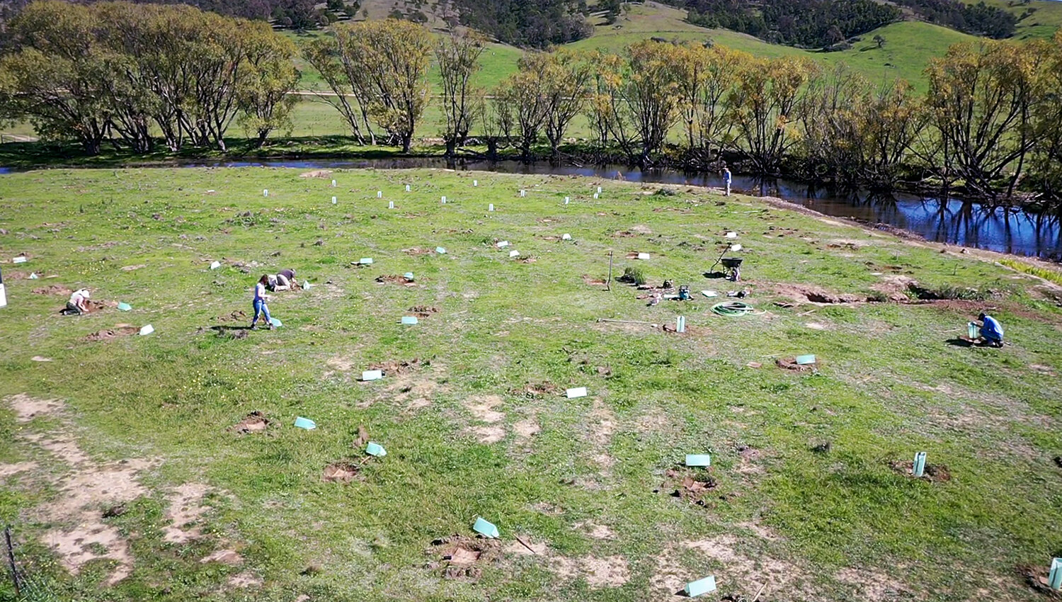
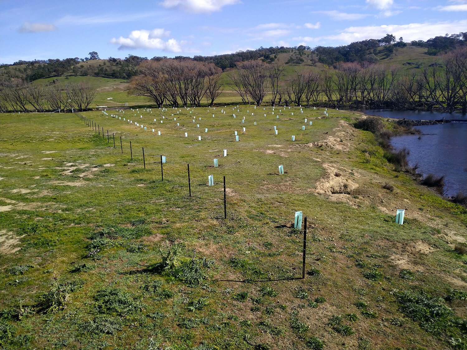
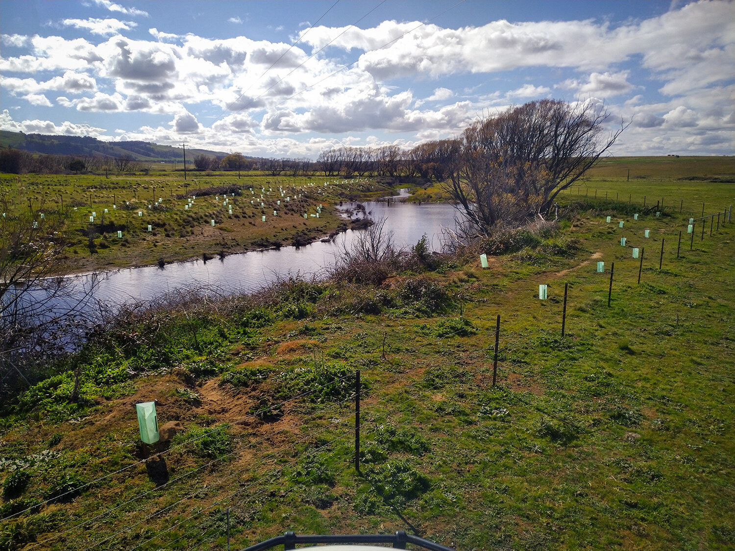
Hailing from Argentina, Venezuela, France, Spain, England, Scotland and more locally from Mulloon Road, they spent several days planting around 600 plants along a section of Mulloon Creek between three structures that were installed earlier this year.
Plants ranged from riparian and reeds, to shrubs and bushes, and several species of trees. We choose native plants suited for the local environment to ensure they have a greater chance of survival. In total 26 different species were planted to increase biodiversity, moderate the micro-climate, help slow the flow, and improve the look of the creek environment.
The area has also been fenced off to exclude livestock, giving the waterway and plants a better chance of repairing the landscape and healing the erosion. As the plants grow, they will help to hold the banks together and provide habitat, food and shelter for various creatures such as insects, frogs, birds, reptiles and mammals.
MI’s Technical Officer Max Brunswick supervised the activities and was on hand to give expert advice on tree planting and riparian revegetation.
> “One thing that you have to do in life is planting a tree and I had the honour to do that in Australia! I will always remember this experience and I hope that this is just the beginning. Thanks Max to show us how to plant trees.”
— Raquel Ramos, Spain
> “The first time that I planted some trees and now I’ve got mine in Australia. Very proud to participate to take care about the landscape. All the people need to learn how planting trees. It was a great experience. Thank you for my baby trees.”
— Charlotte Delestrain, France
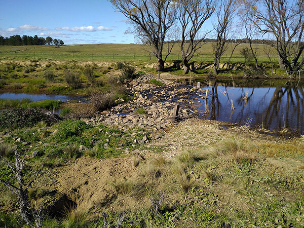
New plantings are visible on the right hand side of the creek with a structure installed halfway up. Two further structures are sited above that. Can you spot them?
This project is jointly funded through the Mulloon Institute and the Australian Government’s National Landcare Program and is supported by various affiliates.