In August 2020 we experienced a 1 in 50 year flood at Mulloon Creek.
It was with a degree of trepidation that the Mulloon Rehydration Initiative’s (MRI) Project Coordinator Peter Hazell ventured out after the main flood to see how very recently installed leaky weir structures in the lower Mulloon catchment had fared, considering they had been in for such a short time. Normally, we would like a relatively small rain event first up to help ‘settle’ them in place.
However, the strength of both the design and the build was evident when Peter visited the creek. All had held up well and done their job of slowing the water flow and pushing water and nutrient rich sediment out onto the adjoining floodplain.
Well done to Peter and his team!
From Peter Hazell, MRI Project Coordinator
On 9 August 2020, the big flood came to Mulloon!
Not since 1974 had Mulloon seen such an event. Back then, the power of the flood caused untold erosion, chewed out the banks and changed the course of the creek.
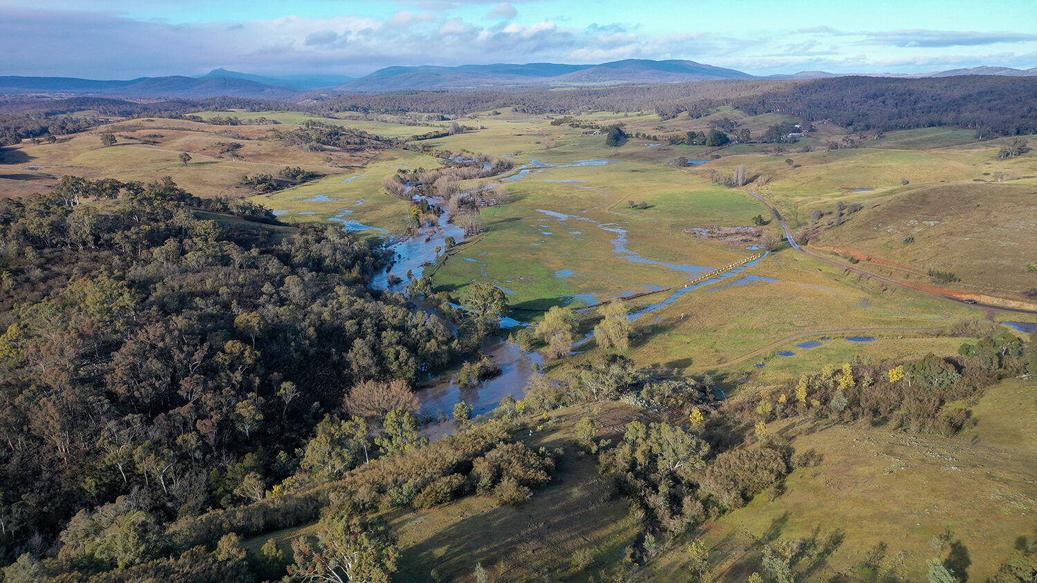
This time however, it was a vastly different story with recent creek works quietening the angry flood. For 36 hours the floodwaters spread across the floodplain filtering the still substantial sediment load from the December 2019 fires and recharging the floodplain aquifer.
All while the very freshly installed leaky weir structures held together as 160 cubic metres of water per second pulsed through the system.
Duralla & Palerang
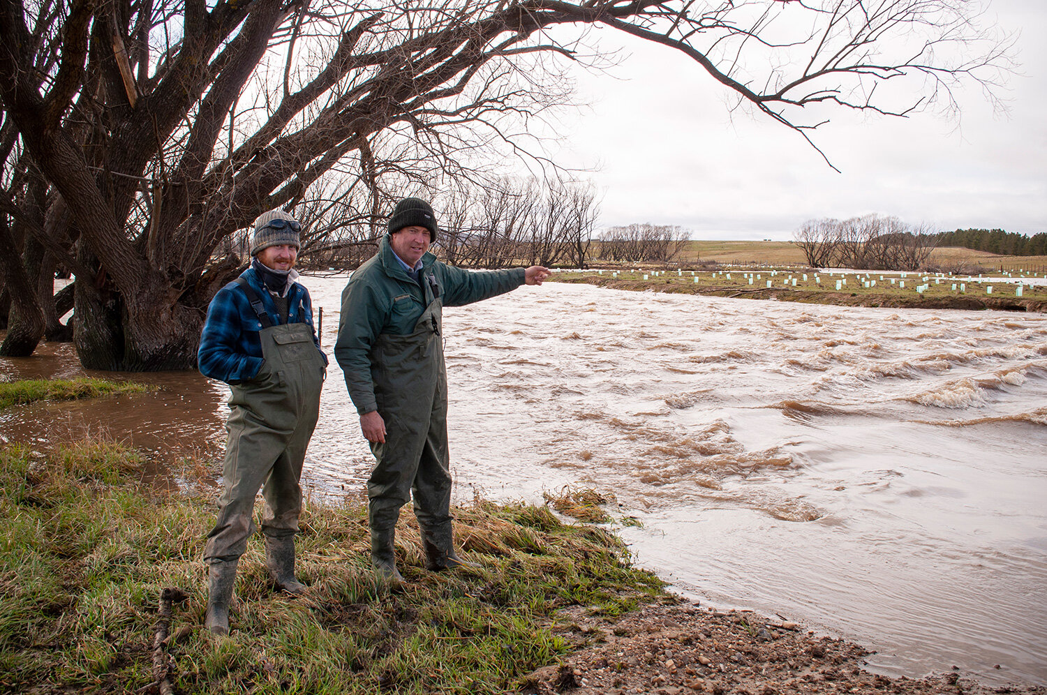
Peter Hazell (right) with team member Max Brunswick at the Palerang property. The water had been slowed by recently installed leaky weirs to such an extent that the tree guards in the background were hardly impacted when the floodwaters came through. Not one was dislodged!
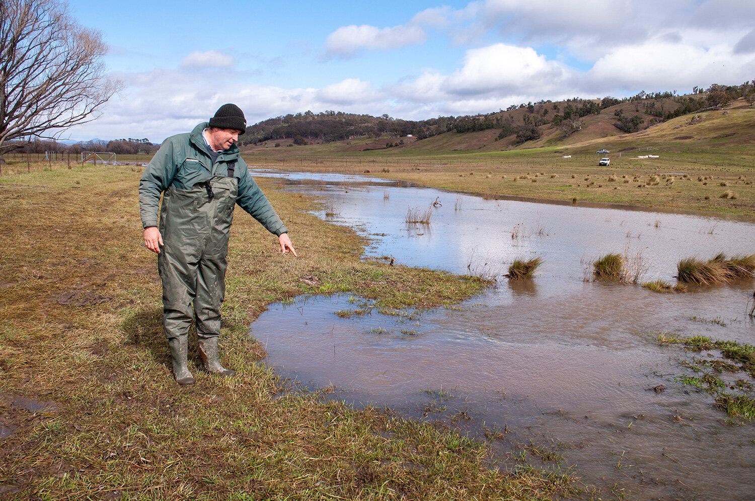
Peter Hazell points out a flooded wombat hole which is now acting as a conduit to help rehydrate the landscape.
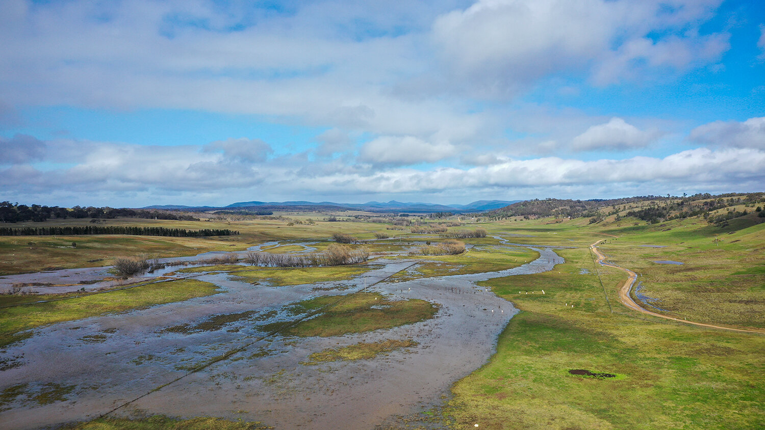
Floodwater braiding across the landscape at the Duralla property, looking towards Palerang.
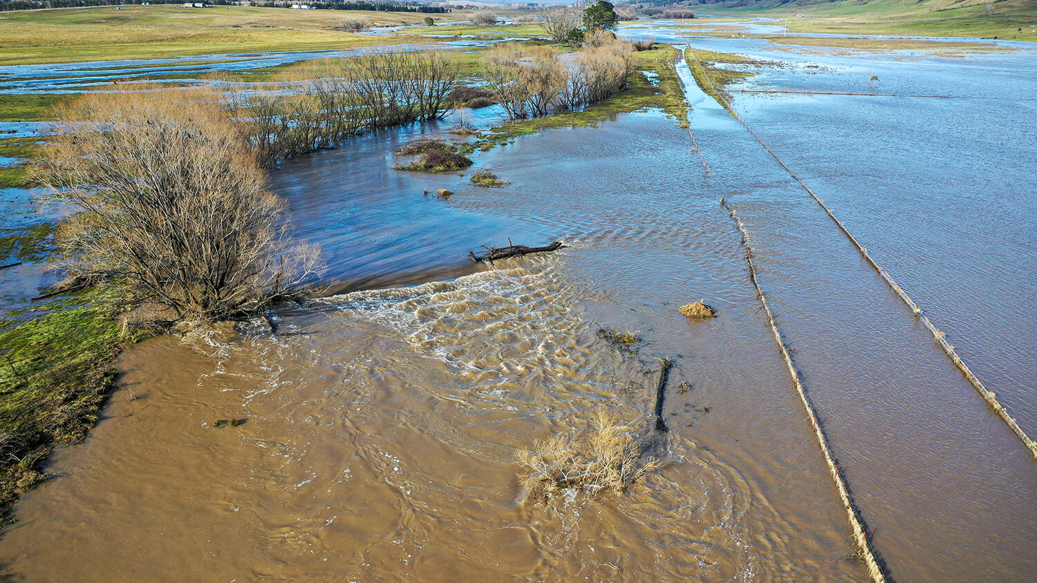
A recently installed leaky weir submerged by floodwaters. Water is spilling onto the floodplain on both sides from the pond above the structure filtering the flow and depositing nutrient rich silt. Sediment in the water has come from the upper catchment which was impacted by the summer bushfires.
Home Farm
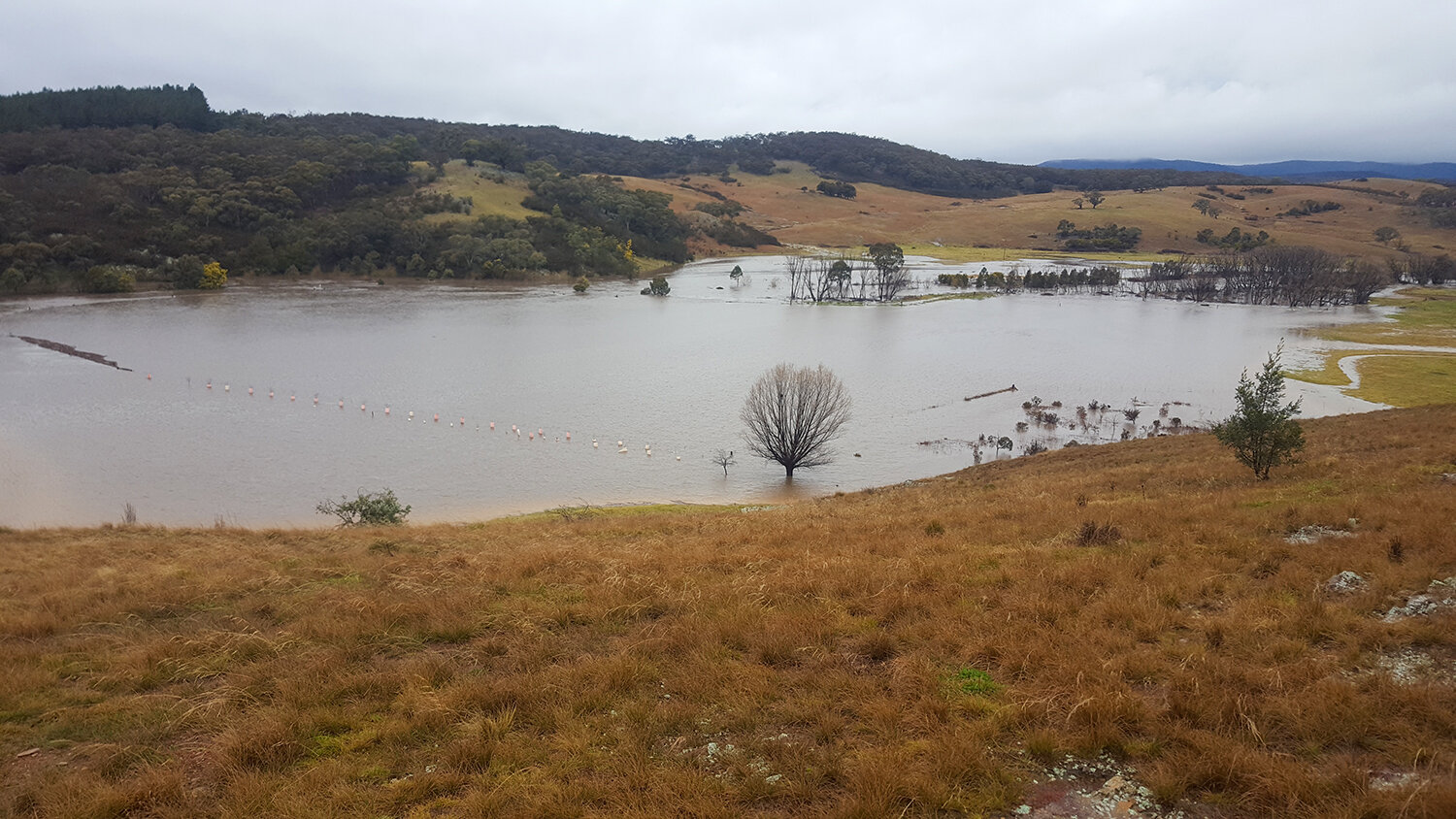
Home Farm floodplain the morning after the flood peak. Much silt was filtered out of the flow.

Peter’s Pond pushing floodwaters out onto the floodplain.
Home Farm floodplain at the peak of the flood. The same scene during the 1974 flood would have shown water torrenting through the valley. Today, right through the valley, floodwaters move more slowly and more quietly – regenerating, not eroding, the floodplain.
The Mulloon Rehydration Initiative is jointly funded through the Mulloon Institute and the Australian Government’s National Landcare Program and is supported by various affiliates.