Mulloon Consulting has recently completed detailed designs for Landscape Rehydration Infrastructure on the Upper Molonglo River at Foxlow, near Captains Flat in the NSW Southern Tablelands. The proposed works at Foxlow is Stage 2 of the Molonglo Catchment Rehydration Initiative (MCRI), a catchment-scale project along the Upper Molonglo River ‘Carwoola’ Floodplain. Detailed designs for Stage 1 of the project, at the downstream Carwoola property, have already been completed, with the Carwoola works currently progressing through regulatory approvals before construction works can commence.
MCRI covers an area of 2,313 hectares, along 19 km of the River and involves the neighbouring property, Foxlow Station. The MCRI aims to restore the natural landscape function and resilience of the Molonglo catchment for the benefit of agriculture, the environment and the community. The Foxlow component of the MCRI covers approximately 1,200 hectares of Molonglo River floodplain.
Mulloon Consulting adopted a rigorous approach to the development of designs for landscape rehydration works. Initial site work and preparation of Conceptual Designs was undertaken in 2022-23. This involved detailed ecological, hydrologic and geomorphic assessments as well as consideration of farm management objectives and site constraints. From this the 12km stretch of Molonglo River through Foxlow was split into individual reaches and in turn a condition and trajectory assessment of each reach enabled the development of prioritised intervention opportunities for each reach.
Following the conceptual design work, Landscape Planners Jack Smart and Erin Healy completed site assessment and survey work in November 2023 to inform preparation of detailed designs. The field survey data was then used to prepare preliminary designs of proposed interventions at Foxlow, including determining the locations and sizes of interventions. Catchment Simulation Solutions (CSS) were engaged to undertake detailed 2-dimensional hydraulic modelling of the Molonglo floodplain to assess the hydraulic conditions (including water depth and extent, stream velocity and bed shear stress) under both pre-intervention and post-intervention scenarios for a range of flow conditions. Analysis of the hydraulic modelling outputs enabled further refinement and finalisation of the designs.
The detailed designs for Foxlow include:
-
22 log-sill and rock weir structures along 7km of the Molonglo River, raising the bed level of the stream by an average of 1m.
-
An additional 4 log-sill and rock weir crossing structures to maintain farm access points across the Molonglo River.
-
4 log-sill and rock weir structures on the Yundyguinula Creek immediately upstream of the confluence with the Molonglo River.
The proposed Landscape Rehydration works aim to achieve the following goals:
-
provide stabilisation to eroded banks
-
slow and dissipate erosive force of streamflow
-
capture mobilised sediment from upstream erosion
-
build and raise stream bed within incised channel
-
submerge and stabilise active headcuts within the stream channel
-
promote the establishment of riparian and instream vegetation in the structure vicinity
-
reconnect flow to adjacent floodplain system, rehydrating pastures
-
moderate micro-climate extremes
-
maintain access points across the Molonglo River
-
provide aesthetic value.
Following completion of detailed designs, the next step for the Foxlow project will be progressing regulatory approvals for the proposed works, which Mulloon Institute are planning to undertake during 2024-25.
This project has been assisted by the NSW Government through its Environmental Trust.
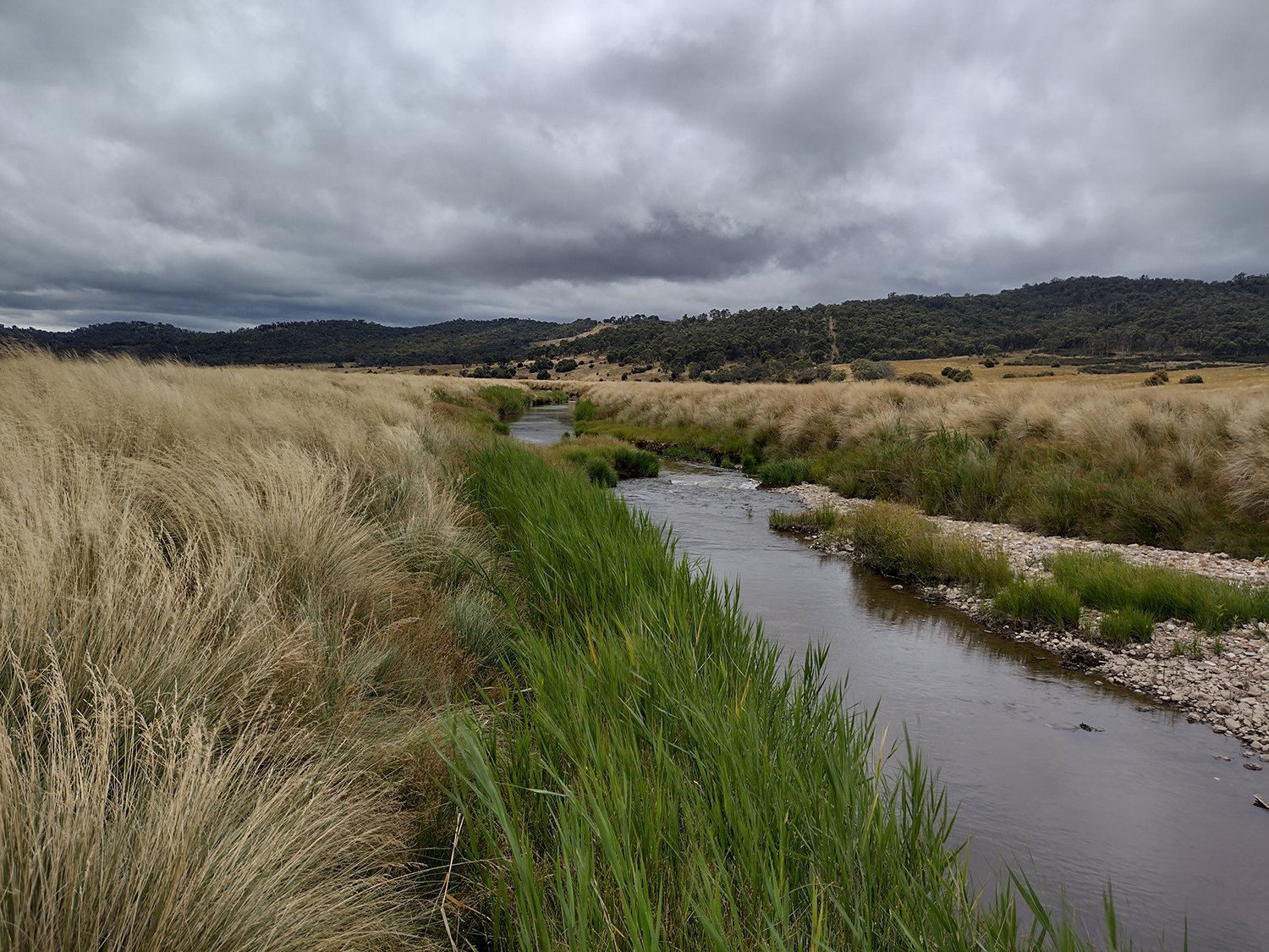
Figure 1. Actively eroding reach of the Molonglo River, Foxlow Station.

Figure 2. Incised but naturally aggrading reach of the Molonglo River, Foxlow Station.
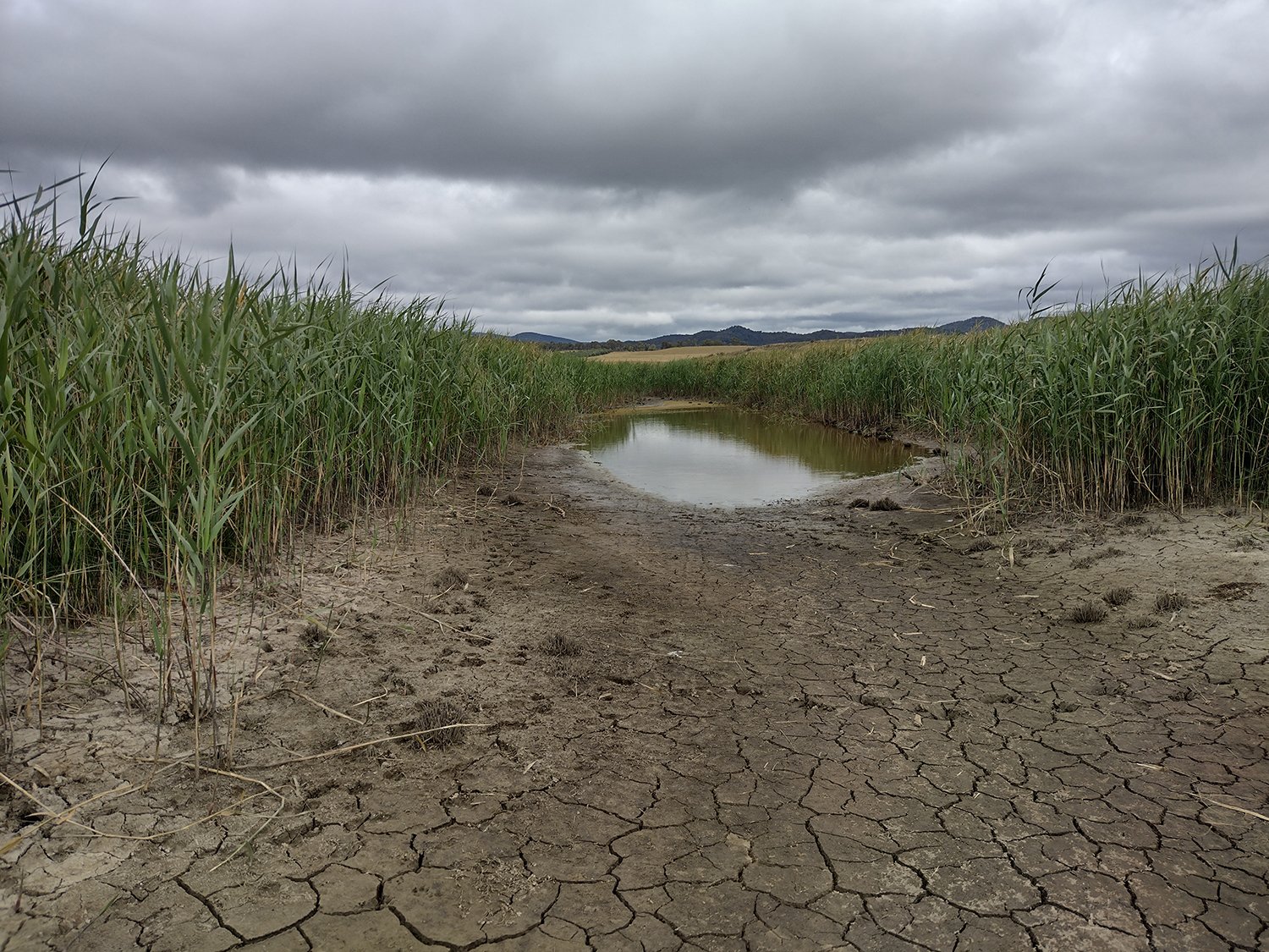
Figure 3. Secondary flood runner on the Molonglo Floodplain, Foxlow Station.
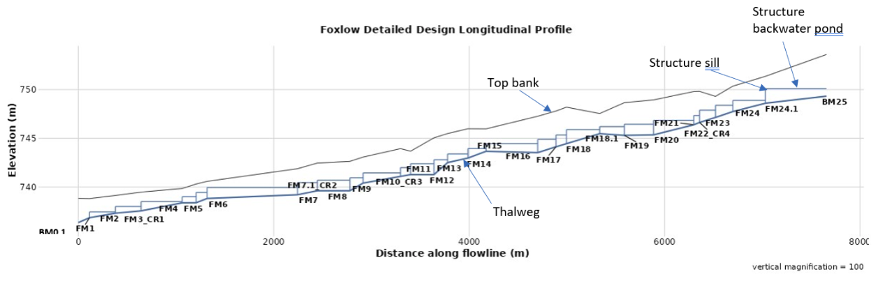
Figure 4. Longitudinal profile of the Molonglo River at Foxlow detailing proposed structure locations, channel thalweg, top bank, structure sill levels and corresponding backwater pond extents.